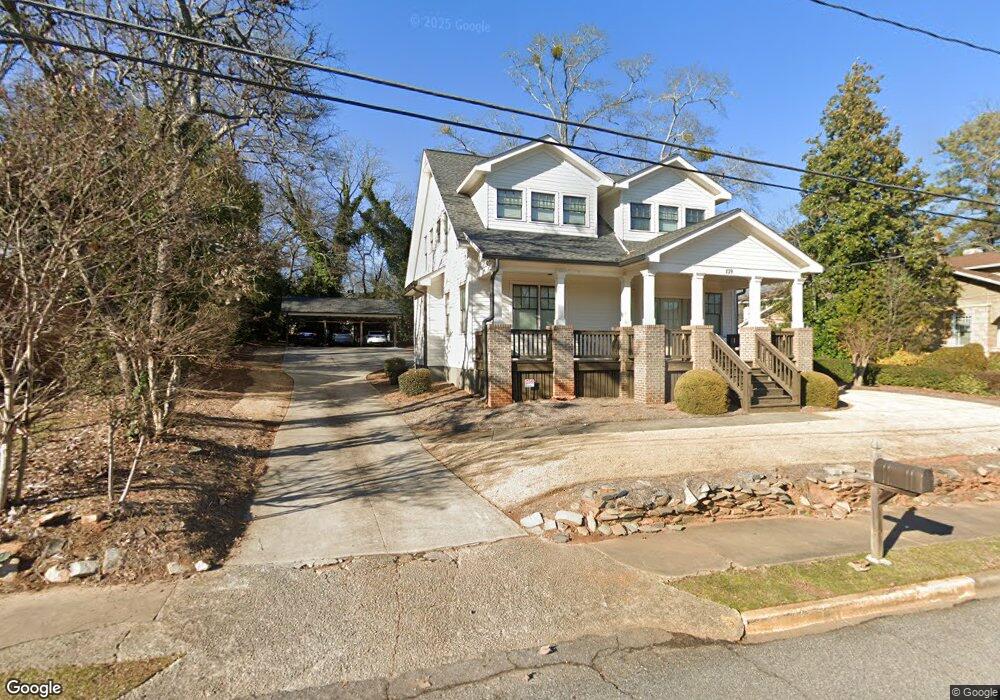
139 E Cloverhurst Ave Athens, GA 30605
Midtown-Bloomfield NeighborhoodEstimated Value: $1,038,000 - $1,178,000
--
Bed
6
Baths
2,760
Sq Ft
$401/Sq Ft
Est. Value
About This Home
This home is located at 139 E Cloverhurst Ave, Athens, GA 30605 and is currently estimated at $1,107,655, approximately $401 per square foot. 139 E Cloverhurst Ave is a home located in Clarke County with nearby schools including Barrow Elementary School, Clarke Middle School, and Clarke Central High School.
Ownership History
Date
Name
Owned For
Owner Type
Purchase Details
Closed on
Jun 23, 2016
Sold by
Piatek Ruth G
Bought by
Uptown Station Holdings Llc
Current Estimated Value
Home Financials for this Owner
Home Financials are based on the most recent Mortgage that was taken out on this home.
Original Mortgage
$300,000
Interest Rate
3.64%
Mortgage Type
Commercial
Create a Home Valuation Report for This Property
The Home Valuation Report is an in-depth analysis detailing your home's value as well as a comparison with similar homes in the area
Home Values in the Area
Average Home Value in this Area
Purchase History
| Date | Buyer | Sale Price | Title Company |
|---|---|---|---|
| Uptown Station Holdings Llc | $200,000 | -- |
Source: Public Records
Mortgage History
| Date | Status | Borrower | Loan Amount |
|---|---|---|---|
| Closed | Uptown Station Holdings Llc | $300,000 |
Source: Public Records
Tax History Compared to Growth
Tax History
| Year | Tax Paid | Tax Assessment Tax Assessment Total Assessment is a certain percentage of the fair market value that is determined by local assessors to be the total taxable value of land and additions on the property. | Land | Improvement |
|---|---|---|---|---|
| 2025 | $12,859 | $414,153 | $55,000 | $359,153 |
| 2024 | $11,761 | $376,363 | $44,000 | $332,363 |
| 2023 | $11,761 | $344,604 | $44,000 | $300,604 |
| 2022 | $9,797 | $307,119 | $44,000 | $263,119 |
| 2021 | $7,113 | $211,061 | $44,000 | $167,061 |
| 2020 | $7,113 | $211,061 | $44,000 | $167,061 |
| 2019 | $7,166 | $211,061 | $44,000 | $167,061 |
| 2018 | $6,562 | $193,274 | $44,000 | $149,274 |
| 2017 | $1,494 | $44,000 | $44,000 | $0 |
| 2016 | $2,545 | $74,953 | $44,000 | $30,953 |
| 2015 | $2,430 | $71,484 | $44,000 | $27,484 |
| 2014 | $2,338 | $68,874 | $37,400 | $31,474 |
Source: Public Records
Map
Nearby Homes
- 50 Springdale St
- 255 Bloomfield St
- 997 S Milledge Ave Unit 2
- 997 S Milledge Ave Unit 3
- 997 S Milledge Ave Unit 1
- 997 S Milledge Ave Unit 4
- 265 Springdale St
- 494 Baxter St Unit 32
- 338 Springdale St
- 365 S Church St Unit 1A, 1B, 1C
- 221 University Dr
- 495 Woodlawn Ave
- 577 W Cloverhurst Ave
- 597 Dearing St
- 500 Dearing St Unit 6
- 1055 Baxter St Unit 504
- 515 Hampton Ct
- 490 Ofarrell St
- 1226 W Broad St
- 490 Mcwhorter Dr
- 85 Springdale St Unit 85 Springdale Street
- 135 E Cloverhurst Ave
- 148 E Cloverhurst Ave
- 449 Bloomfield St
- 95 Springdale St
- 441 Bloomfield St
- 475 Bloomfield St
- 437 Bloomfield St
- 55 Springdale St
- 155 E Cloverhurst Ave
- 427 Bloomfield St
- 124 W Cloverhurst Ave
- 120.5 Cloverhurst Ave W
- 159 E Cloverhurst Ave Unit 5
- 159 E Cloverhurst Ave Unit 2
- 159 E Cloverhurst Ave
- 90 Springdale St
- 98 Springdale St
- 80 Springdale St
- 96 Springdale St