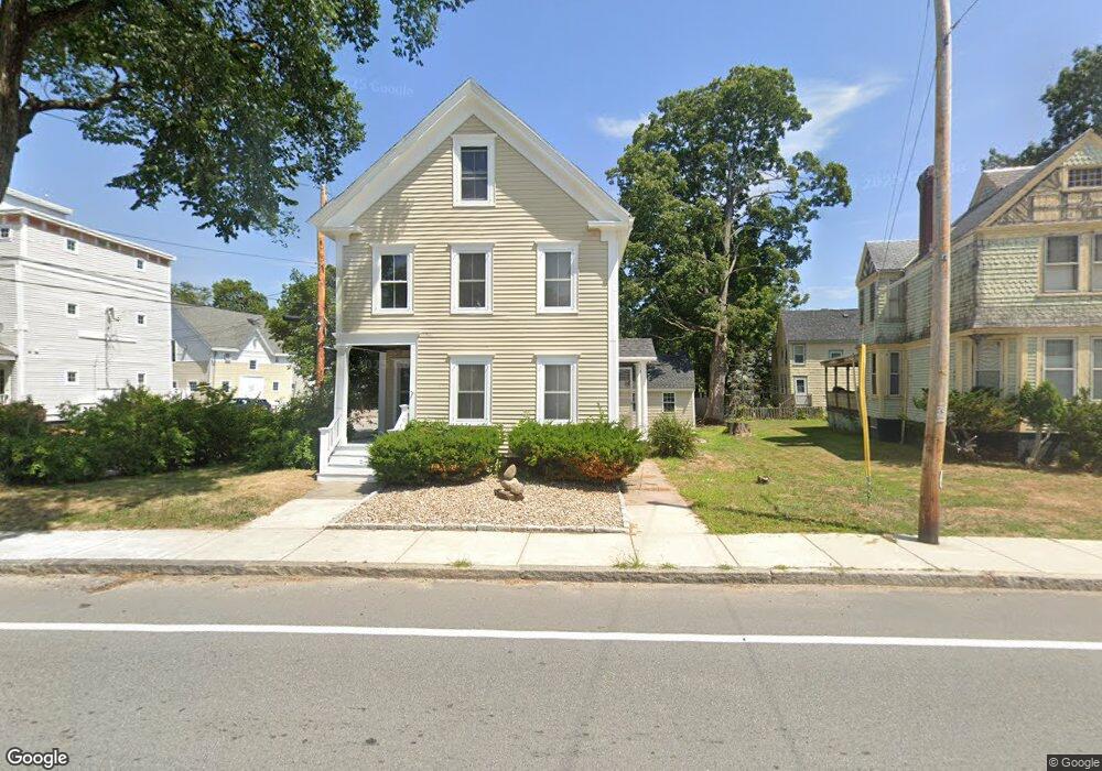
139 Elm St Amesbury, MA 01913
Estimated Value: $530,000 - $649,000
3
Beds
1
Bath
1,368
Sq Ft
$420/Sq Ft
Est. Value
About This Home
This home is located at 139 Elm St, Amesbury, MA 01913 and is currently estimated at $575,059, approximately $420 per square foot. 139 Elm St is a home located in Essex County with nearby schools including Amesbury High School and Amesbury Seventh-Day Adventist School.
Ownership History
Date
Name
Owned For
Owner Type
Purchase Details
Closed on
Sep 10, 2003
Sold by
Gagnon Eric D and Gagnon Ronellen A
Bought by
Geisler Charles
Current Estimated Value
Home Financials for this Owner
Home Financials are based on the most recent Mortgage that was taken out on this home.
Original Mortgage
$184,000
Interest Rate
6.22%
Mortgage Type
Purchase Money Mortgage
Purchase Details
Closed on
Oct 31, 1995
Sold by
Gardner Ft
Bought by
Gagnon Ronellen A and Gagnon Eric D
Create a Home Valuation Report for This Property
The Home Valuation Report is an in-depth analysis detailing your home's value as well as a comparison with similar homes in the area
Home Values in the Area
Average Home Value in this Area
Purchase History
| Date | Buyer | Sale Price | Title Company |
|---|---|---|---|
| Geisler Charles | $230,000 | -- | |
| Gagnon Ronellen A | $107,000 | -- |
Source: Public Records
Mortgage History
| Date | Status | Borrower | Loan Amount |
|---|---|---|---|
| Open | Gagnon Ronellen A | $176,500 | |
| Closed | Gagnon Ronellen A | $184,000 | |
| Previous Owner | Gagnon Ronellen A | $50,000 |
Source: Public Records
Tax History Compared to Growth
Tax History
| Year | Tax Paid | Tax Assessment Tax Assessment Total Assessment is a certain percentage of the fair market value that is determined by local assessors to be the total taxable value of land and additions on the property. | Land | Improvement |
|---|---|---|---|---|
| 2025 | $6,654 | $434,900 | $190,700 | $244,200 |
| 2024 | $6,281 | $401,600 | $179,900 | $221,700 |
| 2023 | $6,178 | $378,100 | $156,400 | $221,700 |
| 2022 | $5,631 | $318,300 | $136,000 | $182,300 |
| 2021 | $5,449 | $298,600 | $105,100 | $193,500 |
| 2020 | $4,812 | $280,100 | $101,000 | $179,100 |
| 2019 | $4,796 | $261,100 | $101,000 | $160,100 |
| 2018 | $4,615 | $243,000 | $96,200 | $146,800 |
| 2017 | $4,403 | $220,700 | $96,200 | $124,500 |
| 2016 | $4,364 | $215,200 | $96,200 | $119,000 |
| 2015 | $4,283 | $208,500 | $96,200 | $112,300 |
| 2014 | $4,114 | $196,200 | $96,200 | $100,000 |
Source: Public Records
Map
Nearby Homes
- 22 Huntington Ave
- 97 Elm St
- 15 Atlantic Ave
- 7 Melrose St
- 179 Elm St
- 25 Cedar St Unit 7
- 53 Market St
- 17 Linwood Place
- 24 Aubin St Unit 2
- 204 Elm St
- 43 Aubin St Unit 1
- 101 Market St Unit B
- 101 Market St Unit A
- 103 Market St Unit A
- 103 Market St Unit B
- 105 Market St Unit B
- 4 Lincoln Ct
- 100 Congress St
- 13 Lincoln Ct
- 17 Lincoln Ct
- 139 Elm St Unit 139
- 141 Elm St
- 4 Huntington Ave
- 1 Huntington Ave Unit 8
- 1 Huntington Ave Unit 4
- 1 Huntington Ave Unit 3
- 1 Huntington Ave Unit 2
- 1 Huntington Ave Unit 1
- 1 Huntington Ave Unit 6
- 1 Huntington Ave Unit 5
- 1-7 Huntington Ave Unit 4
- 1-7 Huntington Ave Unit 3
- 1-7 Huntington Ave Unit Currier W.
- 1-7 Huntington Ave Unit Lincoln
- 1-7 Huntington Ave Unit Chase North
- 1-7 Huntington Ave Unit Bartlett
- 1-7 Huntington Ave Unit 6
- 1-7 Huntington Ave Unit Chase South
- 1-7 Huntington Ave Unit Carriage Hs
- 1-7 Huntington Ave