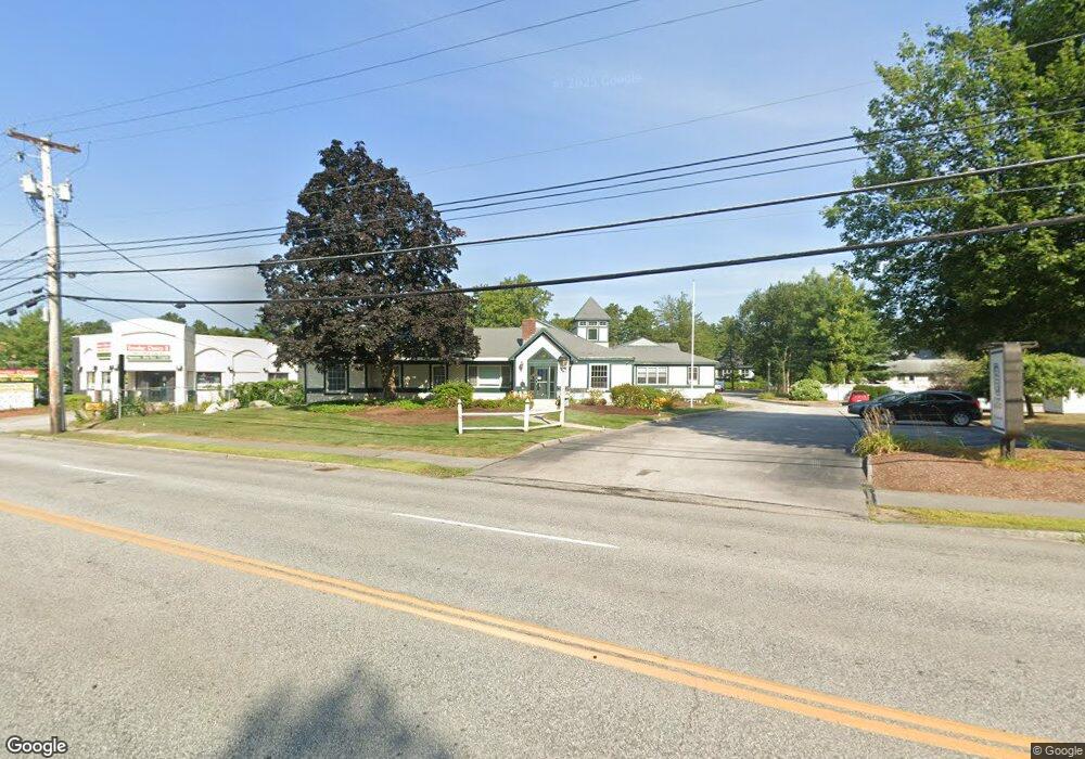
139 Loudon Rd Concord, NH 03301
Concord Heights NeighborhoodEstimated Value: $2,736,616
--
Bed
5
Baths
6,736
Sq Ft
$406/Sq Ft
Est. Value
About This Home
This home is located at 139 Loudon Rd, Concord, NH 03301 and is currently estimated at $2,736,616, approximately $406 per square foot. 139 Loudon Rd is a home located in Merrimack County with nearby schools including Broken Ground School, Rundlett Middle School, and Concord High School.
Ownership History
Date
Name
Owned For
Owner Type
Purchase Details
Closed on
Oct 30, 2015
Sold by
139 Loudon Road Assoc
Bought by
Gsg Realty Gilford Llc
Current Estimated Value
Purchase Details
Closed on
Jun 29, 2005
Sold by
139 Loudon Rd Associat
Bought by
139 Loudon Rd Associat
Purchase Details
Closed on
Jun 15, 2001
Sold by
Wiley William J
Bought by
139 Loudon Rd Assoc
Create a Home Valuation Report for This Property
The Home Valuation Report is an in-depth analysis detailing your home's value as well as a comparison with similar homes in the area
Home Values in the Area
Average Home Value in this Area
Purchase History
| Date | Buyer | Sale Price | Title Company |
|---|---|---|---|
| Gsg Realty Gilford Llc | $1,200,000 | -- | |
| 139 Loudon Rd Associat | $41,000 | -- | |
| 139 Loudon Rd Assoc | $116,000 | -- |
Source: Public Records
Tax History Compared to Growth
Tax History
| Year | Tax Paid | Tax Assessment Tax Assessment Total Assessment is a certain percentage of the fair market value that is determined by local assessors to be the total taxable value of land and additions on the property. | Land | Improvement |
|---|---|---|---|---|
| 2024 | $35,933 | $1,297,700 | $529,200 | $768,500 |
| 2023 | $34,856 | $1,297,700 | $529,200 | $768,500 |
| 2022 | $33,597 | $1,297,700 | $529,200 | $768,500 |
| 2021 | $32,598 | $1,297,700 | $529,200 | $768,500 |
| 2020 | $34,726 | $1,297,700 | $529,200 | $768,500 |
| 2019 | $36,050 | $1,297,700 | $529,200 | $768,500 |
| 2018 | $36,582 | $1,297,700 | $529,200 | $768,500 |
| 2017 | $38,008 | $1,345,900 | $529,200 | $816,700 |
| 2016 | $37,241 | $1,345,900 | $529,200 | $816,700 |
| 2015 | $41,478 | $1,517,100 | $718,600 | $798,500 |
| 2014 | $40,673 | $1,517,100 | $718,600 | $798,500 |
| 2013 | -- | $1,517,100 | $718,600 | $798,500 |
| 2012 | -- | $1,517,100 | $718,600 | $798,500 |
Source: Public Records
Map
Nearby Homes
- 17 Burns Ave Unit 2
- 12 E Side Dr Unit 4-13
- 13 Ellsworth St
- 32 E Side Dr
- 6 Heights Rd
- 43 Branch Turnpike
- 50 Branch Turnpike
- 59 Branch Turnpike
- 6 Lawrence Street Extension
- 1 Guay St
- 24 Cricket Ln
- 8 NE Village Rd
- 4 Venne Cir
- 19 Grappone Dr
- 294 Portsmouth St
- 9 Strawberry Ln
- 15 Bridle Path Trail
- 33 Mulberry St Unit 2
- 7 Highridge Trail
- 87 S Main St Unit 2
- 135 Loudon Rd
- 16 Burns Ave
- 132 Loudon Rd
- 132 Loudon Rd Unit 5
- 20 Burns Ave
- 17 Burns Ave Unit 10
- 17 Burns Ave Unit 8
- 17 Burns Ave Unit 6
- 17 Burns Ave Unit 5
- 17 Burns Ave Unit 4
- 17 Burns Ave Unit 1
- 17 Burns Ave Unit 9
- 17 Burns Ave Unit 3
- 17 Burns Ave Unit 7
- 17 Burns Ave
- 133 Loudon Rd
- 133 Loudon Rd Unit 10-A
- 133 Loudon Rd Unit 3
- 19 Burns Ave Unit 6
- 19 Burns Ave Unit 5