K
Seller's Agent in 2025
Kathy OGrady
Kansas City Regional Homes Inc
(913) 568-8472
8 in this area
33 Total Sales
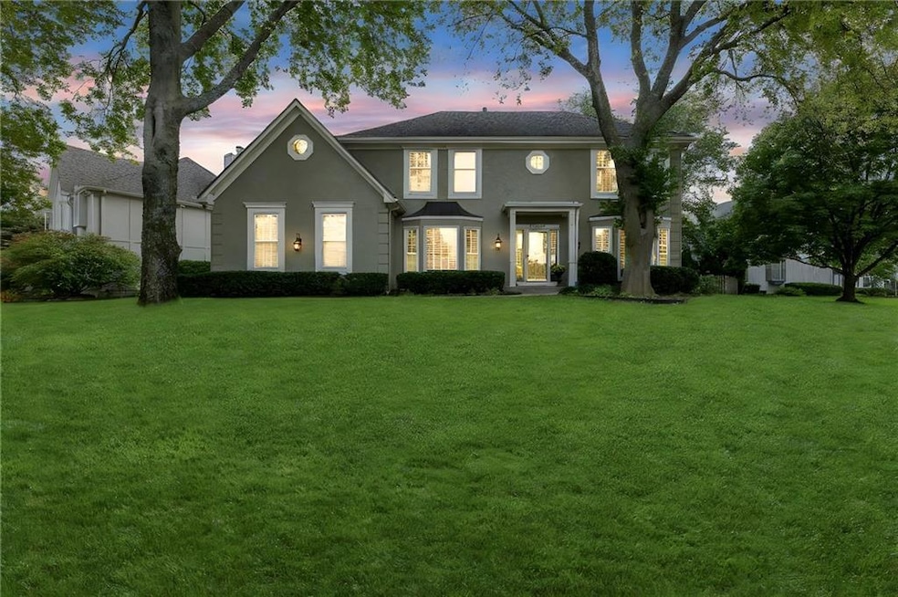
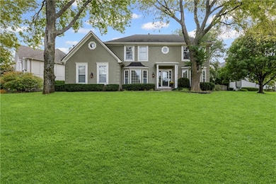
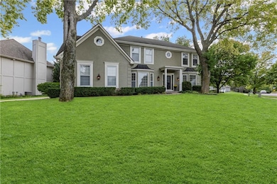
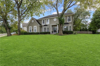
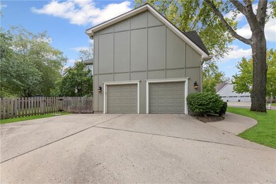
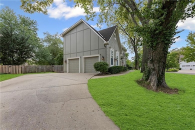
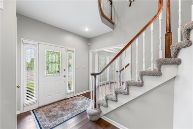
Nestled on a corner lot, sitting high up on a hill in one of Overland Park's favorite neighborhoods, this charming 2 story colonial with a private side drive and mature trees will be the perfect new place for you to call home. Excellent floor plan, All siding has been replaced with Hardie board for low maintenance, New wall of windows in back of home, newer hardwoods throughout main level and brand new sump pump. The open kitchen with tons of natural light, painted cabinets some with glass doors, a large quartz island, electric stove and a 2 year old dishwasher. The spacious finished basement has a half bath, a non-conforming 5th bedroom, tons of storage, built-ins, all new carpet, new paint and a new hot water heater. Two large siding glass doors lead you to the private, flat, backyard with a newer wood fence, in-ground sprinklers, custom built garden beds, and a large patio. Upstairs there is a huge primary Suite with a sitting area and a large bathroom and walk in closet, 3 more bedrooms and two full baths, extra storage, a linen closet, and an attic fan. Close to shopping, highway access, and blue valley schools. Living here means you’re just a hop, skip, and jump from the Nottingham Forest South community pool, swim team, clubhouse, pickle ball/tennis courts, walking trails and more.
Last Agent to Sell the Property
Kansas City Regional Homes Inc Brokerage Phone: 913-568-8472 License #SP00228058 Listed on: 09/20/2025
| Date | Type | Sale Price | Title Company |
|---|---|---|---|
| Interfamily Deed Transfer | -- | None Available | |
| Warranty Deed | -- | Chicago Title Ins Co |
| Date | Status | Loan Amount | Loan Type |
|---|---|---|---|
| Open | $200,000 | New Conventional |
| Date | Event | Price | List to Sale | Price per Sq Ft |
|---|---|---|---|---|
| 11/12/2025 11/12/25 | Sold | -- | -- | -- |
| 10/05/2025 10/05/25 | Pending | -- | -- | -- |
| 10/02/2025 10/02/25 | For Sale | $589,000 | -- | $148 / Sq Ft |
| Year | Tax Paid | Tax Assessment Tax Assessment Total Assessment is a certain percentage of the fair market value that is determined by local assessors to be the total taxable value of land and additions on the property. | Land | Improvement |
|---|---|---|---|---|
| 2024 | $5,237 | $51,256 | $11,714 | $39,542 |
| 2023 | $5,557 | $53,360 | $11,714 | $41,646 |
| 2022 | $4,846 | $45,747 | $11,714 | $34,033 |
| 2021 | $4,367 | $39,100 | $10,654 | $28,446 |
| 2020 | $4,373 | $38,893 | $8,879 | $30,014 |
| 2019 | $4,453 | $38,767 | $5,926 | $32,841 |
| 2018 | $3,846 | $35,673 | $5,926 | $29,747 |
| 2017 | $3,822 | $32,051 | $5,926 | $26,125 |
| 2016 | $3,530 | $29,590 | $5,926 | $23,664 |
| 2015 | $3,512 | $29,325 | $5,926 | $23,399 |
| 2013 | -- | $27,439 | $5,926 | $21,513 |
K
Seller's Agent in 2025
Kathy OGrady
Kansas City Regional Homes Inc
(913) 568-8472
8 in this area
33 Total Sales

Buyer's Agent in 2025
Paul Galbrecht
KW KANSAS CITY METRO
(913) 634-2303
2 in this area
173 Total Sales
Source: Heartland MLS
MLS Number: 2575633
APN: NP53920003-0001
Disclaimer: Certain information contained herein is derived from information provided by parties other than Homes.com. All information provided is deemed reliable, but is not guaranteed to be accurate and should be independently verified.
![]() Based on information submitted to the MLS GRID as of [see last changed date above]. All data is obtained from various sources and may not have been verified by broker or MLS GRID. Supplied Open House Information is subject to change without notice. All information should be independently reviewed and verified for accuracy. Properties may or may not be listed by the office/agent presenting the information. Some IDX listings have been excluded from this website. Prices displayed on all Sold listings are the Last Known Listing Price and may not be the actual selling price.
Based on information submitted to the MLS GRID as of [see last changed date above]. All data is obtained from various sources and may not have been verified by broker or MLS GRID. Supplied Open House Information is subject to change without notice. All information should be independently reviewed and verified for accuracy. Properties may or may not be listed by the office/agent presenting the information. Some IDX listings have been excluded from this website. Prices displayed on all Sold listings are the Last Known Listing Price and may not be the actual selling price.
Listing Information presented by local MLS brokerage: TEN-X, INC., local REALTOR®- Arlene Richardson - (888)952-6393
The Digital Millennium Copyright Act of 1998, 17 U.S.C. § 512 (the “DMCA”) provides recourse for copyright owners who believe that material appearing on the Internet infringes their rights under U.S. copyright law. If you believe in good faith that any content or material made available in connection with our website or services infringes your copyright, you (or your agent) may send us a notice requesting that the content or material be removed, or access to it blocked.
Notices must be sent in writing by email to DMCAnotice@MLSGrid.com.
The DMCA requires that your notice of alleged copyright infringement include the following information:
(1) description of the copyrighted work that is the subject of claimed infringement;
(2) description of the alleged infringing content and information sufficient to permit us to locate the content;
(3) contact information for you, including your address, telephone number and email address;
(4) a statement by you that you have a good faith belief that the content in the manner complained of is not authorized by the copyright owner, or its agent, or by the operation of any law;
(5) a statement by you, signed under penalty of perjury, that the information in the notification is accurate and that you have the authority to enforce the copyrights that are claimed to be infringed; and
(6) a physical or electronic signature of the copyright owner or a person authorized to act on the copyright owner’s behalf. Failure to include all of the above information may result in the delay of the processing of your complaint.