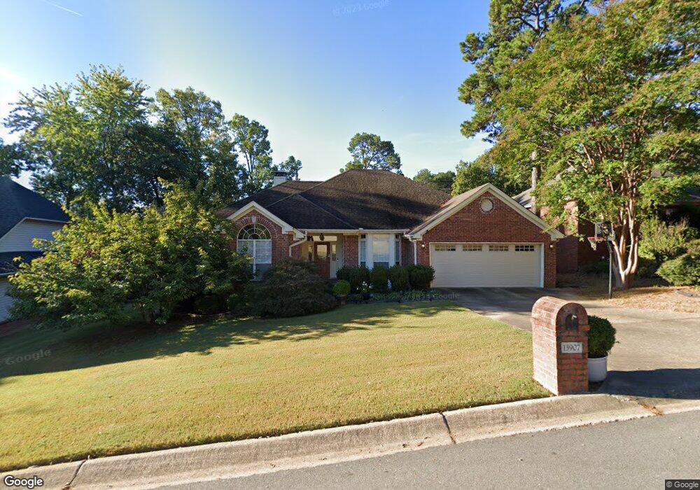
13907 Saint Michael Dr Little Rock, AR 72211
Rock Creek NeighborhoodEstimated Value: $370,737 - $400,000
--
Bed
2
Baths
2,744
Sq Ft
$140/Sq Ft
Est. Value
About This Home
This home is located at 13907 Saint Michael Dr, Little Rock, AR 72211 and is currently estimated at $384,934, approximately $140 per square foot. 13907 Saint Michael Dr is a home located in Pulaski County with nearby schools including Fulbright Elementary School, Pinnacle View Middle School, and LISA Academy West Elementary School.
Ownership History
Date
Name
Owned For
Owner Type
Purchase Details
Closed on
Jul 20, 2012
Sold by
Liu Yong
Bought by
Xu Jing
Current Estimated Value
Purchase Details
Closed on
Feb 20, 2004
Sold by
Vanrossum Hendrik J and Vanrossum Revocab Hendrik J
Bought by
Liu Yong and Xu Jing
Home Financials for this Owner
Home Financials are based on the most recent Mortgage that was taken out on this home.
Original Mortgage
$196,000
Interest Rate
5.67%
Mortgage Type
Purchase Money Mortgage
Purchase Details
Closed on
Nov 3, 1998
Sold by
Vanrossum Hendrick J
Bought by
Vanrossum Hendrick J and Vanrossum Susan E
Home Financials for this Owner
Home Financials are based on the most recent Mortgage that was taken out on this home.
Original Mortgage
$174,400
Interest Rate
6.57%
Mortgage Type
Purchase Money Mortgage
Create a Home Valuation Report for This Property
The Home Valuation Report is an in-depth analysis detailing your home's value as well as a comparison with similar homes in the area
Home Values in the Area
Average Home Value in this Area
Purchase History
| Date | Buyer | Sale Price | Title Company |
|---|---|---|---|
| Xu Jing | -- | None Available | |
| Liu Yong | $246,000 | American Abstract & Title Co | |
| Vanrossum Hendrik J | -- | American Abstract & Title Co | |
| Vanrossum Hendrick J | -- | Lenders Title Company |
Source: Public Records
Mortgage History
| Date | Status | Borrower | Loan Amount |
|---|---|---|---|
| Previous Owner | Liu Yong | $196,000 | |
| Previous Owner | Vanrossum Hendrick J | $174,400 |
Source: Public Records
Tax History Compared to Growth
Tax History
| Year | Tax Paid | Tax Assessment Tax Assessment Total Assessment is a certain percentage of the fair market value that is determined by local assessors to be the total taxable value of land and additions on the property. | Land | Improvement |
|---|---|---|---|---|
| 2025 | $4,584 | $67,521 | $8,600 | $58,921 |
| 2024 | $4,202 | $67,521 | $8,600 | $58,921 |
| 2023 | $4,202 | $67,521 | $8,600 | $58,921 |
| 2022 | $4,041 | $67,521 | $8,600 | $58,921 |
| 2021 | $3,877 | $54,570 | $7,200 | $47,370 |
| 2020 | $3,475 | $54,570 | $7,200 | $47,370 |
| 2019 | $3,475 | $54,570 | $7,200 | $47,370 |
| 2018 | $3,500 | $54,570 | $7,200 | $47,370 |
| 2017 | $3,713 | $54,570 | $7,200 | $47,370 |
| 2016 | $3,737 | $53,380 | $10,140 | $43,240 |
| 2015 | $3,742 | $53,380 | $10,140 | $43,240 |
| 2014 | $3,742 | $53,380 | $10,140 | $43,240 |
Source: Public Records
Map
Nearby Homes
- 8 Combonne Ct
- 79 Saint Thomas Ct
- 817 Saint Michael Place
- 7 Cambay Ct
- 13224 Pompano Dr
- 10 Palmetto Ct
- 8 Red Maple Ct
- 13525 W Markham St
- 3 Bonaparte Cir
- 15 Saint Charles Ct
- 506 Parkway Place Dr
- 13820 Sweet Bay Dr
- 6 Hunter Ct
- 400 Lasalle Dr
- 6 Ridgehaven Ct
- 13110 Morrison Rd
- 14312 Pride Valley Dr
- 12819 Saint Charles Blvd
- 621 Asbury Rd
- 309 Shadow Ridge Dr
- 13911 Saint Michael Dr
- 13903 Saint Michael Dr
- 13915 Saint Michael Dr
- 13915 St Michael
- 13901 Saint Michael Dr
- 13900 Saint Michael Dr
- 13910 Saint Michael Dr
- 13917 Saint Michael Dr
- 13914 St Michael Dr
- 13914 Saint Michael Dr
- 13810 Saint Michael Dr
- 13810 St Michael Dr
- 13817 Saint Michael Dr
- 13815 Saint Michael Dr
- 13919 Saint Michael Dr
- 13919 St Michael
- 13916 Saint Michael Dr
- 0 Saint Michael Dr
- 13811 St Michael
- 13811 Saint Michael Dr