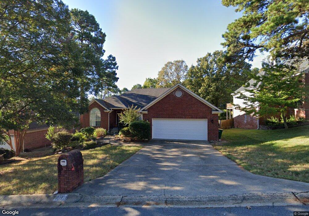
13911 Saint Michael Dr Little Rock, AR 72211
Rock Creek NeighborhoodEstimated Value: $370,000 - $387,000
--
Bed
3
Baths
2,514
Sq Ft
$150/Sq Ft
Est. Value
About This Home
This home is located at 13911 Saint Michael Dr, Little Rock, AR 72211 and is currently estimated at $376,841, approximately $149 per square foot. 13911 Saint Michael Dr is a home located in Pulaski County with nearby schools including Fulbright Elementary School, Pinnacle View Middle School, and LISA Academy West Elementary School.
Ownership History
Date
Name
Owned For
Owner Type
Purchase Details
Closed on
Nov 19, 2020
Sold by
Renner Anna Bernice and Renner Anne Bernie
Bought by
Hill Edward
Current Estimated Value
Home Financials for this Owner
Home Financials are based on the most recent Mortgage that was taken out on this home.
Original Mortgage
$273,946
Outstanding Balance
$243,773
Interest Rate
2.8%
Mortgage Type
FHA
Estimated Equity
$133,068
Purchase Details
Closed on
Feb 19, 1999
Sold by
Castro Roberto J and Castro Diane W
Bought by
Renner Gerald Bartlett and Renner Anne Bernie
Purchase Details
Closed on
May 3, 1997
Sold by
Tong Hoa and Tong Yen H
Bought by
Castro Roberto J and Castro Diana W
Home Financials for this Owner
Home Financials are based on the most recent Mortgage that was taken out on this home.
Original Mortgage
$141,200
Interest Rate
8.1%
Mortgage Type
Purchase Money Mortgage
Create a Home Valuation Report for This Property
The Home Valuation Report is an in-depth analysis detailing your home's value as well as a comparison with similar homes in the area
Home Values in the Area
Average Home Value in this Area
Purchase History
| Date | Buyer | Sale Price | Title Company |
|---|---|---|---|
| Hill Edward | $279,000 | First National Title | |
| Renner Gerald Bartlett | $183,000 | -- | |
| Castro Roberto J | $177,000 | -- |
Source: Public Records
Mortgage History
| Date | Status | Borrower | Loan Amount |
|---|---|---|---|
| Open | Hill Edward | $273,946 | |
| Previous Owner | Castro Roberto J | $141,200 |
Source: Public Records
Tax History Compared to Growth
Tax History
| Year | Tax Paid | Tax Assessment Tax Assessment Total Assessment is a certain percentage of the fair market value that is determined by local assessors to be the total taxable value of land and additions on the property. | Land | Improvement |
|---|---|---|---|---|
| 2025 | $4,421 | $63,150 | $8,600 | $54,550 |
| 2024 | $4,265 | $63,150 | $8,600 | $54,550 |
| 2023 | $4,265 | $63,150 | $8,600 | $54,550 |
| 2022 | $3,938 | $63,150 | $8,600 | $54,550 |
| 2021 | $3,607 | $50,770 | $7,200 | $43,570 |
| 2020 | $2,145 | $50,770 | $7,200 | $43,570 |
| 2019 | $2,145 | $50,770 | $7,200 | $43,570 |
| 2018 | $2,170 | $50,770 | $7,200 | $43,570 |
| 2017 | $2,372 | $50,770 | $7,200 | $43,570 |
| 2016 | $2,372 | $49,010 | $10,140 | $38,870 |
| 2015 | $2,495 | $35,599 | $10,140 | $25,459 |
| 2014 | $2,495 | $35,599 | $10,140 | $25,459 |
Source: Public Records
Map
Nearby Homes
- 8 Combonne Ct
- 817 Saint Michael Place
- 79 Saint Thomas Ct
- 7 Cambay Ct
- 13224 Pompano Dr
- 10 Palmetto Ct
- 3 Bonaparte Cir
- 8 Red Maple Ct
- 13525 W Markham St
- 400 Lasalle Dr
- 15 Saint Charles Ct
- 506 Parkway Place Dr
- 13820 Sweet Bay Dr
- 14312 Pride Valley Dr
- 6 Hunter Ct
- 13110 Morrison Rd
- 6 Ridgehaven Ct
- 14904 Lamplight Way
- 14710 Woodcreek Dr
- 406 Parliament St
- 13915 Saint Michael Dr
- 13907 Saint Michael Dr
- 13915 St Michael
- 13917 Saint Michael Dr
- 13903 Saint Michael Dr
- 13910 Saint Michael Dr
- 13900 Saint Michael Dr
- 13914 St Michael Dr
- 13914 Saint Michael Dr
- 13919 Saint Michael Dr
- 13919 St Michael
- 13901 Saint Michael Dr
- 13916 Saint Michael Dr
- 13810 Saint Michael Dr
- 13810 St Michael Dr
- 13921 Saint Michael Dr
- 13918 Saint Michael Dr
- 13712 Saint Michael Dr
- 13708 Saint Michael Dr
- 13815 Saint Michael Dr