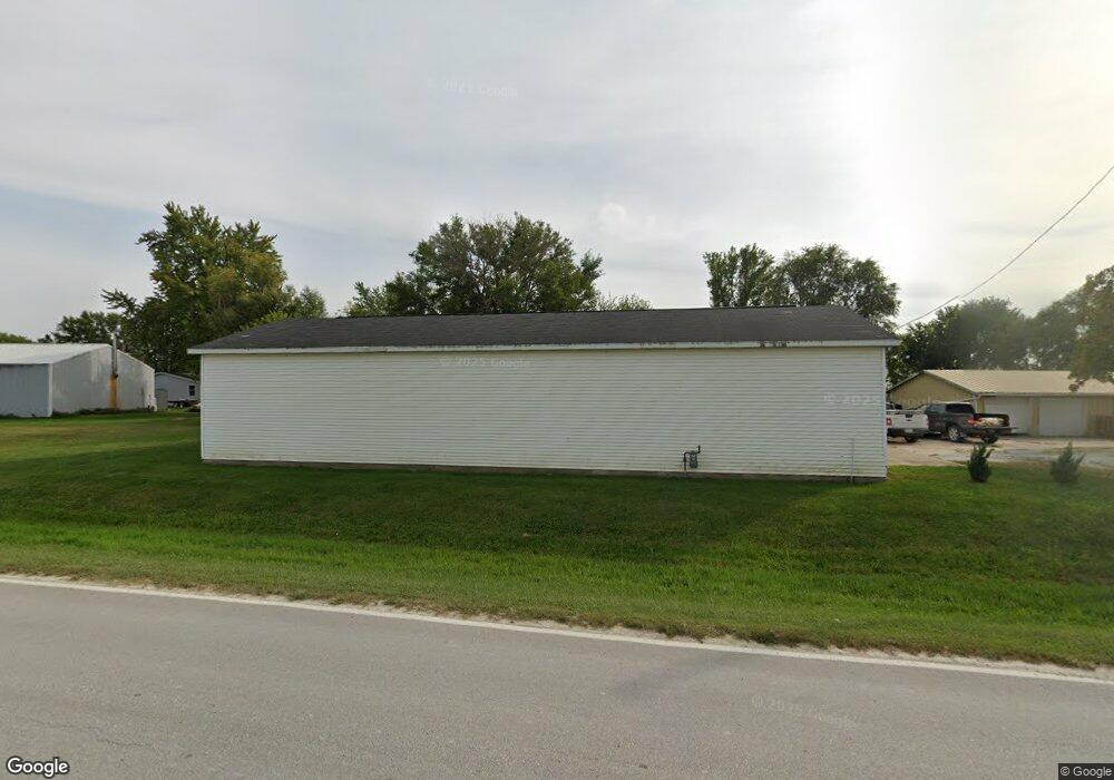
1392 Merrimac Rd Wayland, IA 52654
Estimated Value: $112,000 - $211,000
3
Beds
2
Baths
1,928
Sq Ft
$83/Sq Ft
Est. Value
About This Home
This home is located at 1392 Merrimac Rd, Wayland, IA 52654 and is currently estimated at $160,951, approximately $83 per square foot. 1392 Merrimac Rd is a home with nearby schools including Mount Pleasant High School.
Ownership History
Date
Name
Owned For
Owner Type
Purchase Details
Closed on
Aug 29, 2016
Sold by
Krabill Kurt L and Krabill Michelle M
Bought by
Brookhart Devin M and Brookhart Sam D
Current Estimated Value
Home Financials for this Owner
Home Financials are based on the most recent Mortgage that was taken out on this home.
Original Mortgage
$97,000
Outstanding Balance
$81,278
Interest Rate
4.25%
Mortgage Type
New Conventional
Estimated Equity
$79,673
Purchase Details
Closed on
Jul 11, 2016
Sold by
Washington State Bank
Bought by
Krabill Michelle and Krabill Kurt
Home Financials for this Owner
Home Financials are based on the most recent Mortgage that was taken out on this home.
Original Mortgage
$97,000
Outstanding Balance
$81,278
Interest Rate
4.25%
Mortgage Type
New Conventional
Estimated Equity
$79,673
Create a Home Valuation Report for This Property
The Home Valuation Report is an in-depth analysis detailing your home's value as well as a comparison with similar homes in the area
Home Values in the Area
Average Home Value in this Area
Purchase History
| Date | Buyer | Sale Price | Title Company |
|---|---|---|---|
| Brookhart Devin M | $52,000 | None Available | |
| Krabill Michelle | -- | -- |
Source: Public Records
Mortgage History
| Date | Status | Borrower | Loan Amount |
|---|---|---|---|
| Open | Brookhart Devin M | $97,000 | |
| Previous Owner | Krabill Michelle | $27,000 | |
| Previous Owner | Krabill Michelle | -- |
Source: Public Records
Tax History Compared to Growth
Tax History
| Year | Tax Paid | Tax Assessment Tax Assessment Total Assessment is a certain percentage of the fair market value that is determined by local assessors to be the total taxable value of land and additions on the property. | Land | Improvement |
|---|---|---|---|---|
| 2025 | $1,576 | $126,810 | $26,920 | $99,890 |
| 2024 | $1,480 | $116,350 | $26,920 | $89,430 |
| 2023 | $1,522 | $116,350 | $26,920 | $89,430 |
| 2022 | $1,526 | $97,560 | $26,920 | $70,640 |
| 2021 | $1,526 | $97,560 | $26,920 | $70,640 |
| 2020 | $1,540 | $97,560 | $26,920 | $70,640 |
| 2019 | $1,550 | $98,410 | $0 | $0 |
| 2018 | $1,482 | $98,410 | $0 | $0 |
| 2017 | $1,482 | $93,400 | $0 | $0 |
| 2016 | $1,494 | $92,520 | $0 | $0 |
| 2015 | $1,494 | $93,310 | $0 | $0 |
| 2014 | $1,488 | $93,310 | $0 | $0 |
Source: Public Records
Map
Nearby Homes
- 1326 150th St
- 1408 200th St
- 185th St
- TBD 185th St
- 1320 Clayton Ave
- 0 Ash N Cherry St Unit 5425602
- 1791 180th St
- 1750 140th St
- 204 W 3rd St
- 408 E Front St
- 402 E Railroad St
- 1083 Benton Ave
- TBD Pin Oaks Ln
- Tbd Pin Oaks Ln
- 0 Pin Oaks Lot 8 Unit 6309313
- 1467 Kentucky Ave
- LOT 7 Pin Oaks Ln
- 1129 Highway 34
- LOT 14 Pin Oaks Ln
- LOT 15 Pin Oaks Ln