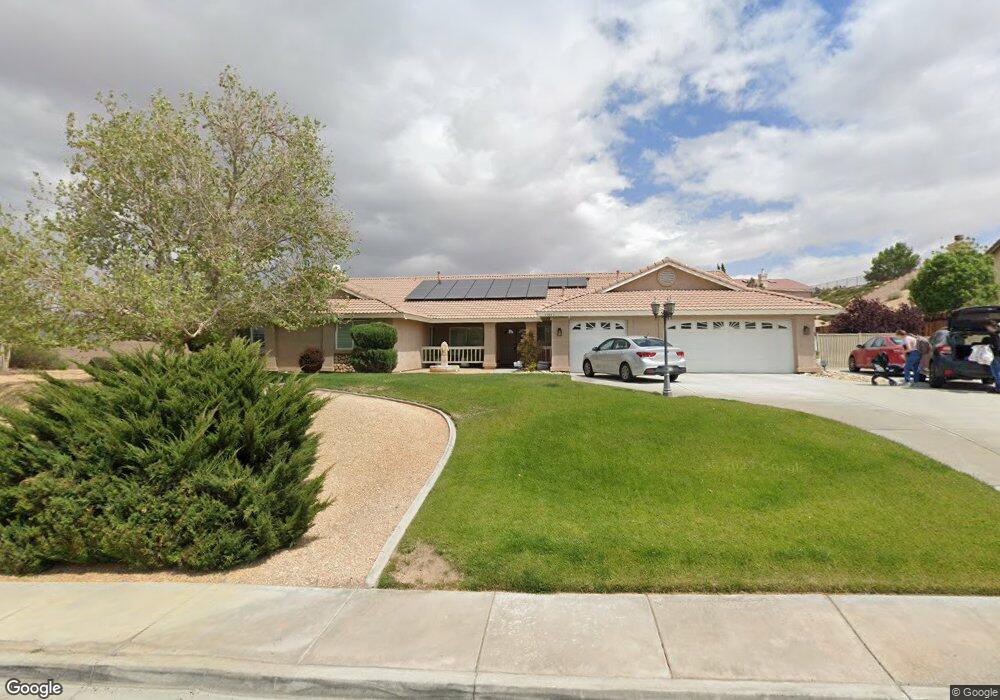
13923 Riverside Dr Apple Valley, CA 92307
High Desert NeighborhoodEstimated Value: $609,609 - $741,000
5
Beds
3
Baths
3,067
Sq Ft
$215/Sq Ft
Est. Value
About This Home
This home is located at 13923 Riverside Dr, Apple Valley, CA 92307 and is currently estimated at $660,902, approximately $215 per square foot. 13923 Riverside Dr is a home located in San Bernardino County with nearby schools including Rio Vista School of Applied Learning, Apple Valley High School, and Academy for Academic Excellence.
Ownership History
Date
Name
Owned For
Owner Type
Purchase Details
Closed on
Jun 9, 2022
Sold by
Robles Burgos and Robles Guillermina
Bought by
Burgos Family Trust
Current Estimated Value
Purchase Details
Closed on
Apr 14, 2002
Sold by
West River Bend Lp
Bought by
Robles Burgos Julio and Robles Burgos Guillermina
Home Financials for this Owner
Home Financials are based on the most recent Mortgage that was taken out on this home.
Original Mortgage
$203,070
Interest Rate
8.5%
Mortgage Type
Construction
Purchase Details
Closed on
Jun 30, 2001
Sold by
High Country Development Company 2
Bought by
West River Bend Lp
Home Financials for this Owner
Home Financials are based on the most recent Mortgage that was taken out on this home.
Original Mortgage
$8,000
Interest Rate
7.09%
Mortgage Type
Purchase Money Mortgage
Create a Home Valuation Report for This Property
The Home Valuation Report is an in-depth analysis detailing your home's value as well as a comparison with similar homes in the area
Home Values in the Area
Average Home Value in this Area
Purchase History
| Date | Buyer | Sale Price | Title Company |
|---|---|---|---|
| Burgos Family Trust | -- | Melinda R Aguilar D&A Law Grou | |
| Robles Burgos Julio | $229,000 | First American Title Ins Co | |
| West River Bend Lp | $608,000 | First American Title Ins Co |
Source: Public Records
Mortgage History
| Date | Status | Borrower | Loan Amount |
|---|---|---|---|
| Previous Owner | Robles Burgos Julio | $203,070 | |
| Previous Owner | West River Bend Lp | $8,000 |
Source: Public Records
Tax History Compared to Growth
Tax History
| Year | Tax Paid | Tax Assessment Tax Assessment Total Assessment is a certain percentage of the fair market value that is determined by local assessors to be the total taxable value of land and additions on the property. | Land | Improvement |
|---|---|---|---|---|
| 2025 | $3,928 | $347,603 | $57,934 | $289,669 |
| 2024 | $3,928 | $340,787 | $56,798 | $283,989 |
| 2023 | $3,893 | $334,105 | $55,684 | $278,421 |
| 2022 | $3,760 | $327,554 | $54,592 | $272,962 |
| 2021 | $3,673 | $321,132 | $53,522 | $267,610 |
| 2020 | $3,628 | $317,839 | $52,973 | $264,866 |
| 2019 | $3,560 | $311,607 | $51,934 | $259,673 |
| 2018 | $3,471 | $305,497 | $50,916 | $254,581 |
| 2017 | $3,422 | $299,507 | $49,918 | $249,589 |
| 2016 | $3,304 | $293,634 | $48,939 | $244,695 |
| 2015 | $3,254 | $289,223 | $48,204 | $241,019 |
| 2014 | $3,210 | $283,558 | $47,260 | $236,298 |
Source: Public Records
Map
Nearby Homes
- 18912 Shoshonee Rd
- 13770 Driftwood Dr
- 18286 Lakeview Dr
- 13501 Driftwood Dr
- 13550 Pyramid Dr
- 18715 Mingo Rd
- 18160 Harbor Dr
- 13395 Driftwood Dr
- 18055 Lakeview Dr
- 13380 Driftwood Dr
- 13771 Wawona Rd
- 13411 Ivanpah Rd
- 18415 Niagara Dr
- 14455 Havasu Rd
- 18091 Mariner Dr
- 13240 Meteor Dr
- 18032 Mariner Dr
- 0 Riverside Dr Unit HD25148269
- 13262 Cuyamaca Rd
- 13700 White Sail Dr
- 13913 Riverside Dr
- 13947 Riverside Dr
- 13964 Shoshonee Ct
- 13912 Riverside Dr
- 13905 Riverside Dr
- 13981 Riverside Dr
- 13892 Riverside Dr
- 13968 Shoshonee Ct
- 18722 Nowata Rd
- 13997 Riverside Dr
- 13976 Shoshonee Ct
- 13870 Riverside Dr
- 18699 Shoshonee Rd
- 13871 Riverside Dr
- 18732 Nowata Rd
- 13992 Shoshonee Ct
- 18675 Shoshonee Rd
- 13980 Riverside Dr
- 13961 Shoshonee Ct
- 14010 Riverside Dr