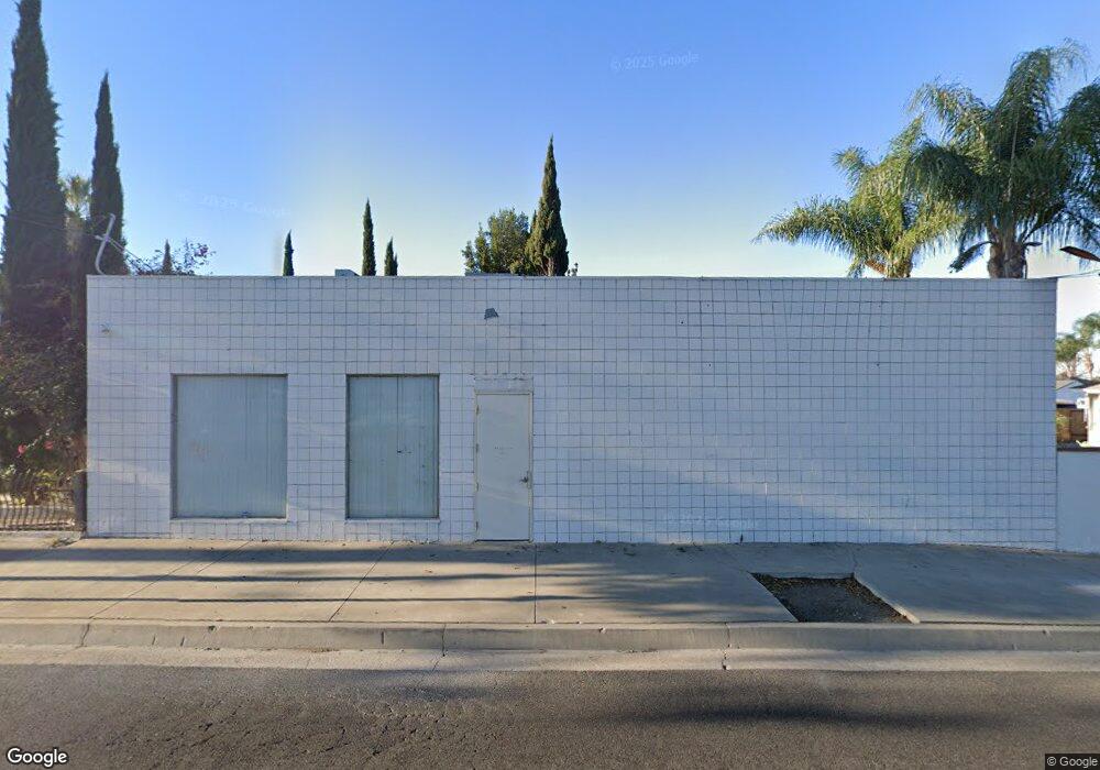
13924 Lambert Rd Whittier, CA 90605
South Whittier NeighborhoodEstimated Value: $475,669
Studio
--
Bath
1,166
Sq Ft
$408/Sq Ft
Est. Value
About This Home
This home is located at 13924 Lambert Rd, Whittier, CA 90605 and is currently estimated at $475,669, approximately $407 per square foot. 13924 Lambert Rd is a home located in Los Angeles County with nearby schools including Laurel Elementary School, Hillview Middle School, and Whittier High School.
Ownership History
Date
Name
Owned For
Owner Type
Purchase Details
Closed on
Oct 6, 2017
Sold by
Arias Ben
Bought by
Mirtorabi Lili and Samani Mirtorabi Survivors Trust
Current Estimated Value
Purchase Details
Closed on
May 27, 2009
Sold by
Arias Ben R and Arias Catherine A
Bought by
Arias Ben
Purchase Details
Closed on
Mar 25, 1993
Sold by
Spinogatti Valente M and Spinogatti Armida M
Bought by
Arias Ben R
Home Financials for this Owner
Home Financials are based on the most recent Mortgage that was taken out on this home.
Original Mortgage
$104,800
Interest Rate
7.13%
Mortgage Type
Seller Take Back
Create a Home Valuation Report for This Property
The Home Valuation Report is an in-depth analysis detailing your home's value as well as a comparison with similar homes in the area
Home Values in the Area
Average Home Value in this Area
Purchase History
| Date | Buyer | Sale Price | Title Company |
|---|---|---|---|
| Mirtorabi Lili | -- | Stewart Title Of Ca Inc | |
| Arias Ben | -- | None Available | |
| Arias Ben R | $115,000 | Commonwealth Land Title |
Source: Public Records
Mortgage History
| Date | Status | Borrower | Loan Amount |
|---|---|---|---|
| Previous Owner | Arias Ben R | $104,800 |
Source: Public Records
Tax History
| Year | Tax Paid | Tax Assessment Tax Assessment Total Assessment is a certain percentage of the fair market value that is determined by local assessors to be the total taxable value of land and additions on the property. | Land | Improvement |
|---|---|---|---|---|
| 2025 | $3,430 | $273,075 | $113,781 | $159,294 |
| 2024 | $3,430 | $267,721 | $111,550 | $156,171 |
| 2023 | $3,372 | $262,472 | $109,363 | $153,109 |
| 2022 | $3,305 | $257,326 | $107,219 | $150,107 |
| 2021 | $3,238 | $252,281 | $105,117 | $147,164 |
| 2019 | $3,998 | $244,800 | $102,000 | $142,800 |
| 2018 | $3,077 | $240,000 | $100,000 | $140,000 |
| 2016 | $2,180 | $165,092 | $83,263 | $81,829 |
| 2015 | $2,240 | $162,613 | $82,013 | $80,600 |
| 2014 | $2,281 | $159,429 | $80,407 | $79,022 |
Source: Public Records
Map
Nearby Homes
- 13840 Danbrook Dr
- 13649 Lanning Dr
- 9308 Tarryton Ave
- 13856 Mulberry Dr
- 9344 Firebird Ave
- 8901 Ocean View Ave
- 13563 Carnell St
- 13448 Dunton Dr
- 9834 Ahmann Ave
- 8847 Ocean View Ave
- 10035 Ben Hur Ave
- 9551 Barkerville Ave
- 14351 Starbuck St
- 10044 Ben Hur Ave
- 14021 Fernview St
- 13814 Mystic St
- 9563 Greening Ave
- 13924 Anola St
- 10202 Mina Ave
- 13527 Ramona Dr
- 9106 Edmaru Ave
- 9101 Edmaru Ave
- 9109 Edmaru Ave
- 9112 Edmaru Ave
- 9115 Edmaru Ave
- 9104 Strub Ave
- 9118 Edmaru Ave
- 9221 Calmada Ave
- 9112 Strub Ave
- 9121 Edmaru Ave
- 13956 Dittmar Dr
- 9118 Strub Ave
- 9229 Calmada Ave
- 13962 Dittmar Dr
- 13950 Dittmar Dr
- 13968 Dittmar Dr
- 13944 Dittmar Dr
- 9126 Strub Ave
- 13974 Dittmar Dr
- 13938 Dittmar Dr
Your Personal Tour Guide
Ask me questions while you tour the home.