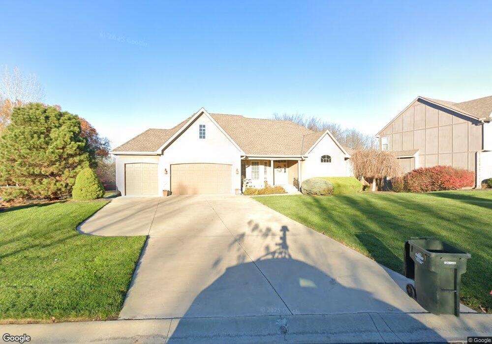
1393 Canyon Ln Lansing, KS 66043
Estimated Value: $492,000 - $516,000
3
Beds
3
Baths
2,291
Sq Ft
$220/Sq Ft
Est. Value
About This Home
This home is located at 1393 Canyon Ln, Lansing, KS 66043 and is currently estimated at $503,622, approximately $219 per square foot. 1393 Canyon Ln is a home located in Leavenworth County with nearby schools including Lansing Elementary School, Lansing Middle 6-8, and Lansing High 9-12.
Ownership History
Date
Name
Owned For
Owner Type
Purchase Details
Closed on
Oct 1, 2005
Bought by
Giese Mary Agnes and Giese Donald L
Current Estimated Value
Home Financials for this Owner
Home Financials are based on the most recent Mortgage that was taken out on this home.
Original Mortgage
$122,260
Interest Rate
5.48%
Mortgage Type
New Conventional
Create a Home Valuation Report for This Property
The Home Valuation Report is an in-depth analysis detailing your home's value as well as a comparison with similar homes in the area
Home Values in the Area
Average Home Value in this Area
Purchase History
| Date | Buyer | Sale Price | Title Company |
|---|---|---|---|
| Giese Mary Agnes | $388,000 | -- |
Source: Public Records
Mortgage History
| Date | Status | Borrower | Loan Amount |
|---|---|---|---|
| Closed | Giese Mary Agnes | $122,260 |
Source: Public Records
Tax History Compared to Growth
Tax History
| Year | Tax Paid | Tax Assessment Tax Assessment Total Assessment is a certain percentage of the fair market value that is determined by local assessors to be the total taxable value of land and additions on the property. | Land | Improvement |
|---|---|---|---|---|
| 2025 | $7,576 | $57,911 | $6,018 | $51,893 |
| 2024 | $7,284 | $55,683 | $6,018 | $49,665 |
| 2023 | $7,284 | $55,683 | $6,018 | $49,665 |
| 2022 | $7,207 | $52,072 | $5,090 | $46,982 |
| 2021 | $7,193 | $49,750 | $5,090 | $44,660 |
| 2020 | $6,962 | $47,381 | $5,090 | $42,291 |
| 2019 | $6,971 | $47,381 | $5,090 | $42,291 |
| 2018 | $6,491 | $44,158 | $5,090 | $39,068 |
| 2017 | $6,315 | $42,872 | $5,090 | $37,782 |
| 2016 | $6,318 | $42,872 | $5,090 | $37,782 |
| 2015 | $6,299 | $42,872 | $5,090 | $37,782 |
| 2014 | $6,002 | $41,711 | $5,090 | $36,621 |
Source: Public Records
Map
Nearby Homes
- 866 Clearview Dr
- 875 Clearview Dr
- 1322 Rock Creek Ct
- 833 Rock Creek Dr
- 1221 S Desoto Rd
- 922 Southfork St
- 811 4-H Rd
- 24431 139th St
- 13965 Mc Intyre Rd
- 527 S Valley Dr
- 13788 McIntyre1 Rd
- 13788 Mcintyre Rd
- 13788 McIntyre2 Rd
- 104 Olive St
- 522 Forestglen Ln
- 202 S Main St
- 124 S Main St
- 546 Hithergreen Dr
- 218 E Kay St
- 521 Hillbrook Dr
- 674 Everly Rd
- 849 Clearview Dr
- 800 Canyon Ln
- 672 Everly Ct
- 672 Everly Rd
- 1392 Canyon Ln
- 851 Clearview Dr
- 675 Everly Rd
- 802 Canyon Ln
- 670 Everly Rd
- 855 Clearview Dr
- 804 Canyon Ln
- 671 Everly Rd
- 850 Clearview Dr
- 673 Everly Rd
- 859 Clearview Dr
- 854 Clearview Dr
- 806 Canyon Ln
- 612 Canyon View Dr
- 635 Willow St