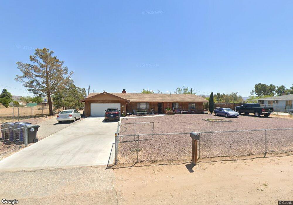
13945 Kiowa Rd Apple Valley, CA 92307
High Desert NeighborhoodEstimated Value: $401,000 - $441,000
3
Beds
2
Baths
1,532
Sq Ft
$277/Sq Ft
Est. Value
About This Home
This home is located at 13945 Kiowa Rd, Apple Valley, CA 92307 and is currently estimated at $423,644, approximately $276 per square foot. 13945 Kiowa Rd is a home located in San Bernardino County with nearby schools including Yucca Loma Elementary School and Apple Valley High School.
Ownership History
Date
Name
Owned For
Owner Type
Purchase Details
Closed on
Jan 10, 2023
Sold by
Wolf Gordon Jerald
Bought by
Wolf Joint Living Trust
Current Estimated Value
Purchase Details
Closed on
Feb 3, 2010
Sold by
Wolf David Larry
Bought by
Wolf David Larry and Wolf Linda Lee
Purchase Details
Closed on
Nov 15, 2007
Sold by
Wolf David L
Bought by
Wolf David Larry and Wolf Gordon Jerald
Create a Home Valuation Report for This Property
The Home Valuation Report is an in-depth analysis detailing your home's value as well as a comparison with similar homes in the area
Home Values in the Area
Average Home Value in this Area
Purchase History
| Date | Buyer | Sale Price | Title Company |
|---|---|---|---|
| Wolf Joint Living Trust | $150,000 | Accommodation/Courtesy Recordi | |
| Wolf David Larry | -- | None Available | |
| Wolf David Larry | -- | None Available |
Source: Public Records
Tax History Compared to Growth
Tax History
| Year | Tax Paid | Tax Assessment Tax Assessment Total Assessment is a certain percentage of the fair market value that is determined by local assessors to be the total taxable value of land and additions on the property. | Land | Improvement |
|---|---|---|---|---|
| 2025 | $3,981 | $347,496 | $107,292 | $240,204 |
| 2024 | $3,981 | $340,682 | $105,188 | $235,494 |
| 2023 | $3,629 | $303,005 | $126,252 | $176,753 |
| 2022 | $3,574 | $297,063 | $123,776 | $173,287 |
| 2021 | $3,306 | $281,000 | $56,000 | $225,000 |
| 2020 | $2,927 | $248,000 | $49,800 | $198,200 |
| 2019 | $2,770 | $234,000 | $47,000 | $187,000 |
| 2018 | $2,390 | $200,600 | $50,200 | $150,400 |
| 2017 | $2,254 | $187,500 | $46,900 | $140,600 |
| 2016 | $2,041 | $173,600 | $43,400 | $130,200 |
| 2015 | -- | $160,000 | $40,000 | $120,000 |
| 2014 | $1,323 | $110,500 | $21,900 | $88,600 |
Source: Public Records
Map
Nearby Homes
- 21248 Rancherias Rd
- 13991 Jicarilla Rd
- 21408 Us Highway 18
- 21431 Pine Ridge Ave
- 21355 Pine Ridge Ave
- 21483 Us Highway 18
- 0 Mohawk Rd Unit IV25164658
- 0 Mohawk Rd Unit MB25110922
- 21160 Us Highway 18
- 21265 Pine Ridge Ave
- 1 California 18
- 13901 Iroquois Rd
- 21235 Pine Ridge Ave
- 13597 Kiowa Rd
- 21268 Chardonnay Dr
- 14055 Mohawk Rd
- 13480 Lakota Rd
- 14182 Gayhead Rd
- 20783 Shawnee Rd
- 13428 Mohawk Rd
- 13925 Kiowa Rd
- 13959 Kiowa Rd
- 13913 Kiowa Rd
- 21233 Rancherias Rd
- 13946 Kiowa Rd
- 13932 Kiowa Rd
- 13920 Kiowa Rd
- 21191 Rancherias Rd
- 21255 Rancherias Rd
- 21181 Rancherias Rd
- 13906 Kiowa Rd
- 21234 Rancherias Rd
- 21204 Rancherias Rd
- 13850 Lakota Rd
- 13889 Kiowa Rd
- 13860 Lakota Rd
- 21220 Rancherias Rd
- 13821 Kiowa Rd
- 21192 Rancherias Rd
- 13902 Kiowa Rd