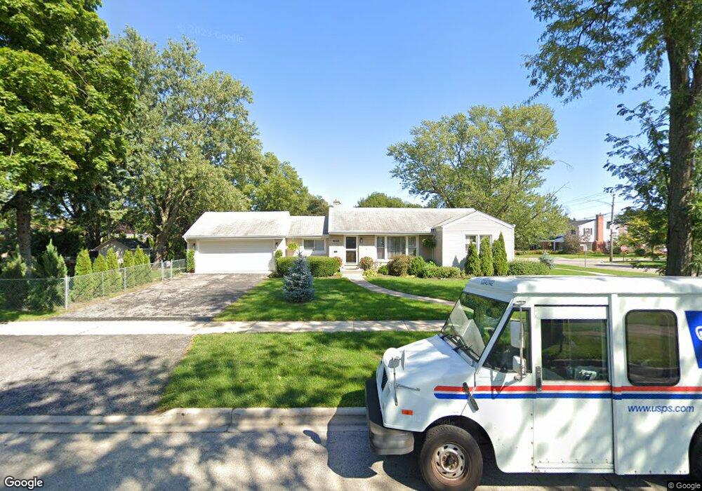
1395 Carol Ln Des Plaines, IL 60018
Estimated Value: $414,051 - $472,000
3
Beds
2
Baths
1,521
Sq Ft
$289/Sq Ft
Est. Value
About This Home
This home is located at 1395 Carol Ln, Des Plaines, IL 60018 and is currently estimated at $440,013, approximately $289 per square foot. 1395 Carol Ln is a home located in Cook County with nearby schools including Forest Elementary School, Algonquin Middle School, and Maine West High School.
Ownership History
Date
Name
Owned For
Owner Type
Purchase Details
Closed on
Dec 27, 2018
Sold by
Wolak Andrzej and Wolak Iwona
Bought by
Wolak Andrzej and Wolak Iwona
Current Estimated Value
Purchase Details
Closed on
Nov 25, 2005
Sold by
Fuhr Jeffrey A and Fuhr Mitchell T
Bought by
Wolak Andrzej
Home Financials for this Owner
Home Financials are based on the most recent Mortgage that was taken out on this home.
Original Mortgage
$228,800
Interest Rate
6.5%
Mortgage Type
Unknown
Purchase Details
Closed on
Oct 4, 2001
Sold by
Chicago Title Land Trust Company
Bought by
Eleanor M Fuhr Trust
Create a Home Valuation Report for This Property
The Home Valuation Report is an in-depth analysis detailing your home's value as well as a comparison with similar homes in the area
Home Values in the Area
Average Home Value in this Area
Purchase History
| Date | Buyer | Sale Price | Title Company |
|---|---|---|---|
| Wolak Andrzej | -- | Attorney | |
| Wolak Andrzej | -- | Attorney | |
| Wolak Andrzej | $286,000 | Baird & Warner Title Service | |
| Eleanor M Fuhr Trust | -- | -- |
Source: Public Records
Mortgage History
| Date | Status | Borrower | Loan Amount |
|---|---|---|---|
| Previous Owner | Wolak Andrzej | $228,800 |
Source: Public Records
Tax History Compared to Growth
Tax History
| Year | Tax Paid | Tax Assessment Tax Assessment Total Assessment is a certain percentage of the fair market value that is determined by local assessors to be the total taxable value of land and additions on the property. | Land | Improvement |
|---|---|---|---|---|
| 2024 | $6,863 | $32,000 | $7,064 | $24,936 |
| 2023 | $6,650 | $32,000 | $7,064 | $24,936 |
| 2022 | $6,650 | $32,000 | $7,064 | $24,936 |
| 2021 | $3,940 | $18,811 | $5,886 | $12,925 |
| 2020 | $3,997 | $18,811 | $5,886 | $12,925 |
| 2019 | $4,765 | $21,137 | $5,886 | $15,251 |
| 2018 | $5,904 | $23,176 | $5,180 | $17,996 |
| 2017 | $6,152 | $24,315 | $5,180 | $19,135 |
| 2016 | $6,308 | $25,196 | $5,180 | $20,016 |
| 2015 | $4,735 | $18,285 | $4,474 | $13,811 |
| 2014 | $5,182 | $20,079 | $4,474 | $15,605 |
| 2013 | $5,654 | $22,224 | $4,474 | $17,750 |
Source: Public Records
Map
Nearby Homes
- 1394 Carol Ln
- 991 Wicke Ave
- 1050 E Oakton St
- 807 Fairmont Ct
- 773 E Lincoln Ave
- 1157 W Grant Dr
- 1205 S Wolf Rd
- 1056 E Villa Dr
- 505 Forest Ave
- 1783 Lee St
- 911 E Villa Dr
- 858 E Grant Dr
- 1596 Oxford Rd
- 881 E Thacker St
- 1632 S Elm St
- 906 Alfini Dr
- 915 Graceland Ave Unit 1E
- 714 E Thacker St
- 1489 E Algonquin Rd
- 1380 Oakwood Ave Unit 306
- 934 E Forest Ave
- 942 E Forest Ave
- 1365 Carol Ln
- 941 E Forest Ave
- 1388 Carol Ln
- 948 E Forest Ave
- 1355 Carol Ln
- 1382 Carol Ln
- 1378 Carol Ln
- 1345 Carol Ln
- 937 E Forest Ave
- 1418 Webster Ln
- 954 E Forest Ave
- 1372 Carol Ln
- 951 E Forest Ave
- 933 E Forest Ave
- 1335 Carol Ln
- 1366 Carol Ln
- 1426 Webster Ln
- 962 E Forest Ave