Estimated Value: $325,000 - $341,188
3
Beds
2
Baths
1,808
Sq Ft
$185/Sq Ft
Est. Value
About This Home
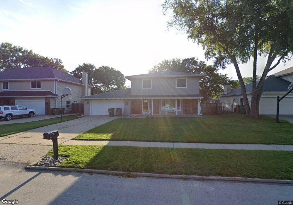
This home is located at 1395 NW 91st St, Clive, IA 50325 and is currently estimated at $334,547, approximately $185 per square foot. 1395 NW 91st St is a home located in Polk County with nearby schools including Indian Hills Junior High School, Valley Southwoods Freshman High School, and Valley High School.
Ownership History
Date
Name
Owned For
Owner Type
Purchase Details
Closed on
May 27, 2009
Sold by
Chamat Nabil C and Chamat Judith Seaver
Bought by
Borland Nathan and Borland Meghan
Current Estimated Value
Home Financials for this Owner
Home Financials are based on the most recent Mortgage that was taken out on this home.
Original Mortgage
$166,920
Outstanding Balance
$105,464
Interest Rate
4.85%
Mortgage Type
FHA
Estimated Equity
$229,083
Create a Home Valuation Report for This Property
The Home Valuation Report is an in-depth analysis detailing your home's value as well as a comparison with similar homes in the area
Home Values in the Area
Average Home Value in this Area
Purchase History
| Date | Buyer | Sale Price | Title Company |
|---|---|---|---|
| Borland Nathan | $169,500 | None Available |
Source: Public Records
Mortgage History
| Date | Status | Borrower | Loan Amount |
|---|---|---|---|
| Open | Borland Nathan | $166,920 |
Source: Public Records
Tax History Compared to Growth
Tax History
| Year | Tax Paid | Tax Assessment Tax Assessment Total Assessment is a certain percentage of the fair market value that is determined by local assessors to be the total taxable value of land and additions on the property. | Land | Improvement |
|---|---|---|---|---|
| 2025 | $4,452 | $336,800 | $62,500 | $274,300 |
| 2024 | $4,452 | $302,100 | $55,400 | $246,700 |
| 2023 | $4,416 | $302,100 | $55,400 | $246,700 |
| 2022 | $4,362 | $244,500 | $45,900 | $198,600 |
| 2021 | $4,204 | $244,500 | $45,900 | $198,600 |
| 2020 | $4,138 | $224,300 | $42,100 | $182,200 |
| 2019 | $4,056 | $224,300 | $42,100 | $182,200 |
| 2018 | $3,972 | $212,100 | $39,000 | $173,100 |
| 2017 | $3,658 | $212,100 | $39,000 | $173,100 |
| 2016 | $3,574 | $191,400 | $34,500 | $156,900 |
| 2015 | $3,574 | $191,400 | $34,500 | $156,900 |
| 2014 | $1,519 | $189,600 | $33,900 | $155,700 |
Source: Public Records
Map
Nearby Homes
- 17662 Hammontree Dr
- 17686 Hammontree Dr
- 17736 Hammontree Dr
- 17769 Townsend Dr
- 17686 Townsend Dr
- 1667 NW 93rd Ct
- 9527 University Ave Unit 21
- 9527 University Ave Unit 15
- 9452 Lincoln Ave
- 1824 NW 90th St
- 8833 Luin Dr
- 1841 NW 89th Ct
- 1901 NW 89th St
- 1679 NW 99th St
- 9906 Lincoln Ave
- 8826 Franklin Ave
- 3997 NW 179th Ct
- 1515 NW 81st St
- 1585 NW 81st St
- 1752 NW 101st St
- 1409 NW 91st St
- 1379 NW 91st St
- 1394 NW 90th Ct
- 1363 NW 91st St
- 1421 NW 91st St
- 1408 NW 90th Ct
- 1378 NW 90th Ct
- 1394 NW 91st St
- 1420 NW 90th Ct
- 1362 NW 90th Ct
- 1408 NW 91st St
- 1433 NW 91st St
- 9085 Indian Hills Dr
- 1362 NW 91st St
- 1420 NW 91st St
- 1432 NW 90th Ct
- 9065 Indian Hills Dr
- 17567 Townsend Dr
- 17530 Townsend Dr
- 17529 Townsend Dr