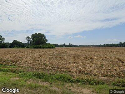
Estimated Value: $150,073 - $201,000
3
Beds
1
Bath
1,425
Sq Ft
$129/Sq Ft
Est. Value
About This Home
This home is located at 13964 Hwy 301, Gable, SC 29051 and is currently estimated at $183,268, approximately $128 per square foot. 13964 Hwy 301 is a home located in Clarendon County with nearby schools including Walker-Gamble Elementary School and East Clarendon Middle-High School.
Ownership History
Date
Name
Owned For
Owner Type
Purchase Details
Closed on
Jun 27, 2024
Sold by
Fannie Mae and Federal National Mortgage Assn
Bought by
Phillips Matthew and Phillips Cassandra
Current Estimated Value
Home Financials for this Owner
Home Financials are based on the most recent Mortgage that was taken out on this home.
Original Mortgage
$193,431
Outstanding Balance
$192,288
Interest Rate
6.94%
Mortgage Type
FHA
Estimated Equity
-$9,020
Purchase Details
Closed on
Dec 12, 2022
Sold by
Clarendon County
Bought by
Federal National Mortgage Association and Fannie Mae
Purchase Details
Closed on
Apr 10, 2007
Sold by
Mosley Rosa Lee and Mosley Theodore
Bought by
Plunkett Louise M
Home Financials for this Owner
Home Financials are based on the most recent Mortgage that was taken out on this home.
Original Mortgage
$65,550
Interest Rate
6.15%
Mortgage Type
New Conventional
Create a Home Valuation Report for This Property
The Home Valuation Report is an in-depth analysis detailing your home's value as well as a comparison with similar homes in the area
Home Values in the Area
Average Home Value in this Area
Purchase History
| Date | Buyer | Sale Price | Title Company |
|---|---|---|---|
| Phillips Matthew | $197,000 | Priority Title & Escrow | |
| Federal National Mortgage Association | $35,000 | -- | |
| Plunkett Louise M | $69,000 | None Available |
Source: Public Records
Mortgage History
| Date | Status | Borrower | Loan Amount |
|---|---|---|---|
| Open | Phillips Matthew | $193,431 | |
| Previous Owner | Plunkett Louise M | $63,017 | |
| Previous Owner | Plunkett Louise M | $65,550 |
Source: Public Records
Tax History Compared to Growth
Tax History
| Year | Tax Paid | Tax Assessment Tax Assessment Total Assessment is a certain percentage of the fair market value that is determined by local assessors to be the total taxable value of land and additions on the property. | Land | Improvement |
|---|---|---|---|---|
| 2024 | $1,140 | $2,760 | $0 | $0 |
| 2023 | $1,111 | $2,760 | $1,596 | $1,164 |
| 2022 | $1,101 | $1,840 | $1,064 | $776 |
| 2021 | $11 | $2,064 | $652 | $1,412 |
| 2020 | $11 | $2,064 | $652 | $1,412 |
| 2019 | $10 | $2,064 | $652 | $1,412 |
| 2018 | $10 | $2,064 | $0 | $0 |
| 2017 | $10 | $2,064 | $0 | $0 |
| 2016 | $9 | $2,064 | $0 | $0 |
| 2015 | $16 | $2,104 | $652 | $1,452 |
| 2014 | $16 | $2,104 | $652 | $1,452 |
| 2013 | -- | $2,104 | $652 | $1,452 |
Source: Public Records
Map
Nearby Homes
- 10988 Highway 301
- 4943 Old Manning Rd
- 2122 William Gibbons Rd
- 1275 Renegade Trail
- 4163 Clarence Coker Hwy
- 8200 Salem Rd
- 775 1 Mile Rd
- 7262 N Brewington Rd
- TBD Clarence Coker Hwy
- 1070 Hickory Hill Rd
- 1179 Coker St
- 1144 Armato Ln
- 1121 Dogwood St
- 0 Pudding Swamp Rd
- 0 Plowden Mill Rd
- 3795 Bart Davis Rd
- TBD American Ave
- 0 Hwy 378 Unit 25004445
- 0 Hwy 378 Unit 11435433
- 1871 State Road S-14-28
