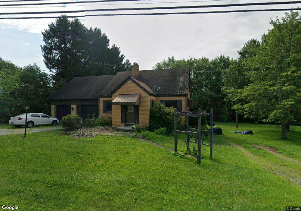
1397 State Route 56 E Apollo, PA 15613
Estimated Value: $169,000 - $197,092
2
Beds
1
Bath
1,590
Sq Ft
$113/Sq Ft
Est. Value
About This Home
This home is located at 1397 State Route 56 E, Apollo, PA 15613 and is currently estimated at $180,023, approximately $113 per square foot. 1397 State Route 56 E is a home located in Armstrong County with nearby schools including Orchard Hills Christian Academy.
Ownership History
Date
Name
Owned For
Owner Type
Purchase Details
Closed on
Oct 31, 2007
Sold by
Knell Robert J and Knell Esther M
Bought by
Osan Lance D
Current Estimated Value
Home Financials for this Owner
Home Financials are based on the most recent Mortgage that was taken out on this home.
Original Mortgage
$94,300
Outstanding Balance
$59,757
Interest Rate
6.41%
Mortgage Type
Purchase Money Mortgage
Estimated Equity
$120,266
Purchase Details
Closed on
Dec 4, 2005
Sold by
Knell Robert J and Knell Esther M
Bought by
Knell Robert J and Knell Esther M
Create a Home Valuation Report for This Property
The Home Valuation Report is an in-depth analysis detailing your home's value as well as a comparison with similar homes in the area
Home Values in the Area
Average Home Value in this Area
Purchase History
| Date | Buyer | Sale Price | Title Company |
|---|---|---|---|
| Osan Lance D | $115,000 | None Available | |
| Knell Robert J | -- | None Available |
Source: Public Records
Mortgage History
| Date | Status | Borrower | Loan Amount |
|---|---|---|---|
| Open | Osan Lance D | $94,300 |
Source: Public Records
Tax History
| Year | Tax Paid | Tax Assessment Tax Assessment Total Assessment is a certain percentage of the fair market value that is determined by local assessors to be the total taxable value of land and additions on the property. | Land | Improvement |
|---|---|---|---|---|
| 2025 | $3,664 | $38,280 | $22,370 | $15,910 |
| 2024 | $3,403 | $38,280 | $22,370 | $15,910 |
| 2023 | $2,825 | $38,280 | $22,370 | $15,910 |
| 2022 | $2,793 | $38,280 | $22,370 | $15,910 |
| 2021 | $2,745 | $38,280 | $22,370 | $15,910 |
| 2020 | $2,745 | $38,280 | $22,370 | $15,910 |
| 2019 | $2,729 | $38,280 | $22,370 | $15,910 |
| 2018 | $2,729 | $31,960 | $9,225 | $22,735 |
| 2017 | $2,713 | $38,280 | $22,370 | $15,910 |
| 2016 | $2,713 | $38,280 | $22,370 | $15,910 |
| 2015 | $2,142 | $38,280 | $22,370 | $15,910 |
| 2014 | $2,142 | $38,280 | $22,370 | $15,910 |
Source: Public Records
Map
Nearby Homes
- 1299 Old State Rd
- 28 Clark Ave
- 139 Maple Dr
- 604 Patterson Rd
- 1212 Gravel Bar Rd
- 1306 Locust Ave
- 1116 Grant St
- 712 16th St
- 28 McKinstry Hill Rd
- 247 Sherman Ave
- 813 Edmon Rd
- 2106 River Rd
- 172 Franklin Ave
- 122 Hamilton Ave
- 219 Quay St
- 250 Kennedy Ave
- 000 Flat Rock Rd
- 137 Sherman Ave
- 502 13th St
- 133 Sherman Ave
- 1403 State Route 56 E
- 1409 State Route 56 E
- 1396 State Route 56 E
- 1400 State Route 56 E
- 1392 State Route 56 E
- 1412 State Route 56 E
- 1417 State Route 56 E
- 1380 State Route 56 E
- 1398 State Route 56 E
- 1377 State Route 56 E
- 1425 State Route 56 E
- 1416 State Route 56 E
- 1373 State Route 56 E
- 1372 Pennsylvania 56
- 1369 State Route 56 E
- 1372 State Route 56 E
- 1429 State Route 56 E
- 105 Elwood Rd
- 1435 State Route 56 E
- 1362 State Route 56 E
Your Personal Tour Guide
Ask me questions while you tour the home.