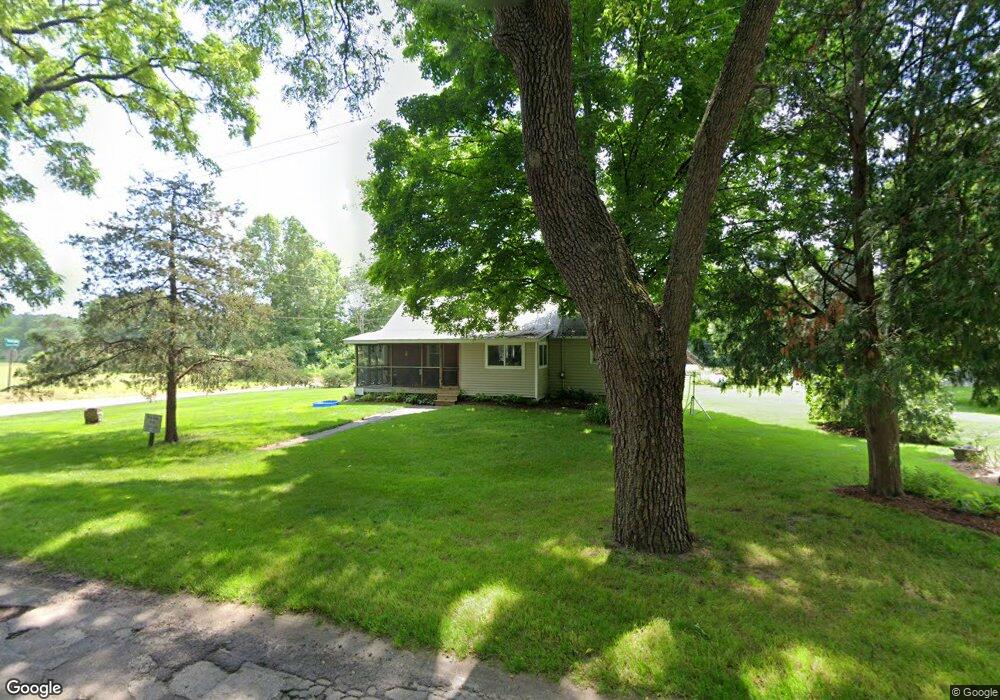
13970 Covered Bridge Rd NE Lowell, MI 49331
Estimated Value: $114,000 - $274,000
2
Beds
1
Bath
1
Sq Ft
$206,861/Sq Ft
Est. Value
About This Home
This home is located at 13970 Covered Bridge Rd NE, Lowell, MI 49331 and is currently estimated at $206,861, approximately $206,861 per square foot. 13970 Covered Bridge Rd NE is a home located in Kent County with nearby schools including Murray Lake Elementary School, Lowell Middle School, and Lowell Senior High School.
Ownership History
Date
Name
Owned For
Owner Type
Purchase Details
Closed on
Dec 1, 2014
Sold by
Rumbaugh Earl Alan
Bought by
Rumbaugh E Alan and E Alan Rumbaugh Trust
Current Estimated Value
Purchase Details
Closed on
Jan 21, 2011
Sold by
West Central Michigan Historical Society
Bought by
Rumbaugh Earl Alan
Purchase Details
Closed on
Jan 15, 1990
Sold by
Westcen Hist
Bought by
Rumbaugh Earl Alan
Create a Home Valuation Report for This Property
The Home Valuation Report is an in-depth analysis detailing your home's value as well as a comparison with similar homes in the area
Home Values in the Area
Average Home Value in this Area
Purchase History
| Date | Buyer | Sale Price | Title Company |
|---|---|---|---|
| Rumbaugh E Alan | -- | None Available | |
| Rumbaugh Earl Alan | $30,000 | Dba Group Title Agency Svcs | |
| Rumbaugh Earl Alan | $34,000 | -- |
Source: Public Records
Tax History Compared to Growth
Tax History
| Year | Tax Paid | Tax Assessment Tax Assessment Total Assessment is a certain percentage of the fair market value that is determined by local assessors to be the total taxable value of land and additions on the property. | Land | Improvement |
|---|---|---|---|---|
| 2025 | $1,056 | $65,800 | $0 | $0 |
| 2024 | $1,056 | $59,800 | $0 | $0 |
| 2023 | $1,010 | $51,500 | $0 | $0 |
| 2022 | $1,493 | $45,200 | $0 | $0 |
| 2021 | $1,461 | $42,300 | $0 | $0 |
| 2020 | $919 | $40,900 | $0 | $0 |
| 2019 | $1,417 | $37,200 | $0 | $0 |
| 2018 | $1,387 | $32,500 | $0 | $0 |
| 2017 | $1,355 | $33,100 | $0 | $0 |
| 2016 | $1,320 | $28,500 | $0 | $0 |
| 2015 | -- | $28,500 | $0 | $0 |
| 2013 | -- | $27,500 | $0 | $0 |
Source: Public Records
Map
Nearby Homes
- 14111 Thompson Dr NE
- 13227 Beckwith Dr NE
- 13164 Beckwith Dr NE
- 13461 Burroughs St NE
- VL Burroughs St NE
- Camden Plan at Fallasburg
- Sycamore Plan at Fallasburg
- Oakwood Plan at Fallasburg
- 2020 Fallasburg Park Dr NE Unit 1
- Elmwood Plan at Fallasburg
- Pentwater Plan at Fallasburg
- Chestnut Plan at Fallasburg
- Bay Harbor Plan at Fallasburg
- Northport Plan at Fallasburg
- Sequoia Plan at Fallasburg
- Maplewood Plan at Fallasburg
- Cedarwood Plan at Fallasburg
- Whitby Plan at Fallasburg
- Harbor Springs Plan at Fallasburg
- Redwood Plan at Fallasburg
- 13959 Covered Bridge Rd NE
- 13959 Covered Bridge Rd
- 853 Montcalm Ave NE
- 13989 Covered Bridge Rd
- 13925 Bieri Rd
- 13980 Bieri Rd
- 13894 Covered Bridge Rd
- 13894 Covered Bridge Rd
- 13907 Covered Bridge Rd
- 14045 Covered Bridge Rd
- 852 Montcalm Ave NE
- 850 Montcalm Ave NE
- 13889 Covered Bridge Rd
- 13885 Covered Bridge Rd
- 13885 Covered Bridge Rd
- 13950 Bieri Rd
- 846 Montcalm Ave NE
- 13900 Bieri Rd
- 843 Montcalm Ave NE
- 13879 Covered Bridge Rd