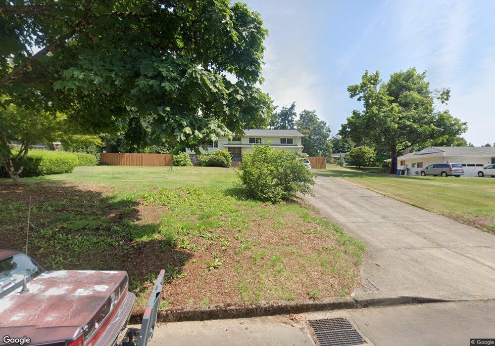
13970 SE Rust Way Damascus, OR 97089
Estimated Value: $558,764 - $648,000
3
Beds
3
Baths
1,971
Sq Ft
$314/Sq Ft
Est. Value
About This Home
This home is located at 13970 SE Rust Way, Damascus, OR 97089 and is currently estimated at $617,941, approximately $313 per square foot. 13970 SE Rust Way is a home located in Clackamas County with nearby schools including Deep Creek - Damascus K-8 School, Sam Barlow High School, and Deep Creek-Damascus K-8 School.
Ownership History
Date
Name
Owned For
Owner Type
Purchase Details
Closed on
May 2, 2003
Sold by
Pearson Rita A and Pearson Survivors Trust
Bought by
Curtis George and Curtis Patricia A
Current Estimated Value
Home Financials for this Owner
Home Financials are based on the most recent Mortgage that was taken out on this home.
Original Mortgage
$206,515
Outstanding Balance
$89,304
Interest Rate
5.84%
Mortgage Type
VA
Estimated Equity
$528,637
Create a Home Valuation Report for This Property
The Home Valuation Report is an in-depth analysis detailing your home's value as well as a comparison with similar homes in the area
Home Values in the Area
Average Home Value in this Area
Purchase History
| Date | Buyer | Sale Price | Title Company |
|---|---|---|---|
| Curtis George | $200,500 | Fidelity Natl Title Co Of Or |
Source: Public Records
Mortgage History
| Date | Status | Borrower | Loan Amount |
|---|---|---|---|
| Open | Curtis George | $206,515 |
Source: Public Records
Tax History Compared to Growth
Tax History
| Year | Tax Paid | Tax Assessment Tax Assessment Total Assessment is a certain percentage of the fair market value that is determined by local assessors to be the total taxable value of land and additions on the property. | Land | Improvement |
|---|---|---|---|---|
| 2025 | $4,927 | $306,816 | -- | -- |
| 2024 | $4,707 | $297,880 | -- | -- |
| 2023 | $4,707 | $289,204 | $0 | $0 |
| 2022 | $4,318 | $280,781 | $0 | $0 |
| 2021 | $4,181 | $272,603 | $0 | $0 |
| 2020 | $4,064 | $264,664 | $0 | $0 |
| 2019 | $3,966 | $256,956 | $0 | $0 |
| 2018 | $3,768 | $249,472 | $0 | $0 |
| 2017 | $3,616 | $242,206 | $0 | $0 |
| 2016 | $3,071 | $235,151 | $0 | $0 |
| 2015 | $3,497 | $228,302 | $0 | $0 |
| 2014 | $3,412 | $221,652 | $0 | $0 |
Source: Public Records
Map
Nearby Homes
- 15400 SE Barlow Ct
- 12035 SE Wiese Rd
- 20320 SE Walgren Rd
- 16003 SE Cielo Ct
- 12591 SE Staley Ave
- 12650 SE Staley Ave
- 18680 SE Highway 212
- 21145 SE Tillstrom Rd
- 23322 SE Bohna Park Rd
- 14543 SE West Park Ct
- 18027 SE Emi St
- 14120 SE Brent Ave
- 13633 SE 178th Ave
- 17000 SE Forest Hill Dr
- 19955 SE Tillstrom Rd
- 14548 SE 172nd Ave
- 20160 SE Foster Rd
- 0 SE Armstrong Cir
- 14790 SE 172nd Ave
- 17483 SE Acadia St
- 13940 SE Rust Way
- 14000 SE Rust Way
- 20801 SE Lansing Ln
- 13900 SE Rust Way
- 20763 SE Lansing Ln
- 20821 SE Lansing Ln
- 13961 SE Rust Way
- 13993 SE Rust Way
- 0 SE Lansing Ln
- 13880 SE Rust Way
- 13925 SE Rust Way
- 14052 SE Rust Way
- 20851 SE Lansing Ln
- 20820 SE Lansing Ln
- 14011 SE Rust Way
- 14083 SE Rust Way
- 13844 SE Rust Way
- 14130 SE Rust Way
- 13857 SE Rust Way
- 20758 SE Lansing Ln