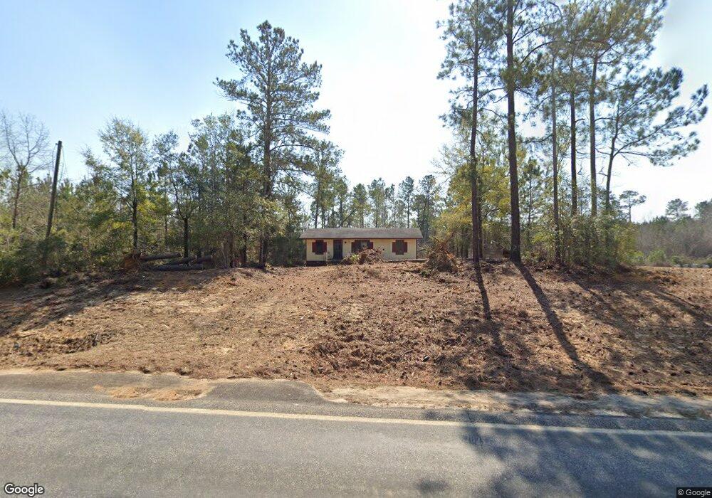
13974 Ga Highway 242 Bartow, GA 30413
Estimated Value: $63,387 - $203,000
--
Bed
--
Bath
1,008
Sq Ft
$109/Sq Ft
Est. Value
About This Home
This home is located at 13974 Ga Highway 242, Bartow, GA 30413 and is currently estimated at $109,597, approximately $108 per square foot. 13974 Ga Highway 242 is a home with nearby schools including Ridge Road Primary School, Ridge Road Elementary School, and T.J. Elder Middle School.
Ownership History
Date
Name
Owned For
Owner Type
Purchase Details
Closed on
Sep 3, 2013
Sold by
Washington County Tax Comm
Bought by
Jordon Sammie Lee
Current Estimated Value
Purchase Details
Closed on
Apr 15, 2005
Sold by
State Street Bank & Trust
Bought by
Us Bank Corporate Trust Svcs
Purchase Details
Closed on
Jun 2, 1997
Sold by
Goldome Credit Corpo
Bought by
State Street Bank
Purchase Details
Closed on
Jun 2, 1991
Sold by
White Robert L and White Louise D
Bought by
Goldome Credit Corpo
Purchase Details
Closed on
Mar 13, 1990
Sold by
Washington County
Bought by
Watkins Margaret
Purchase Details
Closed on
Jun 5, 1989
Sold by
White Louise
Bought by
Dixon John L
Purchase Details
Closed on
Oct 22, 1985
Sold by
Cecil Hodges Lumber Company
Bought by
White Louise
Create a Home Valuation Report for This Property
The Home Valuation Report is an in-depth analysis detailing your home's value as well as a comparison with similar homes in the area
Home Values in the Area
Average Home Value in this Area
Purchase History
| Date | Buyer | Sale Price | Title Company |
|---|---|---|---|
| Jordon Sammie Lee | $2,142 | -- | |
| Us Bank Corporate Trust Svcs | -- | -- | |
| State Street Bank | $32,300 | -- | |
| Goldome Credit Corpo | $31,600 | -- | |
| Watkins Margaret | -- | -- | |
| Dixon John L | -- | -- | |
| White Louise | $3,300 | -- |
Source: Public Records
Tax History Compared to Growth
Tax History
| Year | Tax Paid | Tax Assessment Tax Assessment Total Assessment is a certain percentage of the fair market value that is determined by local assessors to be the total taxable value of land and additions on the property. | Land | Improvement |
|---|---|---|---|---|
| 2024 | $558 | $17,000 | $2,440 | $14,560 |
| 2023 | $396 | $13,600 | $1,000 | $12,600 |
| 2022 | $397 | $13,600 | $1,000 | $12,600 |
| 2021 | $408 | $13,600 | $1,000 | $12,600 |
| 2020 | $411 | $13,600 | $1,000 | $12,600 |
| 2019 | $410 | $13,600 | $1,000 | $12,600 |
| 2018 | $411 | $13,600 | $1,000 | $12,600 |
| 2017 | $383 | $14,620 | $1,009 | $13,611 |
| 2016 | $444 | $14,620 | $1,009 | $13,611 |
| 2015 | $541 | $806 | $1,009 | $13,611 |
| 2014 | $541 | $14,459 | $848 | $13,611 |
| 2013 | $541 | $14,458 | $847 | $13,611 |
Source: Public Records
Map
Nearby Homes
- 1617 New Bethel Rd
- 39.702 AC Heards Bridge Rd
- 9872 Harrison Davisboro Rd
- 0 Jackson Gin Rd Unit 10439206
- 0 Jackson Gin Rd Unit 52265
- 0 Jackson Gin Rd Unit 10469996
- 9357 E Highway 242
- 0 Bartow-Dublin Rd Unit 24028627
- 0 Bartow-Dublin Rd Unit 10559571
- 8849 Sunhill Rd
- Lt.1 Harrison-Davisboro Rd Unit 1
- Lt.1 Harrison-Davisboro Rd
- 0 Newman Smith Rd Unit 10573699
- 0 Newman Smith Rd Unit 24281399
- 2010 Page Rd
- 00 Breezy Hill Rd
- 1480 Smith Bedgood Rd
- 00 Sheppard Rd
- 0 Sheppard Rd Unit 10545353
- 0 Sinquefield Rd Unit 10570118
- 14051 Ga Highway 242
- 13989 Ga Highway 242
- 14035 Ga Highway 242
- 13896 Ga Highway 242
- 13899 Ga Highway 242
- 13867 Ga Highway 242
- 13902 Ga Highway 242
- 13902 Ga Highway 242
- 14107 Ga Highway 242
- 14129 Ga Highway 242
- 14181 Ga Highway 242
- 2524 Tarver Rd
- 2908 Tarver Rd
- 2758 Tarver Rd
- 2672 Tarver Rd
- 523 Dukes Rd
- 321 Dukes Rd
- 2463 Wilson Rd
- 2279 Wilson Rd
- 2279 Wilson Rd