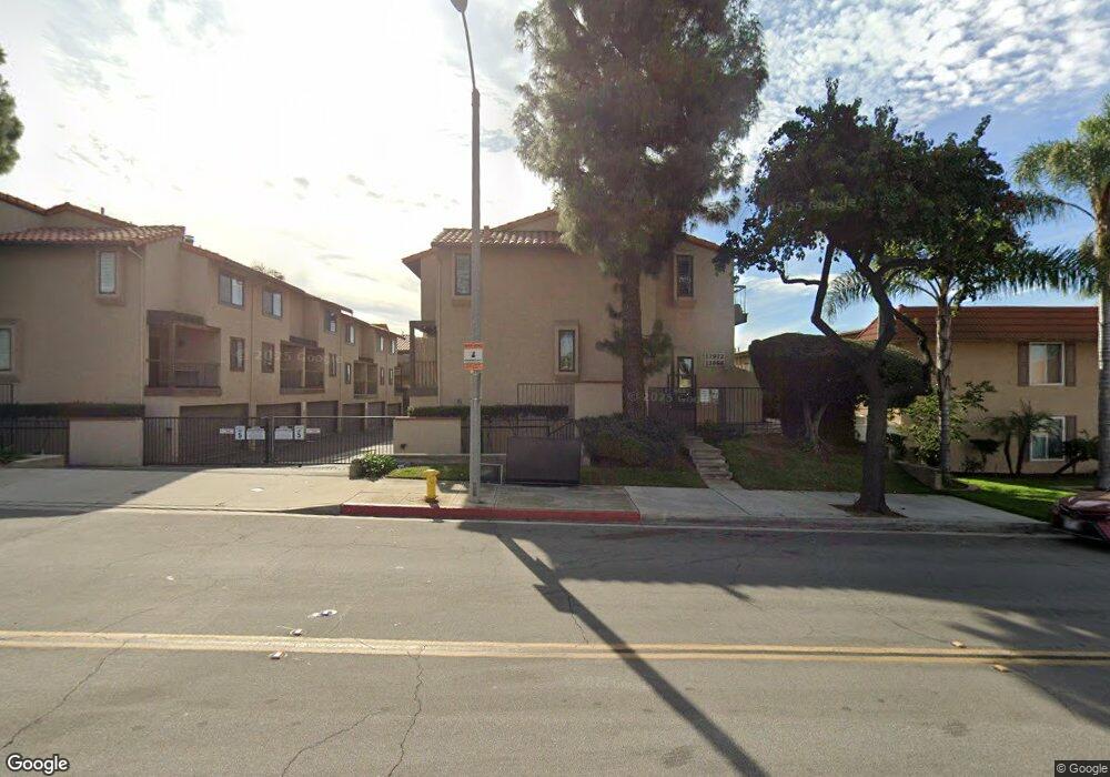
13984 Ramhurst Dr Unit 7 La Mirada, CA 90638
Estimated Value: $543,000 - $625,000
2
Beds
3
Baths
1,125
Sq Ft
$519/Sq Ft
Est. Value
About This Home
This home is located at 13984 Ramhurst Dr Unit 7, La Mirada, CA 90638 and is currently estimated at $584,352, approximately $519 per square foot. 13984 Ramhurst Dr Unit 7 is a home located in Los Angeles County with nearby schools including Foster Road Elementary School, Reginald M. Benton Middle School, and La Mirada High School.
Ownership History
Date
Name
Owned For
Owner Type
Purchase Details
Closed on
Jan 6, 2005
Sold by
Marmolejo Jose G
Bought by
Marmolejo Jose G
Current Estimated Value
Home Financials for this Owner
Home Financials are based on the most recent Mortgage that was taken out on this home.
Original Mortgage
$211,000
Outstanding Balance
$106,883
Interest Rate
5.8%
Mortgage Type
New Conventional
Estimated Equity
$477,469
Purchase Details
Closed on
Jan 20, 2003
Sold by
Marmolejo Maria
Bought by
Marmolejo Jose G
Purchase Details
Closed on
Oct 23, 2002
Sold by
Johnson E Jean
Bought by
Marmolejo Jose G
Home Financials for this Owner
Home Financials are based on the most recent Mortgage that was taken out on this home.
Original Mortgage
$192,060
Interest Rate
5.97%
Mortgage Type
FHA
Create a Home Valuation Report for This Property
The Home Valuation Report is an in-depth analysis detailing your home's value as well as a comparison with similar homes in the area
Home Values in the Area
Average Home Value in this Area
Purchase History
| Date | Buyer | Sale Price | Title Company |
|---|---|---|---|
| Marmolejo Jose G | -- | Equity Title Company | |
| Marmolejo Jose G | -- | -- | |
| Marmolejo Jose G | $198,000 | Fidelity National Title |
Source: Public Records
Mortgage History
| Date | Status | Borrower | Loan Amount |
|---|---|---|---|
| Open | Marmolejo Jose G | $211,000 | |
| Previous Owner | Marmolejo Jose G | $192,060 | |
| Closed | Marmolejo Jose G | $5,940 |
Source: Public Records
Tax History Compared to Growth
Tax History
| Year | Tax Paid | Tax Assessment Tax Assessment Total Assessment is a certain percentage of the fair market value that is determined by local assessors to be the total taxable value of land and additions on the property. | Land | Improvement |
|---|---|---|---|---|
| 2025 | $3,724 | $286,745 | $131,642 | $155,103 |
| 2024 | $3,724 | $281,123 | $129,061 | $152,062 |
| 2023 | $3,597 | $275,612 | $126,531 | $149,081 |
| 2022 | $3,532 | $270,208 | $124,050 | $146,158 |
| 2021 | $3,478 | $264,911 | $121,618 | $143,293 |
| 2019 | $3,376 | $257,055 | $118,011 | $139,044 |
| 2018 | $3,262 | $252,016 | $115,698 | $136,318 |
| 2016 | $3,122 | $242,232 | $111,206 | $131,026 |
| 2015 | $3,094 | $238,594 | $109,536 | $129,058 |
| 2014 | $2,883 | $233,921 | $107,391 | $126,530 |
Source: Public Records
Map
Nearby Homes
- 13976 Ramhurst Dr
- 14000 Lake View Dr
- 14036 Lake View Dr Unit 143
- 14020 Lake Crest Dr Unit 84
- 12818 Duffield Ave
- 12726 Lake Forest Ave Unit 25
- 13854 Adoree St
- 13102 Sunnybrook Ln
- 13007 Duffield Ave
- 12309 Ramsey Dr
- 14216 Adoree St
- 14243 Gagely Dr
- 14246 Gagely Dr
- 14135 Chere Dr
- 14049 Foster Rd
- 13703 Placid Dr
- 13857 Leffingwell Rd
- 11827 Loma Dr Unit 15
- 14034 Coteau Dr Unit 1103
- 12222 Corley Dr
- 14000 Ramhurst Dr
- 13992 Ramhurst Dr Unit 16
- 13988 Ramhurst Dr
- 13972 Ramhurst Dr Unit 1
- 13990 Ramhurst Dr
- 14004 Ramhurst Dr
- 13982 Ramhurst Dr Unit 6
- 13974 Ramhurst Dr
- 13986 Ramhurst Dr Unit 8
- 13978 Ramhurst Dr Unit 4
- 13994 Ramhurst Dr
- 13996 Ramhurst Dr
- 14002 Ramhurst Dr
- 13986 Ramhurst Dr
- 13980 Ramhurst Dr
- 13978 Ramhurst Dr
- 13998 Ramhurst Dr Unit 13
- 13964 Ramhurst Dr
- 12709 Lake Park Way Unit 119
- 12703 Lake Park Way Unit 120