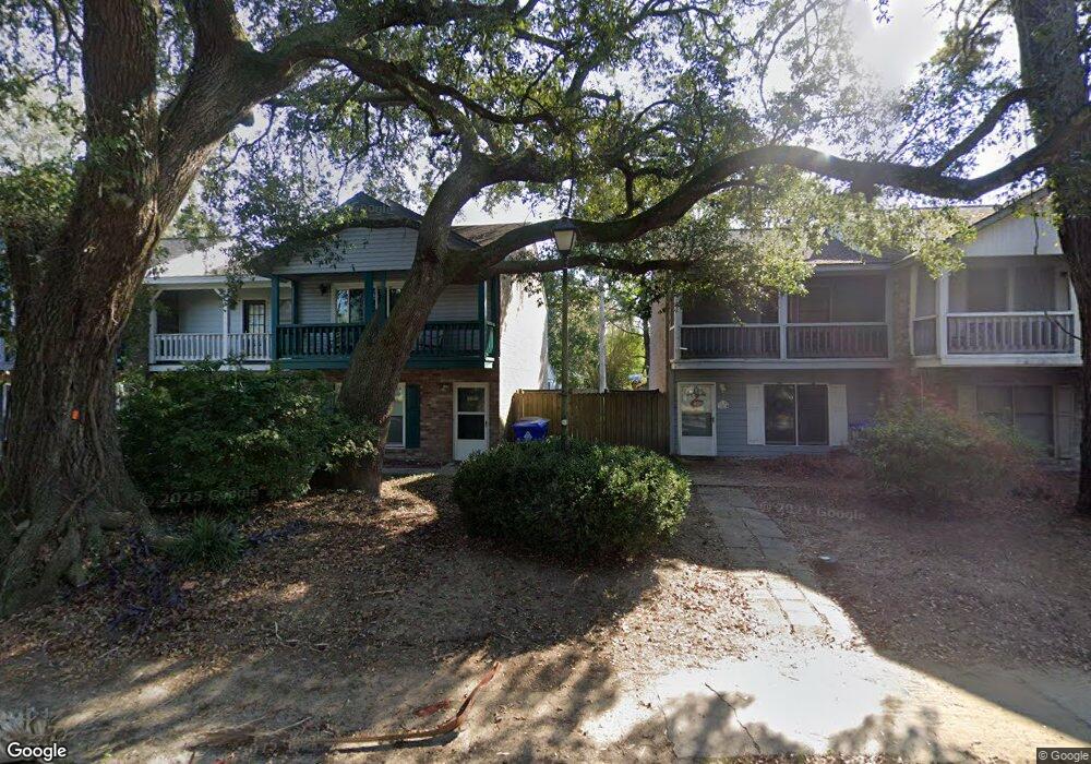
1399 Camp Rd Charleston, SC 29412
James Island NeighborhoodEstimated Value: $304,000 - $366,000
2
Beds
2
Baths
1,332
Sq Ft
$251/Sq Ft
Est. Value
About This Home
This home is located at 1399 Camp Rd, Charleston, SC 29412 and is currently estimated at $334,585, approximately $251 per square foot. 1399 Camp Rd is a home located in Charleston County with nearby schools including James Island Elementary School, Camp Road Middle, and James Island Charter High School.
Ownership History
Date
Name
Owned For
Owner Type
Purchase Details
Closed on
Jun 11, 2007
Sold by
Smith Sharlie E and Smith Bryan T
Bought by
Stutsman Megan
Current Estimated Value
Purchase Details
Closed on
Jul 20, 2005
Sold by
Green Jenny A and Green Jose A
Bought by
Smith Sharlie E and Smith Bryan T
Purchase Details
Closed on
Dec 15, 2004
Sold by
Morrison Jenny A
Bought by
Green Jose A
Purchase Details
Closed on
Oct 28, 2003
Sold by
Depriest Elizabeth M
Bought by
Morrison Jenny A
Create a Home Valuation Report for This Property
The Home Valuation Report is an in-depth analysis detailing your home's value as well as a comparison with similar homes in the area
Home Values in the Area
Average Home Value in this Area
Purchase History
| Date | Buyer | Sale Price | Title Company |
|---|---|---|---|
| Stutsman Megan | $165,000 | None Available | |
| Smith Sharlie E | $139,500 | -- | |
| Green Jose A | -- | -- | |
| Morrison Jenny A | $108,000 | -- |
Source: Public Records
Tax History Compared to Growth
Tax History
| Year | Tax Paid | Tax Assessment Tax Assessment Total Assessment is a certain percentage of the fair market value that is determined by local assessors to be the total taxable value of land and additions on the property. | Land | Improvement |
|---|---|---|---|---|
| 2024 | $904 | $6,110 | $0 | $0 |
| 2023 | $904 | $6,110 | $0 | $0 |
| 2022 | $815 | $6,110 | $0 | $0 |
| 2021 | $851 | $6,110 | $0 | $0 |
| 2020 | $880 | $6,110 | $0 | $0 |
| 2019 | $790 | $5,310 | $0 | $0 |
| 2017 | $765 | $5,310 | $0 | $0 |
| 2016 | $736 | $5,310 | $0 | $0 |
| 2015 | $758 | $5,310 | $0 | $0 |
| 2014 | $866 | $0 | $0 | $0 |
| 2011 | -- | $0 | $0 | $0 |
Source: Public Records
Map
Nearby Homes
- 1418 Kentwood Cir
- 1402 Camp Rd Unit 5E
- 1402 Camp Rd Unit 6E
- 1402 Camp Rd Unit 1H
- 1402 Camp Rd Unit 8B
- 1402 Camp Rd Unit 9C
- 1402 Camp Rd Unit 12F
- 1453 Camp Rd
- 1014 Arborwood Dr
- 1 S Anderson Ave
- 1359 White House Blvd
- 17 S Anderson Ave Unit A,B,C, D
- 27 Brockman Dr Unit 27B
- 27 Brockman Dr Unit 27C
- 1336 Briarfield Ave
- 1335 Camp Rd
- 1 Maplecrest Dr
- 1107 Secessionville Rd
- 14 Maplecrest Dr
- 1030 Pauline Ave
- 1399 Camp Rd
- 1399 Camp Rd
- 1399 Camp Rd
- 1399 Camp Rd Unit B
- 1399 Camp Rd Unit A
- 1399 Camp Rd Unit D
- 1399 Camp Rd Unit C
- 1411 Camp Rd Unit A
- 1395 Camp Rd
- 1395 Camp Rd
- 1395 Camp Rd
- 1395 Camp Rd
- 1395 Camp Rd Unit D
- 1401 Camp Rd
- 1401 Camp Rd
- 1401 Camp Rd
- 1401 Camp Rd
- 1401 Camp Rd Unit A
- 1401 Camp Rd Unit D
- 1401 Camp Rd Unit C