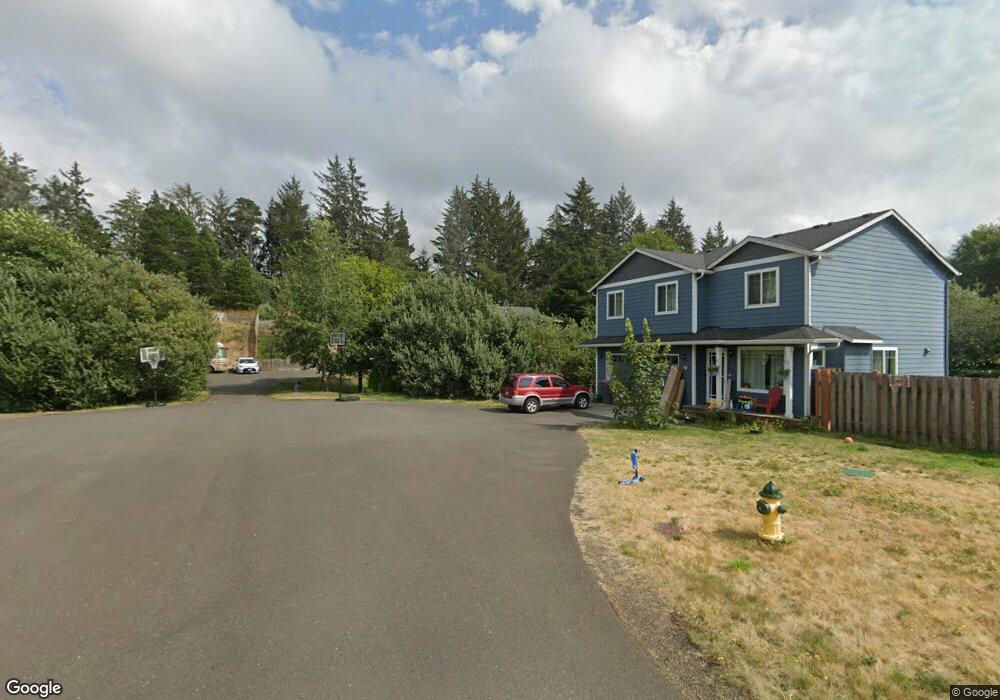
1399 Sandy Ridge Road Ln Gearhart, OR 97138
Estimated Value: $577,000 - $634,058
3
Beds
3
Baths
2,068
Sq Ft
$294/Sq Ft
Est. Value
About This Home
This home is located at 1399 Sandy Ridge Road Ln, Gearhart, OR 97138 and is currently estimated at $607,265, approximately $293 per square foot. 1399 Sandy Ridge Road Ln is a home located in Clatsop County with nearby schools including Seaside High School.
Ownership History
Date
Name
Owned For
Owner Type
Purchase Details
Closed on
Aug 23, 2018
Sold by
Woodruff Michael and Woodruff Tera
Bought by
Harper Taira
Current Estimated Value
Home Financials for this Owner
Home Financials are based on the most recent Mortgage that was taken out on this home.
Original Mortgage
$339,055
Outstanding Balance
$294,456
Interest Rate
4.5%
Mortgage Type
New Conventional
Estimated Equity
$312,809
Purchase Details
Closed on
May 31, 2017
Sold by
Boucher Kenneth Mark and Boucher Laure Jane
Bought by
Woodruff Michael and Woodruff Tera
Home Financials for this Owner
Home Financials are based on the most recent Mortgage that was taken out on this home.
Original Mortgage
$257,600
Interest Rate
5.5%
Mortgage Type
Adjustable Rate Mortgage/ARM
Purchase Details
Closed on
Apr 19, 2010
Sold by
Cartus Financial Corporation
Bought by
Boucher Kenneth Mark and Boucher Laure Jane
Home Financials for this Owner
Home Financials are based on the most recent Mortgage that was taken out on this home.
Original Mortgage
$244,000
Interest Rate
4.92%
Mortgage Type
New Conventional
Purchase Details
Closed on
Mar 31, 2010
Sold by
Skirko Eric and Skirko Kaye L
Bought by
Cartus Financial Corporation
Home Financials for this Owner
Home Financials are based on the most recent Mortgage that was taken out on this home.
Original Mortgage
$244,000
Interest Rate
4.92%
Mortgage Type
New Conventional
Purchase Details
Closed on
Oct 4, 2006
Sold by
Kerslake Billie K and Esposito Scott R
Bought by
Skirko Eric and Skirko Kaye L
Home Financials for this Owner
Home Financials are based on the most recent Mortgage that was taken out on this home.
Original Mortgage
$260,000
Interest Rate
6.43%
Mortgage Type
Purchase Money Mortgage
Purchase Details
Closed on
Mar 24, 2006
Sold by
Olstedt Construction Inc
Bought by
Kerslake Billie K and Esposito Scott R
Home Financials for this Owner
Home Financials are based on the most recent Mortgage that was taken out on this home.
Original Mortgage
$257,000
Interest Rate
6.25%
Mortgage Type
Fannie Mae Freddie Mac
Create a Home Valuation Report for This Property
The Home Valuation Report is an in-depth analysis detailing your home's value as well as a comparison with similar homes in the area
Home Values in the Area
Average Home Value in this Area
Purchase History
| Date | Buyer | Sale Price | Title Company |
|---|---|---|---|
| Harper Taira | $356,900 | Title Ins Co | |
| Woodruff Michael | $322,000 | Ticor Title Company Of Or | |
| Boucher Kenneth Mark | $305,000 | Pacific Title Company | |
| Cartus Financial Corporation | $305,000 | Pacific Title Company | |
| Skirko Eric | $325,000 | Fidelity National Title Co | |
| Kerslake Billie K | $290,000 | Pacific Title Company |
Source: Public Records
Mortgage History
| Date | Status | Borrower | Loan Amount |
|---|---|---|---|
| Open | Harper Taira | $339,055 | |
| Previous Owner | Woodruff Michael | $257,600 | |
| Previous Owner | Boucher Kenneth Mark | $244,000 | |
| Previous Owner | Skirko Eric | $260,000 | |
| Previous Owner | Kerslake Billie K | $257,000 |
Source: Public Records
Tax History Compared to Growth
Tax History
| Year | Tax Paid | Tax Assessment Tax Assessment Total Assessment is a certain percentage of the fair market value that is determined by local assessors to be the total taxable value of land and additions on the property. | Land | Improvement |
|---|---|---|---|---|
| 2024 | $3,215 | $281,097 | -- | -- |
| 2023 | $3,125 | $272,911 | $0 | $0 |
| 2022 | $3,031 | $264,963 | $0 | $0 |
| 2021 | $3,094 | $257,246 | $0 | $0 |
| 2020 | $2,985 | $249,754 | $0 | $0 |
| 2019 | $2,908 | $242,481 | $0 | $0 |
| 2018 | $2,803 | $235,420 | $0 | $0 |
| 2017 | $2,729 | $228,564 | $0 | $0 |
| 2016 | $2,357 | $221,907 | $64,904 | $157,003 |
| 2015 | $2,242 | $215,445 | $63,014 | $152,431 |
| 2014 | $2,167 | $209,171 | $0 | $0 |
| 2013 | -- | $203,080 | $0 | $0 |
Source: Public Records
Map
Nearby Homes
- 1348 Dooley Ln
- 2499 Pine Ridge Dr
- 1309 Cottonwood Ln
- 2998 Pine Ct
- 4586 Drummond Ct
- 88271 McCormick Gardens Rd
- 5399 Drummond Dr
- 568 Browning Ln
- 0 Rd
- 645 Meadow Ln
- 0 Salminen Rd
- 0 Vl High Ridge Rd Unit Lot 58
- Lot 58 High Ridge Rd
- 0 High Ridge Rd Unit 278550860
- Lot 59 High Ridge Rd
- 0 McCormick Garden Rd
- 1729 Gearhart Green Condo Unit 510
- 4830 Butterfly Ln
- 88161 McCormick Garden Rd
- 4580 Fairway Ave
- 1399 Sandy Ridge Ln
- 1399 Sandy Ridge Rd
- 1396 Sandy Ridge Rd
- 1383 Sandy Ridge Rd
- 1383 Sandy Ridge Ln
- 1383 Sandy Ridge
- 1384 Sandy Ridge Rd
- 1384 Sandy Ridge Ln
- 1370 Sandy Ridge Ln
- 1370 Sandy Ridge Rd
- 1370 Sandy Ridge
- 1355 Sandy Ridge Rd
- 4575 Highway 101 N
- 4575 Hwy 101 N
- 4575 Hwy 101 N
- 1354 Sandy Ridge Rd
- 1354 Sandy Ridge Ln
- 4657 Us-101 N
- 4657 Us-101
- 4657 U S 101