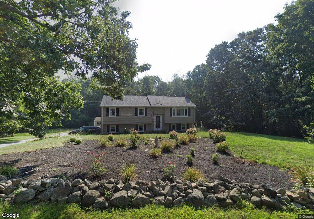
14 5th Ave Bellingham, MA 02019
Estimated Value: $527,000 - $602,000
3
Beds
2
Baths
2,011
Sq Ft
$276/Sq Ft
Est. Value
About This Home
This home is located at 14 5th Ave, Bellingham, MA 02019 and is currently estimated at $554,600, approximately $275 per square foot. 14 5th Ave is a home located in Norfolk County with nearby schools including Stall Brook Elementary School, Bellingham High School, and Bethany Christian Academy.
Ownership History
Date
Name
Owned For
Owner Type
Purchase Details
Closed on
Jun 10, 2011
Sold by
Wingert Edward J
Bought by
Wingert Edward J and Wingert Elizabeth J
Current Estimated Value
Purchase Details
Closed on
Feb 27, 1998
Sold by
Davis Janice M
Bought by
Wingert Edward J
Purchase Details
Closed on
Mar 30, 1995
Sold by
Russo John J
Bought by
Davis John W and Davis Janice M
Purchase Details
Closed on
Nov 29, 1993
Sold by
Silvia David M
Bought by
Russo Paul J and Russo John J
Purchase Details
Closed on
Dec 30, 1987
Sold by
Dittami Joan M
Bought by
Dion Jacqueline M
Create a Home Valuation Report for This Property
The Home Valuation Report is an in-depth analysis detailing your home's value as well as a comparison with similar homes in the area
Home Values in the Area
Average Home Value in this Area
Purchase History
| Date | Buyer | Sale Price | Title Company |
|---|---|---|---|
| Wingert Edward J | -- | -- | |
| Wingert Edward J | $151,500 | -- | |
| Davis John W | $142,000 | -- | |
| Russo Paul J | $132,500 | -- | |
| Dion Jacqueline M | $150,000 | -- |
Source: Public Records
Mortgage History
| Date | Status | Borrower | Loan Amount |
|---|---|---|---|
| Previous Owner | Dion Jacqueline M | $6,600 | |
| Previous Owner | Dion Jacqueline M | $240,000 |
Source: Public Records
Tax History Compared to Growth
Tax History
| Year | Tax Paid | Tax Assessment Tax Assessment Total Assessment is a certain percentage of the fair market value that is determined by local assessors to be the total taxable value of land and additions on the property. | Land | Improvement |
|---|---|---|---|---|
| 2025 | $5,127 | $408,200 | $168,100 | $240,100 |
| 2024 | $4,910 | $381,800 | $153,400 | $228,400 |
| 2023 | $4,733 | $362,700 | $146,100 | $216,600 |
| 2022 | $4,606 | $327,100 | $121,800 | $205,300 |
| 2021 | $4,487 | $311,400 | $121,800 | $189,600 |
| 2020 | $4,343 | $305,400 | $121,800 | $183,600 |
| 2019 | $4,253 | $299,300 | $121,800 | $177,500 |
| 2018 | $3,935 | $273,100 | $117,200 | $155,900 |
| 2017 | $3,827 | $266,900 | $117,200 | $149,700 |
| 2016 | $3,664 | $256,400 | $115,200 | $141,200 |
| 2015 | $3,510 | $246,300 | $110,800 | $135,500 |
| 2014 | $3,520 | $240,100 | $108,200 | $131,900 |
Source: Public Records
Map
Nearby Homes
- 108 N Main St
- 49 Horseshoe Dr
- 6 Lisa Ann Dr
- 1136 S Main St
- 123-125 Mendon St
- 49 Monique Dr
- 7 Debra Ln
- 1099 S Main St
- 501 Old Bridge Ln Unit 501
- 125 Blackstone St
- 1501 Old Bridge Ln Unit 1501
- 1303 Old Bridge Ln Unit 1303
- 22 Roger Belanger Dr
- 0 Hartford Ave
- 29 Rawson Rd
- 214 Conlyn Ave
- 11 Silver Ave
- 17 Pine St
- 370 S Main St
- 975 S Main St