NOT LISTED FOR SALE

14 Aurora Way Nantucket, MA 02554

Estimated Value: $4,434,000 - $5,143,000

0.2 Acre
$23,331,605 Price per Acre
8,712 Sq Ft Lot

Last Sold July 01, 2021

Last sale price $825,000

Est. 466% increase in value since last sale

Current estimated payment $27,011/month

26 Days on Market

About This Lot

As of July 2021

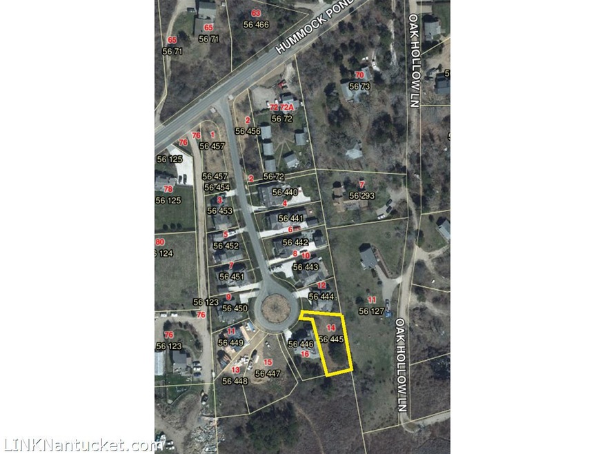
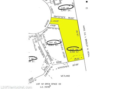
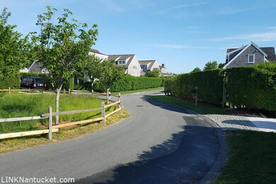
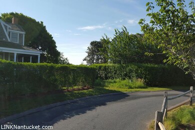
Nice buildable lot in well developed vacation neighborhood. In the Hummock Pond/Cisco area of Nantucket this property is approx 1.5 miles to Town and 2.5 to Cisco Beach. Not far from Bartlett Farm, 167 Hummock Seafood, Cisco Brewery and Boatyard Farm this property has access to Hummock Pond Road Bike Path. Build Nantucket Dream home in this highly sought after location. Cluster Subdivision regulations apply, allowable ground cover is 50% Front yard Setback it 15' Side and Rear 5'

Last Agent to Sell the Property

Gary Winn

Maury People Sotheby's International Realty Listed on: 05/06/2021

Last Buyer's Agent

Kathy Gallaher

Maury People Sotheby's International Realty

Property Details

Property Type

  • Land

Est. Annual Taxes

  • $2,650

Year Built

  • 2022

Lot Details

  • 8,712 Sq Ft Lot
  • Property is zoned R20

Property Views

  • Views of Woods

Listing and Financial Details

  • Tax Lot 48
  • Assessor Parcel Number 445

Property Details

Property Type

Land

Est. Annual Taxes

$2,650

Year Built

2022

Lot Details

0

Listing Details

  • Property Sub Type: Unimproved Land
  • Prop. Type: Land
  • Road Frontage Type: None
  • Lot Size Acres: 0.2
  • Special Features: None
  • Year Built (Public Record): 2022

Interior Features

  • Possible Use: 15196 - P

Exterior Features

  • Lot Features: Aurora Way Restrictions and Easements Doc 98263, Aurora Way Homeowners Association Doc 98263, HOA Architectural review, Wetlands on Lot, Cluster Subdivision regulations apply, allowable ground cover is 50% Front yard Setback it 15' Side and Rear 5'
  • Pool Private: No
  • View: None, Trees/Woods

Utilities

  • Sewer: Twn
  • Water Source: Town

Lot Info

  • Lot Size Sq Ft: 8712
  • Parcel #: 445
  • Zoning: R20

Tax Info

  • Tax Annual Amount: 2650
  • Tax Lot: 48
  • Tax Map Number: 56
  • Tax Other Annual Assessment Amount: 730100
  • Tax Year: 2021

Range of Values:

Collateral Analytics

Collateral Analytics Collateral Analytics AVMs (Automated Valuation Model) employ a number of statistical approaches combined with neighborhood-specific comparable selection guarantees the most up-to-date and precise valuations.

Not Available

Collateral Analytics does not have data for the current month. Please view the chart for historical values.

ICE

ICE Mortgage Technology ICE Mortgage Technology’s AVM (Automated Valuation Model) is a state-of-the-art online residential property valuation tool that provides a quick and accurate estimate of the value of almost any home in the U.S.

Not Available

ICE Mortgage Technology does not have data for the current month. Please view the chart for historical values.

First American

First American First American Data & Analytics’ next-generation AVM combines unrivaled data assets with a blended ensemble of valuation models to produce highly accurate, reliable valuations you can trust.

Not Available

First American does not have data for the current month. Please view the chart for historical values.

Quantarium

Quantarium Quantarium’s valuation service, repeatedly proven the industry’s most accurate and comprehensive, is supercharged with a self-learning and auto-tuning AI engine that continually becomes smarter and more accurate as it processes daily inputs from the industry’s leading RE data lake.

Not Available

Quantarium does not have data for the current month. Please view the chart for historical values.

Average Value
Not Available
List Price
Sold Price
Create a Home Valuation Report for This Property
The Home Valuation Report is an in-depth analysis detailing your home's value as well as a comparison with similar homes in the area

Home Values in the Area

Source: Public Records

Average Home Value in this Area


Source: Public Records

Mortgage History

Date Status Borrower Loan Amount
Closed Sampson Scott $1,788,300
Closed Sampson Scott $618,750
Source: Public Records

Property History

Date Event Price Change Sq Ft Price
07/01/2021 07/01/21 Sold $825,000 +3.8% --
06/01/2021 06/01/21 Pending -- -- --
05/06/2021 05/06/21 For Sale $795,000 -- --
Source: LINK

Tax History Compared to Growth

Source: Public Records

Tax History

Year Tax Paid Tax Assessment Tax Assessment Total Assessment is a certain percentage of the fair market value that is determined by local assessors to be the total taxable value of land and additions on the property. Land Improvement
2025 $11,000 $3,353,700 $1,028,000 $2,325,700
2024 $9,442 $3,016,600 $1,028,000 $1,988,600
2023 $3,143 $979,200 $979,200 $0
2022 $2,570 $687,200 $687,200 $0
2021 $2,650 $730,100 $730,100 $0
2020 $2,163 $627,000 $627,000 $0
2019 $2,107 $627,000 $627,000 $0
2018 $2,429 $661,400 $661,400 $0
2017 $2,242 $661,400 $661,400 $0
2016 $2,309 $687,200 $687,200 $0
2015 $1,383 $383,000 $383,000 $0
2014 $1,368 $363,900 $363,900 $0
Source: Public Records

Agents Affiliated with this Home

  • Section Image
  • Section Image
See All Agents

Map

Source: LINK

MLS Number: 88310

APN: NANT-000-056-000-000-0004-45-000-000