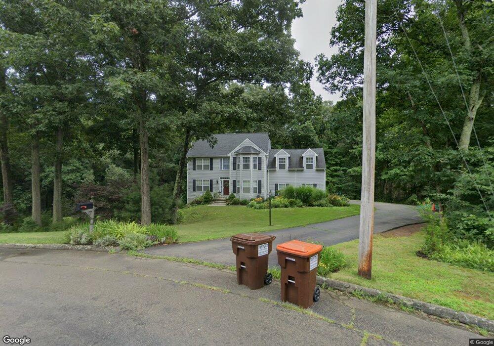
14 Balaurel Dr Guilford, CT 06437
Estimated Value: $619,000 - $710,000
3
Beds
3
Baths
2,113
Sq Ft
$314/Sq Ft
Est. Value
About This Home
This home is located at 14 Balaurel Dr, Guilford, CT 06437 and is currently estimated at $663,807, approximately $314 per square foot. 14 Balaurel Dr is a home located in New Haven County with nearby schools including E.C. Adams Middle School, A. Baldwin Middle School, and Guilford High School.
Ownership History
Date
Name
Owned For
Owner Type
Purchase Details
Closed on
Aug 17, 2006
Sold by
Bonanno Stephanie
Bought by
Loukakes James and Loukakes Halina
Current Estimated Value
Purchase Details
Closed on
May 30, 2000
Sold by
Verni Patricia P
Bought by
Bonanno Stephanie and Bonanno Michael
Purchase Details
Closed on
May 16, 1994
Sold by
Anderson Wilcox Bldrs
Bought by
Verni Gary N and Verni Patricia P
Create a Home Valuation Report for This Property
The Home Valuation Report is an in-depth analysis detailing your home's value as well as a comparison with similar homes in the area
Home Values in the Area
Average Home Value in this Area
Purchase History
| Date | Buyer | Sale Price | Title Company |
|---|---|---|---|
| Loukakes James | $449,900 | -- | |
| Bonanno Stephanie | $285,000 | -- | |
| Verni Gary N | $196,800 | -- |
Source: Public Records
Mortgage History
| Date | Status | Borrower | Loan Amount |
|---|---|---|---|
| Closed | Verni Gary N | $75,000 | |
| Open | Verni Gary N | $173,174 | |
| Closed | Verni Gary N | $180,000 |
Source: Public Records
Tax History Compared to Growth
Tax History
| Year | Tax Paid | Tax Assessment Tax Assessment Total Assessment is a certain percentage of the fair market value that is determined by local assessors to be the total taxable value of land and additions on the property. | Land | Improvement |
|---|---|---|---|---|
| 2025 | $9,077 | $328,300 | $164,500 | $163,800 |
| 2024 | $8,726 | $328,300 | $164,500 | $163,800 |
| 2023 | $8,496 | $328,300 | $164,500 | $163,800 |
| 2022 | $8,229 | $247,490 | $148,400 | $99,090 |
| 2021 | $8,073 | $247,490 | $148,400 | $99,090 |
| 2020 | $7,996 | $247,490 | $148,400 | $99,090 |
| 2019 | $7,927 | $247,490 | $148,400 | $99,090 |
| 2018 | $7,741 | $247,490 | $148,400 | $99,090 |
| 2017 | $7,966 | $271,310 | $157,500 | $113,810 |
| 2016 | $7,778 | $271,310 | $157,500 | $113,810 |
| 2015 | $7,662 | $271,310 | $157,500 | $113,810 |
| 2014 | $7,439 | $271,310 | $157,500 | $113,810 |
Source: Public Records
Map
Nearby Homes
- 1028 Moose Hill Rd
- 59 Hoadley Creek Cir
- 522 Peddlers Rd
- 181 Denison Dr
- 40 Kenneth Cir
- LOT #22 Kenneth Cir Unit MAP 77
- LOT 28B Bruce Ln Unit MAP 83
- 2805 Boston Post Rd
- 42 Copper Hill Dr
- 3 Ashman Ct
- 360 Jefferson Dr
- 20 Copper Hill Dr Unit 20
- 55-69 Sawmill Rd
- 288 Jefferson Dr
- 312 Leetes Island Rd
- 37 Long Hill Farm
- 15 Briarwood Dr
- 1066 Long Hill Rd
- 12 Bowhay Hill Rd
- 63 Gould Ln