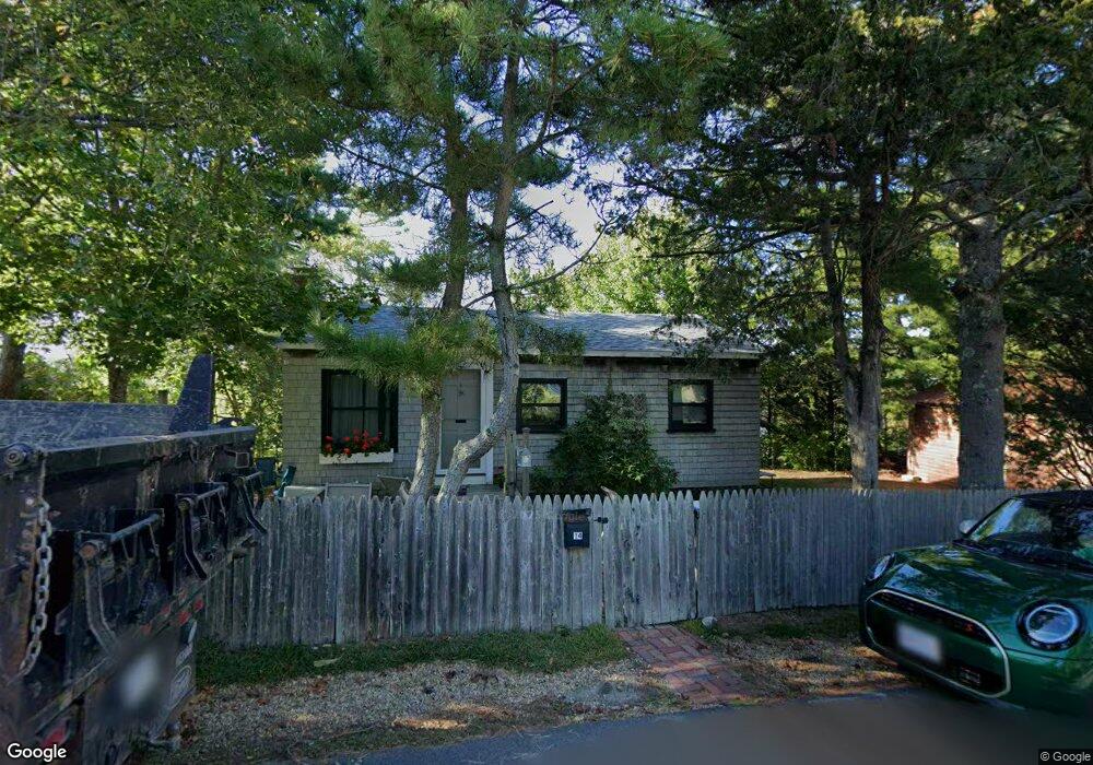
14 Barberry Way Gloucester, MA 01930
East Gloucester NeighborhoodEstimated Value: $553,000 - $864,000
2
Beds
1
Bath
600
Sq Ft
$1,161/Sq Ft
Est. Value
About This Home
This home is located at 14 Barberry Way, Gloucester, MA 01930 and is currently estimated at $696,691, approximately $1,161 per square foot. 14 Barberry Way is a home located in Essex County with nearby schools including East Gloucester Elementary School, Ralph B O'maley Middle School, and Gloucester High School.
Ownership History
Date
Name
Owned For
Owner Type
Purchase Details
Closed on
Aug 1, 1997
Sold by
Hallenborg John C
Bought by
Richmond Martha
Current Estimated Value
Home Financials for this Owner
Home Financials are based on the most recent Mortgage that was taken out on this home.
Original Mortgage
$100,000
Outstanding Balance
$15,002
Interest Rate
7.55%
Mortgage Type
Purchase Money Mortgage
Estimated Equity
$681,689
Create a Home Valuation Report for This Property
The Home Valuation Report is an in-depth analysis detailing your home's value as well as a comparison with similar homes in the area
Home Values in the Area
Average Home Value in this Area
Purchase History
| Date | Buyer | Sale Price | Title Company |
|---|---|---|---|
| Richmond Martha | $125,000 | -- |
Source: Public Records
Mortgage History
| Date | Status | Borrower | Loan Amount |
|---|---|---|---|
| Open | Richmond Martha | $100,000 |
Source: Public Records
Tax History Compared to Growth
Tax History
| Year | Tax Paid | Tax Assessment Tax Assessment Total Assessment is a certain percentage of the fair market value that is determined by local assessors to be the total taxable value of land and additions on the property. | Land | Improvement |
|---|---|---|---|---|
| 2025 | $7,378 | $759,100 | $591,300 | $167,800 |
| 2024 | $7,086 | $728,300 | $563,100 | $165,200 |
| 2023 | $6,970 | $658,200 | $502,600 | $155,600 |
| 2022 | $6,678 | $569,300 | $437,300 | $132,000 |
| 2021 | $6,540 | $525,700 | $397,500 | $128,200 |
| 2020 | $6,007 | $487,200 | $374,800 | $112,400 |
| 2019 | $6,042 | $476,100 | $374,800 | $101,300 |
| 2018 | $6,037 | $466,900 | $374,800 | $92,100 |
| 2017 | $5,874 | $445,300 | $357,100 | $88,200 |
| 2016 | $5,605 | $411,800 | $338,800 | $73,000 |
| 2015 | $5,097 | $373,400 | $297,500 | $75,900 |
Source: Public Records
Map
Nearby Homes
- 26 Marina Dr
- 29 Harrison Ave
- 10 Amero Ct
- 20 Haskell St
- 9 Rocky Pasture Rd
- 33 Highview Rd
- 86 E Main St
- 20 Calder St
- 97 E Main St
- 100 E Main St
- 36 Links Rd
- 30 Chapel St Unit B
- 22 Taylor St Unit 1
- 160 Prospect St Unit 3
- 197 E Main St
- 197 E Main St Unit 1
- 197 E Main St Unit 2
- 197 E Main St Unit 1 & 2
- 4 Mount Vernon St
- 27 Hodgkins Rd
- 12 Barberry Way
- 13 Barberry Way
- 11 Barberry Way
- 43 Cliff Rd Unit 2
- 43 Cliff Rd Unit 43B
- 43 Cliff Rd Unit 43A
- 41 Cliff Rd Unit A
- 41 Cliff Rd Unit A
- 45 Cliff Rd Unit 45B
- 45 Cliff Rd Unit 45A
- 5 Barberry Way
- 15 Barberry Way
- 8 Brier Neck Rd
- 3 Barberry Way
- 34 Cliff Rd
- 8 Barberry Way
- 11 Barberry Way
- 39 Cliff Rd
- 6 Brier Neck Rd
- 84 Thatcher Rd