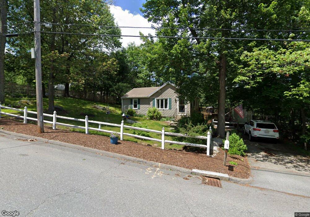
14 Barrows Rd Worcester, MA 01609
West Tatnuck NeighborhoodEstimated Value: $329,710 - $530,000
2
Beds
1
Bath
786
Sq Ft
$518/Sq Ft
Est. Value
About This Home
This home is located at 14 Barrows Rd, Worcester, MA 01609 and is currently estimated at $407,428, approximately $518 per square foot. 14 Barrows Rd is a home located in Worcester County with nearby schools including Chandler Magnet, Jacob Hiatt Magnet School, and Flagg Street School.
Ownership History
Date
Name
Owned For
Owner Type
Purchase Details
Closed on
Jul 7, 2009
Sold by
Theodhoraqi Magdalena and Theodhoraqi Ilia
Bought by
Alartosky Ann M
Current Estimated Value
Home Financials for this Owner
Home Financials are based on the most recent Mortgage that was taken out on this home.
Original Mortgage
$164,957
Interest Rate
4.86%
Mortgage Type
Purchase Money Mortgage
Purchase Details
Closed on
Jan 30, 2009
Sold by
Jp Morgan Chase Bk
Bought by
Theodhoraqi Ilia and Theodhoraqi Magdalena
Purchase Details
Closed on
May 20, 2008
Sold by
Smajkiewicz John K
Bought by
Washington Mutual Bk
Purchase Details
Closed on
May 26, 1999
Sold by
Brown Gary P
Bought by
Smajkiewicz Pamela J
Purchase Details
Closed on
Mar 29, 1989
Sold by
Grigaitis Wm J
Bought by
Brown Gary P
Create a Home Valuation Report for This Property
The Home Valuation Report is an in-depth analysis detailing your home's value as well as a comparison with similar homes in the area
Home Values in the Area
Average Home Value in this Area
Purchase History
| Date | Buyer | Sale Price | Title Company |
|---|---|---|---|
| Alartosky Ann M | $168,000 | -- | |
| Theodhoraqi Ilia | $84,100 | -- | |
| Washington Mutual Bk | $140,250 | -- | |
| Smajkiewicz Pamela J | $80,000 | -- | |
| Brown Gary P | $92,000 | -- |
Source: Public Records
Mortgage History
| Date | Status | Borrower | Loan Amount |
|---|---|---|---|
| Open | Brown Gary P | $165,522 | |
| Closed | Alartosky Ann M | $164,957 | |
| Previous Owner | Brown Gary P | $142,200 | |
| Previous Owner | Brown Gary P | $52,128 |
Source: Public Records
Tax History
| Year | Tax Paid | Tax Assessment Tax Assessment Total Assessment is a certain percentage of the fair market value that is determined by local assessors to be the total taxable value of land and additions on the property. | Land | Improvement |
|---|---|---|---|---|
| 2025 | $3,933 | $298,200 | $118,200 | $180,000 |
| 2024 | $3,880 | $282,200 | $118,200 | $164,000 |
| 2023 | $3,724 | $259,700 | $102,800 | $156,900 |
| 2022 | $3,288 | $216,200 | $82,300 | $133,900 |
| 2021 | $3,009 | $184,800 | $65,800 | $119,000 |
| 2020 | $2,922 | $171,900 | $65,800 | $106,100 |
| 2019 | $2,754 | $153,000 | $59,200 | $93,800 |
| 2018 | $2,710 | $143,300 | $59,200 | $84,100 |
| 2017 | $2,710 | $141,000 | $59,200 | $81,800 |
| 2016 | $2,566 | $124,500 | $43,300 | $81,200 |
| 2015 | $2,499 | $124,500 | $43,300 | $81,200 |
| 2014 | $2,433 | $124,500 | $43,300 | $81,200 |
Source: Public Records
Map
Nearby Homes
- 770 Salisbury St Unit 517
- 770 Salisbury St Unit 333
- 16 Baiting Brook Ln Unit 64
- 14 Baiting Brook Ln Unit 65
- 10 Baiting Brook Ln Unit 67
- 7 Primmett Ln
- 4004 Brompton Cir
- 8 Salisbury Hill Blvd Unit 79
- 10 Salisbury Hill Blvd Unit 75
- 5 Chartwell Ln Unit 87
- 46 Barry Rd
- 61 Barry Rd
- 288 Fisher Rd
- 28 Lynnwood Ln
- 158 Chester St
- 70 Moreland Green Dr
- 84 Chester St
- 90 Bjorklund Ave
- 163 Moreland St
- 97 Parkton Ave
Your Personal Tour Guide
Ask me questions while you tour the home.