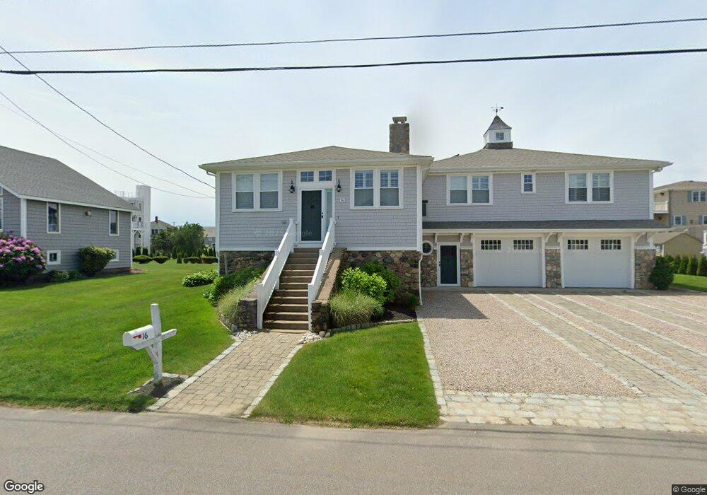
14 Benson Ave Westerly, RI 02891
Estimated Value: $993,433 - $1,038,000
2
Beds
2
Baths
1,089
Sq Ft
$933/Sq Ft
Est. Value
About This Home
This home is located at 14 Benson Ave, Westerly, RI 02891 and is currently estimated at $1,015,858, approximately $932 per square foot. 14 Benson Ave is a home located in Washington County with nearby schools including Westerly High School.
Ownership History
Date
Name
Owned For
Owner Type
Purchase Details
Closed on
Jul 30, 2025
Sold by
Anne G Berti 3Rd Ret and Berti
Bought by
Benson Al Mare Llc
Current Estimated Value
Purchase Details
Closed on
Jul 11, 2019
Sold by
Berti Anne G
Bought by
Anne G Berti 2019 Ret and Berti
Create a Home Valuation Report for This Property
The Home Valuation Report is an in-depth analysis detailing your home's value as well as a comparison with similar homes in the area
Home Values in the Area
Average Home Value in this Area
Purchase History
| Date | Buyer | Sale Price | Title Company |
|---|---|---|---|
| Benson Al Mare Llc | -- | -- | |
| Benson Al Mare Llc | -- | -- | |
| Benson Al Mare Llc | -- | -- | |
| Anne G Berti 2019 Ret | -- | -- | |
| Anne G Berti 2019 Ret | -- | -- | |
| Anne G Berti 2019 Ret | -- | -- |
Source: Public Records
Tax History
| Year | Tax Paid | Tax Assessment Tax Assessment Total Assessment is a certain percentage of the fair market value that is determined by local assessors to be the total taxable value of land and additions on the property. | Land | Improvement |
|---|---|---|---|---|
| 2025 | $7,043 | $990,600 | $741,200 | $249,400 |
| 2024 | $7,024 | $716,000 | $529,500 | $186,500 |
| 2023 | $6,888 | $716,000 | $529,500 | $186,500 |
| 2022 | $6,845 | $716,000 | $529,500 | $186,500 |
| 2021 | $6,108 | $530,200 | $383,800 | $146,400 |
| 2020 | $5,997 | $530,200 | $383,800 | $146,400 |
| 2019 | $5,938 | $530,200 | $383,800 | $146,400 |
| 2018 | $5,726 | $482,000 | $348,900 | $133,100 |
| 2017 | $5,438 | $469,200 | $348,900 | $120,300 |
| 2016 | $5,387 | $461,200 | $348,900 | $112,300 |
| 2015 | $5,114 | $472,600 | $356,000 | $116,600 |
| 2014 | $5,028 | $472,600 | $356,000 | $116,600 |
Source: Public Records
Map
Nearby Homes
- 27 Benson Ave
- 10 Tristam St
- 4 Shore Rd
- 9 Compass Way Unit 201
- 9 Compass Way Unit 202
- 9 Compass Way Unit 101
- 9 Compass Way Unit 102
- 9 Compass Way Unit 103
- 9 Compass Way Unit 203
- 109 Watch Hill Rd
- 4 Quail Run
- 20 Browning Rd
- 52 Avondale Rd
- 60 Avondale Rd
- 9 Champlin Dr
- 417 River Rd
- 432 Atlantic Ave
- 18 Timothy Dr
- 446 Atlantic Ave
- 19 Wicklow Rd
Your Personal Tour Guide
Ask me questions while you tour the home.