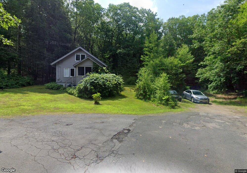
14 Billings Rd Montague, MA 01351
Estimated Value: $257,000 - $319,000
3
Beds
2
Baths
1,025
Sq Ft
$274/Sq Ft
Est. Value
About This Home
This home is located at 14 Billings Rd, Montague, MA 01351 and is currently estimated at $280,369, approximately $273 per square foot. 14 Billings Rd is a home located in Franklin County.
Ownership History
Date
Name
Owned For
Owner Type
Purchase Details
Closed on
Mar 11, 2024
Sold by
Freeman Donald A Est and Freeman
Bought by
Freeman Ft and Freeman
Current Estimated Value
Purchase Details
Closed on
Dec 6, 2019
Sold by
Freeman Int and Freeman F
Bought by
Freeman Donald A
Purchase Details
Closed on
Feb 21, 2018
Sold by
Freeman Donald A
Bought by
Freeman Int and Freeman F
Purchase Details
Closed on
Dec 1, 1969
Bought by
Freeman Donald A and Freeman Dorothy B
Create a Home Valuation Report for This Property
The Home Valuation Report is an in-depth analysis detailing your home's value as well as a comparison with similar homes in the area
Home Values in the Area
Average Home Value in this Area
Purchase History
| Date | Buyer | Sale Price | Title Company |
|---|---|---|---|
| Freeman Ft | -- | None Available | |
| Elizabeth L Freeman T L | -- | None Available | |
| Elizabeth L Freeman T L | -- | None Available | |
| Freeman Ft | -- | None Available | |
| Freeman Ft | -- | None Available | |
| Freeman Donald A | -- | None Available | |
| Freeman Donald A | -- | None Available | |
| Freeman Int | -- | -- | |
| Freeman Int | -- | -- | |
| Freeman Donald A | -- | -- | |
| Freeman Donald A | -- | -- | |
| Freeman Donald A | -- | -- | |
| Freeman Donald A | -- | -- |
Source: Public Records
Tax History Compared to Growth
Tax History
| Year | Tax Paid | Tax Assessment Tax Assessment Total Assessment is a certain percentage of the fair market value that is determined by local assessors to be the total taxable value of land and additions on the property. | Land | Improvement |
|---|---|---|---|---|
| 2025 | $2,925 | $192,300 | $70,800 | $121,500 |
| 2024 | $2,865 | $182,500 | $70,800 | $111,700 |
| 2023 | $2,767 | $176,800 | $70,800 | $106,000 |
| 2022 | $2,742 | $163,600 | $70,800 | $92,800 |
| 2021 | $2,930 | $154,300 | $65,600 | $88,700 |
| 2020 | $2,460 | $140,000 | $65,600 | $74,400 |
| 2019 | $2,414 | $140,900 | $70,700 | $70,200 |
| 2018 | $2,393 | $140,000 | $70,700 | $69,300 |
| 2017 | $2,305 | $138,300 | $70,700 | $67,600 |
| 2016 | $2,543 | $144,400 | $71,400 | $73,000 |
| 2015 | $2,449 | $144,400 | $71,400 | $73,000 |
| 2014 | $2,359 | $144,400 | $71,400 | $73,000 |
Source: Public Records
Map
Nearby Homes
- 35 A N Leverett Rd
- 39 N Leverett Rd
- 2 Gunn Rd
- 2 Gunn Rd
- 495 Federal St Unit B
- 64 Main St
- 10 Hannabrooke Dr
- 132 Meadow Rd
- 134 Montague Rd
- 0 Pocumtuck Dr Unit 73379330
- 0 Dudleyville Rd
- 7 Stage Rd
- 259 Long Plain Rd
- 238 N Main St
- 55 Putney Rd
- 345 Greenfield Rd
- 13 Capt Lathrop Dr
- 208 Greenfield Rd
- 8 Craig Ave
- 55 A + B Randall Rd