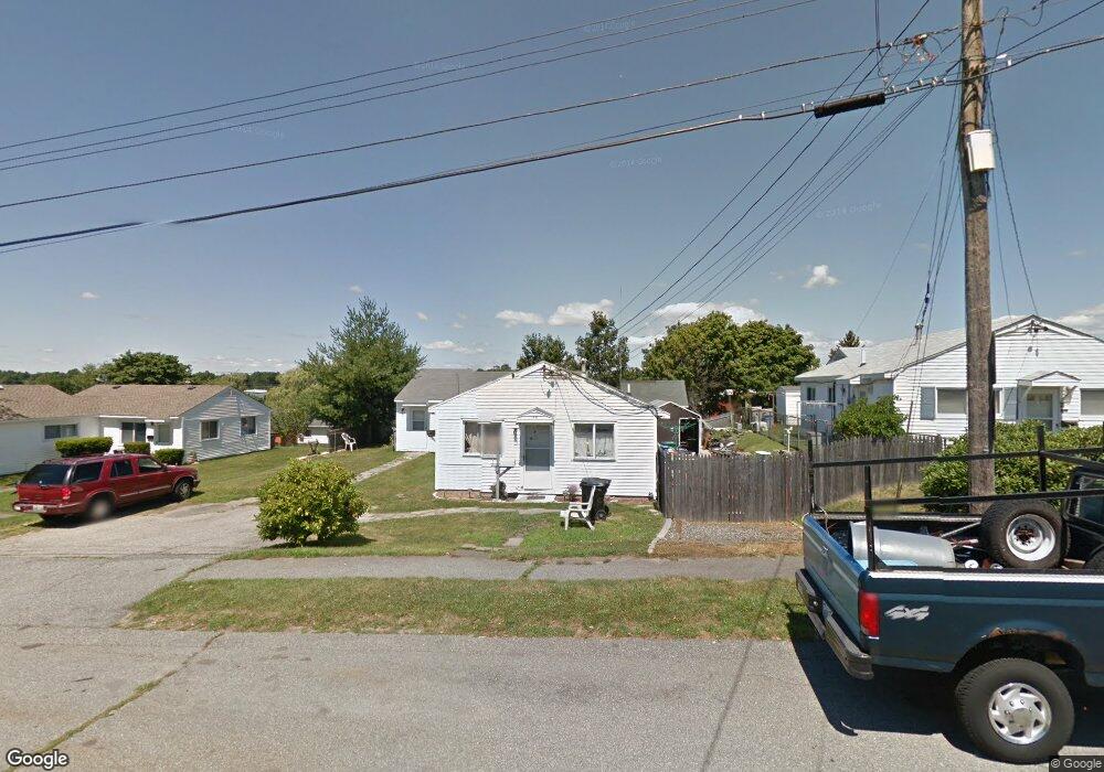
14 Bristol Rd Middletown, RI 02842
Estimated Value: $456,527 - $564,000
4
Beds
2
Baths
1,426
Sq Ft
$362/Sq Ft
Est. Value
About This Home
This home is located at 14 Bristol Rd, Middletown, RI 02842 and is currently estimated at $516,882, approximately $362 per square foot. 14 Bristol Rd is a home located in Newport County with nearby schools including Middletown High School, All Saints STEAM Academy, and St Michael's Country Day School.
Ownership History
Date
Name
Owned For
Owner Type
Purchase Details
Closed on
Apr 2, 2025
Sold by
Kent Robyn
Bought by
Marshall Merrilee
Current Estimated Value
Purchase Details
Closed on
Jul 30, 1997
Sold by
Diomandes Sophia Est
Bought by
Kent Alan J and Kent Mercedes
Home Financials for this Owner
Home Financials are based on the most recent Mortgage that was taken out on this home.
Original Mortgage
$59,000
Interest Rate
7.55%
Create a Home Valuation Report for This Property
The Home Valuation Report is an in-depth analysis detailing your home's value as well as a comparison with similar homes in the area
Home Values in the Area
Average Home Value in this Area
Purchase History
| Date | Buyer | Sale Price | Title Company |
|---|---|---|---|
| Marshall Merrilee | -- | None Available | |
| Marshall Merrilee | -- | None Available | |
| Kent Alan J | $29,000 | -- | |
| Kent Alan J | $29,000 | -- |
Source: Public Records
Mortgage History
| Date | Status | Borrower | Loan Amount |
|---|---|---|---|
| Previous Owner | Kent Alan J | $59,000 |
Source: Public Records
Tax History Compared to Growth
Tax History
| Year | Tax Paid | Tax Assessment Tax Assessment Total Assessment is a certain percentage of the fair market value that is determined by local assessors to be the total taxable value of land and additions on the property. | Land | Improvement |
|---|---|---|---|---|
| 2025 | $3,851 | $326,600 | $153,500 | $173,100 |
| 2024 | $3,678 | $326,600 | $153,500 | $173,100 |
| 2023 | $2,660 | $211,300 | $99,000 | $112,300 |
| 2022 | $2,540 | $211,300 | $99,000 | $112,300 |
| 2021 | $2,540 | $211,300 | $99,000 | $112,300 |
| 2020 | $2,597 | $188,700 | $86,100 | $102,600 |
| 2018 | $2,595 | $188,700 | $86,100 | $102,600 |
| 2016 | $2,601 | $168,700 | $73,900 | $94,800 |
| 2015 | $2,537 | $168,700 | $73,900 | $94,800 |
| 2014 | $2,660 | $165,500 | $80,600 | $84,900 |
| 2013 | $2,600 | $165,500 | $80,600 | $84,900 |
Source: Public Records
Map
Nearby Homes
- 6 Wabasso Terrace
- 74 Valley Rd
- 521 Forest Park
- 529 Forest Park
- 533 Forest Park
- 841 Forest Park
- 836 Forest Park
- 16 King Rd
- 65 Maple Ave
- 17 Underwood Ln
- 67 Linden St
- 114 Maple Ave
- 17 Mariner Way
- 149 W Main Rd
- 231 Maple Ave Unit 204
- 117 W Main Rd
- 481 Oliphant Ln
- 476 Green End Ave
- 223 Corey Ln
- 0 Honeyman Ave
- 12 Bristol Rd
- 16 Bristol Rd
- 13 Ludlow Rd
- 13 Ludlow Rd Unit B
- 13 Ludlow Rd Unit 13 Ludlow Rd. A
- 11 Ludlow Rd
- 15 Ludlow Rd
- 10 Bristol Rd
- 10 Bristol Rd Unit A
- 17 Ludlow Rd
- 17 Ludlow Rd Unit B
- 9 Bristol Rd
- 9 Ludlow Rd
- 7 Bristol Rd
- 7 Bristol Rd Unit A
- 7 Bristol Rd Unit B
- 19 Ludlow Rd
- 8 Bristol Rd
- 24 Ludlow Rd
- 5 Bristol Rd