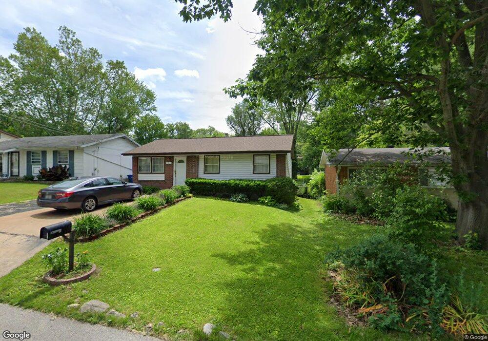
14 Cady Dr Saint Louis, MO 63135
Estimated Value: $101,000 - $117,000
3
Beds
2
Baths
960
Sq Ft
$112/Sq Ft
Est. Value
About This Home
This home is located at 14 Cady Dr, Saint Louis, MO 63135 and is currently estimated at $107,349, approximately $111 per square foot. 14 Cady Dr is a home located in St. Louis County with nearby schools including Walnut Grove Elementary School, Ferguson Middle School, and McCluer High School.
Ownership History
Date
Name
Owned For
Owner Type
Purchase Details
Closed on
Jul 8, 2014
Sold by
Hensley Diana K
Bought by
Hensley Diana K
Current Estimated Value
Purchase Details
Closed on
Feb 20, 2003
Sold by
Horne Kenneth A and Horne Deloris S
Bought by
Hensley Dennis R
Home Financials for this Owner
Home Financials are based on the most recent Mortgage that was taken out on this home.
Original Mortgage
$71,400
Outstanding Balance
$30,177
Interest Rate
5.77%
Mortgage Type
VA
Estimated Equity
$77,172
Create a Home Valuation Report for This Property
The Home Valuation Report is an in-depth analysis detailing your home's value as well as a comparison with similar homes in the area
Home Values in the Area
Average Home Value in this Area
Purchase History
| Date | Buyer | Sale Price | Title Company |
|---|---|---|---|
| Hensley Diana K | -- | None Available | |
| Hensley Dennis R | $70,000 | -- |
Source: Public Records
Mortgage History
| Date | Status | Borrower | Loan Amount |
|---|---|---|---|
| Open | Hensley Dennis R | $71,400 |
Source: Public Records
Tax History Compared to Growth
Tax History
| Year | Tax Paid | Tax Assessment Tax Assessment Total Assessment is a certain percentage of the fair market value that is determined by local assessors to be the total taxable value of land and additions on the property. | Land | Improvement |
|---|---|---|---|---|
| 2025 | $1,355 | $19,550 | $1,960 | $17,590 |
| 2024 | $1,355 | $17,160 | $780 | $16,380 |
| 2023 | $1,355 | $17,160 | $780 | $16,380 |
| 2022 | $989 | $10,950 | $2,340 | $8,610 |
| 2021 | $986 | $10,950 | $2,340 | $8,610 |
| 2020 | $957 | $9,880 | $1,580 | $8,300 |
| 2019 | $939 | $9,880 | $1,580 | $8,300 |
| 2018 | $1,103 | $10,450 | $1,220 | $9,230 |
| 2017 | $1,097 | $10,450 | $1,220 | $9,230 |
| 2016 | $1,290 | $12,010 | $1,980 | $10,030 |
| 2015 | $1,297 | $12,010 | $1,980 | $10,030 |
| 2014 | $1,517 | $14,590 | $1,940 | $12,650 |
Source: Public Records
Map
Nearby Homes
- 13 Cady Dr
- 116 Grether Ave
- 18 White Dr
- 16 White Dr
- 110 Young Dr
- 135 Grether Ave
- 135 Anistasia Dr
- 6717 Thurston Ave
- 217 Anistasia Dr
- 230 Anistasia Dr
- 231 Wooster Dr
- 6640 Thurston Ave
- 144 Flora Dr
- 222 Wooster Dr
- 40 Connolly Dr
- 6612 Torlina Dr
- 15 Lake Pembroke Dr
- 6616 Dunwold Dr
- 8293 Frost Ave
- 1815 S New Florissant Rd