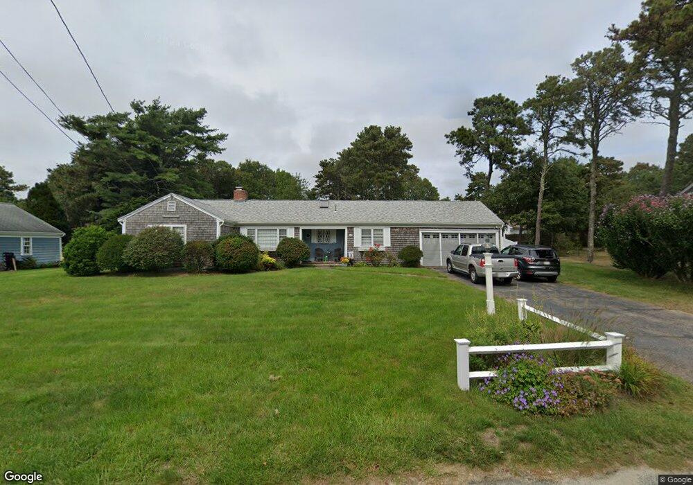
14 Captain Nickerson Rd South Yarmouth, MA 02664
Estimated Value: $605,299 - $654,000
3
Beds
2
Baths
1,201
Sq Ft
$522/Sq Ft
Est. Value
About This Home
This home is located at 14 Captain Nickerson Rd, South Yarmouth, MA 02664 and is currently estimated at $626,825, approximately $521 per square foot. 14 Captain Nickerson Rd is a home located in Barnstable County with nearby schools including Dennis-Yarmouth Regional High School and St. Pius X. School.
Ownership History
Date
Name
Owned For
Owner Type
Purchase Details
Closed on
Apr 9, 2012
Sold by
Taylor John M
Bought by
Taylor Kenneth B and Taylor Gail M
Current Estimated Value
Home Financials for this Owner
Home Financials are based on the most recent Mortgage that was taken out on this home.
Original Mortgage
$195,000
Outstanding Balance
$26,434
Interest Rate
3.95%
Mortgage Type
New Conventional
Estimated Equity
$600,391
Purchase Details
Closed on
Jun 30, 1994
Sold by
Foley Gloria Z
Bought by
Taylor Elizabeth A
Create a Home Valuation Report for This Property
The Home Valuation Report is an in-depth analysis detailing your home's value as well as a comparison with similar homes in the area
Home Values in the Area
Average Home Value in this Area
Purchase History
| Date | Buyer | Sale Price | Title Company |
|---|---|---|---|
| Taylor Kenneth B | $245,000 | -- | |
| Taylor Elizabeth A | $119,900 | -- |
Source: Public Records
Mortgage History
| Date | Status | Borrower | Loan Amount |
|---|---|---|---|
| Open | Taylor Kenneth B | $195,000 | |
| Previous Owner | Taylor Elizabeth A | $102,000 | |
| Previous Owner | Taylor Elizabeth A | $110,000 |
Source: Public Records
Tax History Compared to Growth
Tax History
| Year | Tax Paid | Tax Assessment Tax Assessment Total Assessment is a certain percentage of the fair market value that is determined by local assessors to be the total taxable value of land and additions on the property. | Land | Improvement |
|---|---|---|---|---|
| 2025 | $3,999 | $564,900 | $182,200 | $382,700 |
| 2024 | $3,731 | $505,500 | $154,000 | $351,500 |
| 2023 | $3,613 | $445,500 | $133,300 | $312,200 |
| 2022 | $3,393 | $369,600 | $121,100 | $248,500 |
| 2021 | $3,171 | $331,700 | $121,100 | $210,600 |
| 2020 | $3,090 | $309,000 | $121,100 | $187,900 |
| 2019 | $8,098 | $281,700 | $121,100 | $160,600 |
| 2018 | $2,715 | $263,800 | $103,200 | $160,600 |
| 2017 | $7,186 | $256,200 | $98,700 | $157,500 |
| 2016 | $2,467 | $247,200 | $89,700 | $157,500 |
| 2015 | $2,343 | $233,400 | $89,700 | $143,700 |
Source: Public Records
Map
Nearby Homes
- 75 Captain York Rd
- 76 Captain Chase Rd
- 33 Sparrow Way
- 0 Forsyth Ave
- 147 Captain Bacon Rd
- 72 Quartermaster Row
- 6 Billingsgate Rd
- 30 Quartermaster Row
- 97 Astor Way
- 4 Raymond Ave
- 140 Diane Ave
- 338 Forest Rd
- 255 Long Pond Dr
- 7 Sunset Pines Rd
- 38 Autumn Dr
- 5 Miriah Dr
- 15 Sharon Rd
- 55 Lower Brook Rd
- 22 Powhatan Rd
- 20 Captain Nickerson Rd
- 6 Captain Nickerson Rd
- 321 Station Ave
- 327 Station Ave
- 15 Captain Nickerson Rd
- 9 Captain Nickerson Rd
- 24 Captain Nickerson Rd
- 19 Captain Nickerson Rd
- 11 Capt Bacon Rd
- 5 Captain Nickerson Rd
- 7 Captain Bacon Rd
- 10 Station Ave
- 3 Captain Bacon Rd
- 7 Haywood Ave
- 11 Captain Bacon Rd
- 18 Captain Small Rd
- 14 Captain Small Rd
- 326 Station Ave
- 23 Captain Nickerson Rd
- 17 Captain Bacon Rd