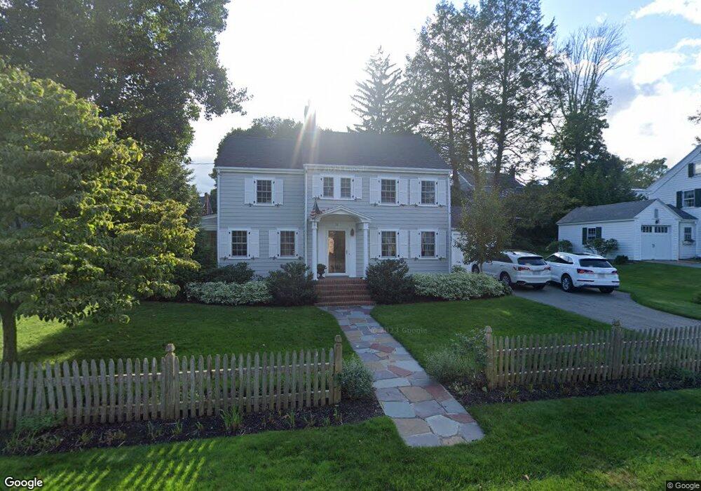
14 Cheever Cir Andover, MA 01810
Shawsheen Heights NeighborhoodEstimated Value: $896,000 - $1,332,000
3
Beds
2
Baths
1,880
Sq Ft
$577/Sq Ft
Est. Value
About This Home
This home is located at 14 Cheever Cir, Andover, MA 01810 and is currently estimated at $1,083,918, approximately $576 per square foot. 14 Cheever Cir is a home located in Essex County with nearby schools including West Elementary School, Doherty Middle School, and Andover High School.
Ownership History
Date
Name
Owned For
Owner Type
Purchase Details
Closed on
Sep 6, 2019
Sold by
Marks Debra J and Hanafin Joseph
Bought by
Debra Jo Marks Ret and Hanafin
Current Estimated Value
Purchase Details
Closed on
Aug 17, 2001
Sold by
Reynolds David B and Reynolds Wendelyn
Bought by
Marks Debra J and Hanafin Joseph
Create a Home Valuation Report for This Property
The Home Valuation Report is an in-depth analysis detailing your home's value as well as a comparison with similar homes in the area
Home Values in the Area
Average Home Value in this Area
Purchase History
| Date | Buyer | Sale Price | Title Company |
|---|---|---|---|
| Debra Jo Marks Ret | -- | -- | |
| Debra Jo Marks Ret | -- | -- | |
| Marks Debra J | $515,000 | -- | |
| Marks Debra J | $515,000 | -- |
Source: Public Records
Mortgage History
| Date | Status | Borrower | Loan Amount |
|---|---|---|---|
| Previous Owner | Marks Debra J | $247,000 | |
| Previous Owner | Marks Debra J | $257,200 |
Source: Public Records
Tax History
| Year | Tax Paid | Tax Assessment Tax Assessment Total Assessment is a certain percentage of the fair market value that is determined by local assessors to be the total taxable value of land and additions on the property. | Land | Improvement |
|---|---|---|---|---|
| 2024 | $12,304 | $955,300 | $577,400 | $377,900 |
| 2023 | $11,752 | $860,300 | $520,100 | $340,200 |
| 2022 | $11,017 | $754,600 | $452,100 | $302,500 |
| 2021 | $10,523 | $688,200 | $410,900 | $277,300 |
| 2020 | $10,087 | $672,000 | $400,900 | $271,100 |
| 2019 | $9,991 | $654,300 | $389,200 | $265,100 |
| 2018 | $9,656 | $617,400 | $374,100 | $243,300 |
| 2017 | $9,226 | $607,800 | $366,700 | $241,100 |
| 2016 | $9,008 | $607,800 | $366,700 | $241,100 |
| 2015 | $9,013 | $602,100 | $375,100 | $227,000 |
Source: Public Records
Map
Nearby Homes
- 1 Sweeney Ct
- 181 High St Unit 1
- 2 Powder Mill Square Unit 2B
- 50C Washington Park Dr Unit 10
- 5 Lewis St
- Lot 7 Weeping Willow Dr
- 33 Chestnut St Unit 2
- 1 Longwood Dr Unit 105
- 96 N Main St Unit 3
- 100.5 Main St Unit Q
- 170 Haverhill St Unit 138
- 15 Alcott Way
- 16 Balmoral St Unit 214
- 35 Peters St
- 28 Stirling St
- 42 York St
- 3 Torr St
- 124 Quail Run Rd
- 136 Quail Run Rd
- 30 Canterbury St
Your Personal Tour Guide
Ask me questions while you tour the home.