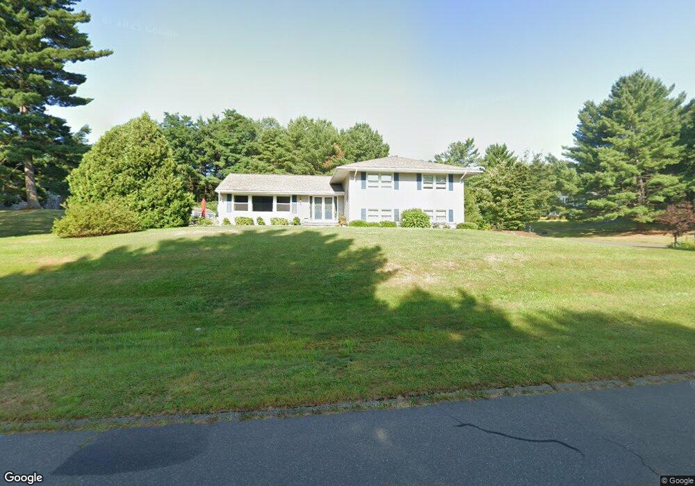
14 Chestnut Hill Rd West Simsbury, CT 06092
Estimated Value: $562,000 - $645,919
4
Beds
3
Baths
2,026
Sq Ft
$300/Sq Ft
Est. Value
About This Home
This home is located at 14 Chestnut Hill Rd, West Simsbury, CT 06092 and is currently estimated at $607,730, approximately $299 per square foot. 14 Chestnut Hill Rd is a home located in Hartford County with nearby schools including Tootin' Hills School, Henry James Memorial School, and Simsbury High School.
Ownership History
Date
Name
Owned For
Owner Type
Purchase Details
Closed on
Jul 26, 2024
Sold by
Keating Kevin P and Keating Catherine A
Bought by
Catherine A Keating Ret and Keating
Current Estimated Value
Purchase Details
Closed on
Sep 11, 1995
Sold by
Skaret Philip and Skaret David
Bought by
Lillestolen Kirk and Lillestolen Judy
Purchase Details
Closed on
May 22, 1990
Sold by
Walton John
Bought by
Keating Kevin
Create a Home Valuation Report for This Property
The Home Valuation Report is an in-depth analysis detailing your home's value as well as a comparison with similar homes in the area
Home Values in the Area
Average Home Value in this Area
Purchase History
| Date | Buyer | Sale Price | Title Company |
|---|---|---|---|
| Catherine A Keating Ret | -- | None Available | |
| Lillestolen Kirk | $50,000 | -- | |
| Lillestolen Kirk | $50,000 | -- | |
| Keating Kevin | $240,000 | -- |
Source: Public Records
Mortgage History
| Date | Status | Borrower | Loan Amount |
|---|---|---|---|
| Previous Owner | Keating Kevin | $107,000 | |
| Previous Owner | Keating Kevin | $200,000 |
Source: Public Records
Tax History Compared to Growth
Tax History
| Year | Tax Paid | Tax Assessment Tax Assessment Total Assessment is a certain percentage of the fair market value that is determined by local assessors to be the total taxable value of land and additions on the property. | Land | Improvement |
|---|---|---|---|---|
| 2025 | $11,009 | $322,280 | $81,480 | $240,800 |
| 2024 | $10,735 | $322,280 | $81,480 | $240,800 |
| 2023 | $10,255 | $322,280 | $81,480 | $240,800 |
| 2022 | $9,321 | $241,290 | $88,470 | $152,820 |
| 2021 | $9,321 | $241,290 | $88,470 | $152,820 |
| 2020 | $8,949 | $241,290 | $88,470 | $152,820 |
| 2019 | $9,005 | $241,290 | $88,470 | $152,820 |
| 2018 | $9,070 | $241,290 | $88,470 | $152,820 |
| 2017 | $8,116 | $209,390 | $86,700 | $122,690 |
| 2016 | $7,773 | $209,390 | $86,700 | $122,690 |
| 2015 | $7,773 | $209,390 | $86,700 | $122,690 |
| 2014 | $7,777 | $209,390 | $86,700 | $122,690 |
Source: Public Records
Map
Nearby Homes
- 19 Glenbrook Dr
- 10 Sachems Trail
- 395 Bushy Hill Rd
- 121 Gracey Rd
- 24 Drumlin Rd
- 301 Bushy Hill Rd
- 302 Bushy Hill Rd
- 23 Red Fox Run
- 15 Red Fox Run
- 6 Highwood Rd
- 370A W Mountain Rd
- 8 Crane Place
- 51 Pine Glen Rd
- 42 Garrett Rd
- 41 Applegate Ln
- 3 Applegate Ln Unit 3
- 31 Applegate Ln Unit 31
- 49 Applegate Ln Unit 49
- 143 N Mountain Rd
- 1 Alcima Dr
- 12 Chestnut Hill Rd
- 3 Watch Hill Ln
- 19 Chestnut Hill Rd
- 4 Watch Hill Ln
- 15 Chestnut Hill Rd
- 15 Chestnut Hill Rd Unit RD
- 18 Huckleberry Ln
- 21 Chestnut Hill Rd
- 5 Watch Hill Ln
- 19 Huckleberry Ln
- 11 Chestnut Hill Rd
- 6 Watch Hill Ln
- 22 Chestnut Hill Rd
- 8 Chestnut Hill Rd
- 10 Chestnut Hill Rd
- 2 Huckleberry Ln
- 7 Watch Hill Ln
- 7 Watch Hill Ln Unit LANE
- 6 Sherwood Ln
- 4 Huckleberry Ln