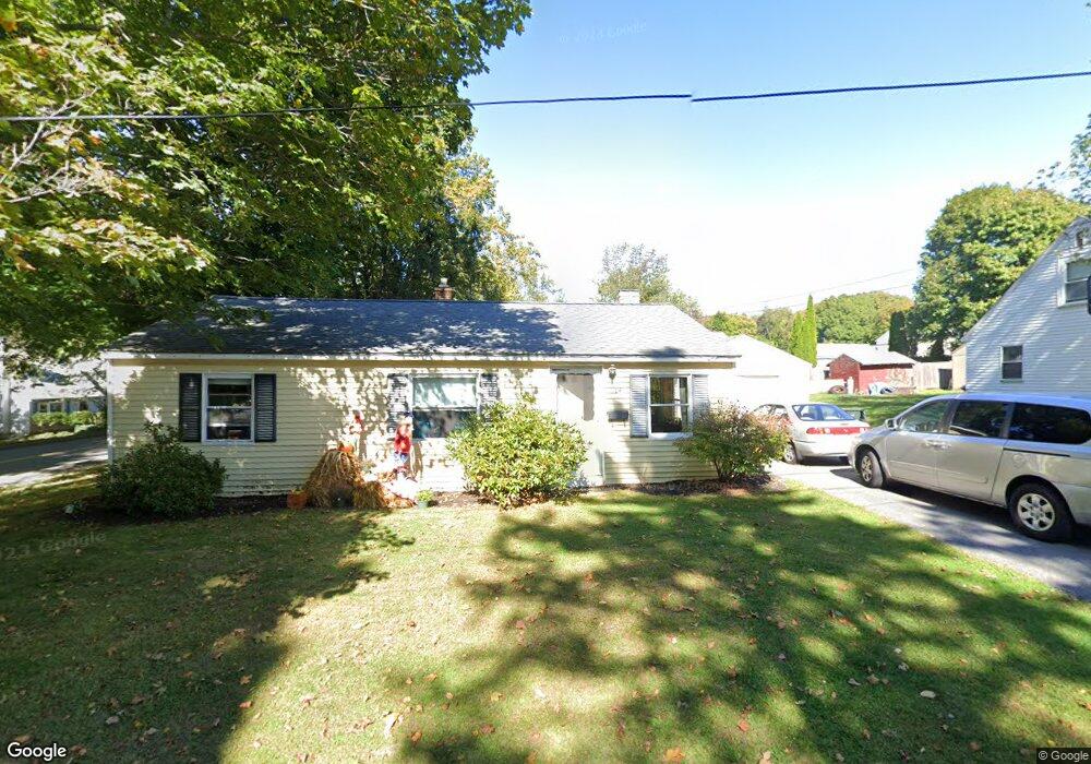
14 Clarendon Rd Auburn, MA 01501
Pakachoag NeighborhoodEstimated Value: $309,000 - $371,000
3
Beds
2
Baths
925
Sq Ft
$375/Sq Ft
Est. Value
About This Home
This home is located at 14 Clarendon Rd, Auburn, MA 01501 and is currently estimated at $346,803, approximately $374 per square foot. 14 Clarendon Rd is a home located in Worcester County with nearby schools including Auburn Senior High School, Canterbury Street School, and Shrewsbury Montessori School - Auburn Campus.
Ownership History
Date
Name
Owned For
Owner Type
Purchase Details
Closed on
May 4, 2020
Sold by
Souza Dorothy L Est
Bought by
Dorothy L Leveillee Rt
Current Estimated Value
Purchase Details
Closed on
Mar 29, 1974
Bought by
Leveillee Dorothy L
Create a Home Valuation Report for This Property
The Home Valuation Report is an in-depth analysis detailing your home's value as well as a comparison with similar homes in the area
Home Values in the Area
Average Home Value in this Area
Purchase History
| Date | Buyer | Sale Price | Title Company |
|---|---|---|---|
| Dorothy L Leveillee Rt | -- | None Available | |
| Leveillee Dorothy L | -- | -- |
Source: Public Records
Tax History Compared to Growth
Tax History
| Year | Tax Paid | Tax Assessment Tax Assessment Total Assessment is a certain percentage of the fair market value that is determined by local assessors to be the total taxable value of land and additions on the property. | Land | Improvement |
|---|---|---|---|---|
| 2025 | $40 | $276,800 | $110,700 | $166,100 |
| 2024 | $3,983 | $266,800 | $104,500 | $162,300 |
| 2023 | $3,833 | $241,400 | $95,000 | $146,400 |
| 2022 | $3,621 | $215,300 | $95,000 | $120,300 |
| 2021 | $3,370 | $185,800 | $83,800 | $102,000 |
| 2020 | $3,341 | $185,800 | $83,800 | $102,000 |
| 2019 | $3,225 | $175,100 | $83,000 | $92,100 |
| 2018 | $47 | $162,200 | $77,600 | $84,600 |
| 2017 | $2,843 | $155,000 | $70,400 | $84,600 |
| 2016 | $2,706 | $149,600 | $72,600 | $77,000 |
| 2015 | $2,584 | $149,700 | $72,600 | $77,100 |
| 2014 | $2,445 | $141,400 | $69,100 | $72,300 |
Source: Public Records
Map
Nearby Homes
- 204-212 Hampton St
- 326 Pakachoag St
- 61 Elmwood St
- 31 Walsh Ave
- 33 Walsh Ave
- 31-33 Walsh Ave
- 37 Elmwood St
- 52 Harrison Ave
- 34 Rockland Rd
- 2 Victoria Dr Unit 1
- 25 Vinal St Unit 26
- 25 Vinal St Unit 29
- 25 Vinal St Unit 30
- 2 Breezy Bend
- 5 Commonwealth Ave
- 6 Newton St
- 22 Lesley Ave
- 177 Boyce St
- 176 Boyce St
- 3 Lower Windbrook Dr
- 12 Clarendon Rd
- 235 Hampton St
- 13 Clarendon Rd
- 10 Clarendon Rd
- 11 Clarendon Rd
- 240 Hampton St
- 238 Hampton St
- 9 Clarendon Rd
- 236 Hampton St
- 242 Hampton St
- 233 Hampton St
- 8 Clarendon Rd
- 14 Kimball Rd
- 12 Kimball Rd
- 234 Hampton St
- 234 Hampton St Unit 2
- 7 Clarendon Rd
- 10 Kimball Rd
- 231 Hampton St
- 6 Clarendon Rd