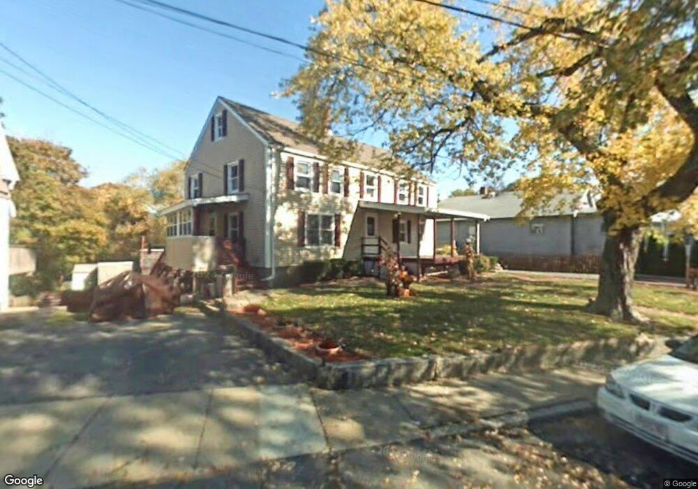
14 Cross St Gloucester, MA 01930
Central Gloucester NeighborhoodEstimated Value: $562,000 - $709,000
4
Beds
3
Baths
1,850
Sq Ft
$341/Sq Ft
Est. Value
About This Home
This home is located at 14 Cross St, Gloucester, MA 01930 and is currently estimated at $630,133, approximately $340 per square foot. 14 Cross St is a home located in Essex County with nearby schools including East Veterans Memorial Elementary, Ralph B O'maley Middle School, and Gloucester High School.
Ownership History
Date
Name
Owned For
Owner Type
Purchase Details
Closed on
Dec 29, 1987
Sold by
Mackey Albert J
Bought by
Mackey Albert J
Current Estimated Value
Create a Home Valuation Report for This Property
The Home Valuation Report is an in-depth analysis detailing your home's value as well as a comparison with similar homes in the area
Home Values in the Area
Average Home Value in this Area
Purchase History
| Date | Buyer | Sale Price | Title Company |
|---|---|---|---|
| Mackey Albert J | $80,000 | -- |
Source: Public Records
Mortgage History
| Date | Status | Borrower | Loan Amount |
|---|---|---|---|
| Open | Mackey Albert J | $15,000 | |
| Open | Mackey Albert J | $135,000 | |
| Closed | Mackey Albert J | $100,000 |
Source: Public Records
Tax History
| Year | Tax Paid | Tax Assessment Tax Assessment Total Assessment is a certain percentage of the fair market value that is determined by local assessors to be the total taxable value of land and additions on the property. | Land | Improvement |
|---|---|---|---|---|
| 2025 | $5,362 | $551,600 | $149,200 | $402,400 |
| 2024 | $5,299 | $544,600 | $142,200 | $402,400 |
| 2023 | $5,665 | $534,900 | $126,900 | $408,000 |
| 2022 | $5,134 | $437,700 | $110,400 | $327,300 |
| 2021 | $4,970 | $399,500 | $100,300 | $299,200 |
| 2020 | $4,717 | $382,600 | $100,300 | $282,300 |
| 2019 | $4,402 | $346,900 | $100,300 | $246,600 |
| 2018 | $4,122 | $318,800 | $100,300 | $218,500 |
| 2017 | $3,877 | $293,900 | $90,400 | $203,500 |
| 2016 | $3,750 | $275,500 | $90,400 | $185,100 |
| 2015 | $3,684 | $269,900 | $90,400 | $179,500 |
Source: Public Records
Map
Nearby Homes
- 36 Eastern Ave
- 3 Mondello Square
- 5 Wise Place
- 139A Prospect St
- 15 Mount Vernon St
- 26 Marina Dr
- 19 Trask St Unit 2
- 50 Warner St
- 197 E Main St Unit 1
- 191 Main St Unit 3
- 191 Main St Unit 2A
- 113 Pleasant St
- 40 Sargent St
- 33 Maplewood Ave Unit 310
- 60 Rocky Neck Ave Unit 202
- 12 Arthur St
- 73 Rocky Neck Ave Unit 2
- 9 Cleveland Place
- 35 Middle St Unit 4
- 33 Middle St
Your Personal Tour Guide
Ask me questions while you tour the home.