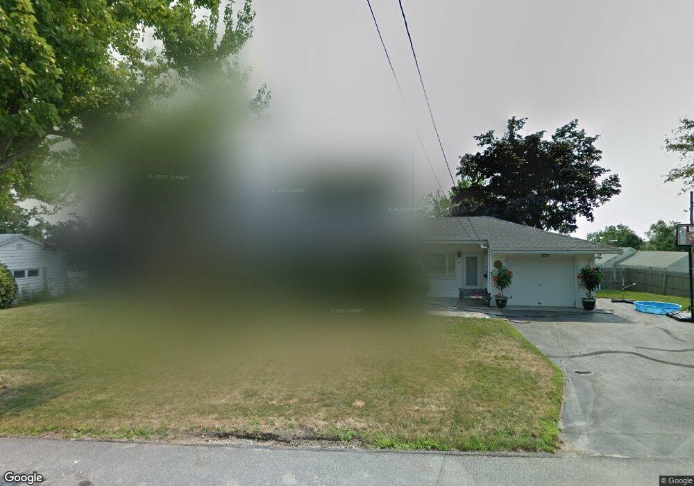
14 Davidson Rd West Boylston, MA 01583
Estimated Value: $604,204 - $691,000
3
Beds
3
Baths
2,471
Sq Ft
$266/Sq Ft
Est. Value
About This Home
This home is located at 14 Davidson Rd, West Boylston, MA 01583 and is currently estimated at $656,801, approximately $265 per square foot. 14 Davidson Rd is a home located in Worcester County with nearby schools including Major Edwards Elementary School, West Boylston Junior/Senior High School, and Abby Kelley Foster Charter Public School.
Ownership History
Date
Name
Owned For
Owner Type
Purchase Details
Closed on
Jun 13, 2007
Sold by
Pohl Karen and Pohl Tonya S
Bought by
Pohl Tonya S
Current Estimated Value
Purchase Details
Closed on
Aug 27, 2001
Sold by
Yankowskas George P and Yankowskas Irene A
Bought by
Pohl Karen and Rogers Tonya S
Purchase Details
Closed on
Apr 27, 1992
Sold by
Commerce Bk & Tr
Bought by
Yankowskas George and Yankowskas Irene
Purchase Details
Closed on
Jan 31, 1992
Sold by
Berthiaume Cheryl
Bought by
Commerce Bk & Tr
Create a Home Valuation Report for This Property
The Home Valuation Report is an in-depth analysis detailing your home's value as well as a comparison with similar homes in the area
Home Values in the Area
Average Home Value in this Area
Purchase History
| Date | Buyer | Sale Price | Title Company |
|---|---|---|---|
| Pohl Tonya S | -- | -- | |
| Pohl Karen | $269,900 | -- | |
| Yankowskas George | $158,000 | -- | |
| Commerce Bk & Tr | $17,000 | -- |
Source: Public Records
Mortgage History
| Date | Status | Borrower | Loan Amount |
|---|---|---|---|
| Previous Owner | Commerce Bk & Tr | $270,000 | |
| Previous Owner | Commerce Bk & Tr | $20,000 |
Source: Public Records
Tax History Compared to Growth
Tax History
| Year | Tax Paid | Tax Assessment Tax Assessment Total Assessment is a certain percentage of the fair market value that is determined by local assessors to be the total taxable value of land and additions on the property. | Land | Improvement |
|---|---|---|---|---|
| 2025 | $76 | $546,400 | $87,200 | $459,200 |
| 2024 | $7,198 | $487,000 | $87,200 | $399,800 |
| 2023 | $7,037 | $451,700 | $86,700 | $365,000 |
| 2022 | $6,657 | $376,500 | $86,700 | $289,800 |
| 2021 | $6,651 | $360,300 | $81,900 | $278,400 |
| 2020 | $6,299 | $339,000 | $81,900 | $257,100 |
| 2019 | $6,170 | $327,300 | $81,900 | $245,400 |
| 2018 | $5,865 | $313,300 | $81,900 | $231,400 |
| 2017 | $5,802 | $308,600 | $81,900 | $226,700 |
| 2016 | $5,729 | $310,500 | $76,100 | $234,400 |
| 2015 | $5,407 | $294,800 | $75,300 | $219,500 |
Source: Public Records
Map
Nearby Homes
- 39 Davidson Rd
- 1 Highland Ave
- 535 Prospect St
- 12 Birchbrush Ln
- 1 Juneberry Ln Unit 82
- 33 Isleboro St
- 29 Isleboro St
- 23 Orono St
- 1110 W Boylston St Unit A
- 740 Burncoat St Unit B
- 15 Cumberland St
- 22 Danielles Way
- 26 Danielles Way
- 31 Danielles Way
- 21 Wyoming Dr
- 10 Beale St
- 9 Idalla Ave
- 93 Winfield Rd
- 54 Maple St
- 12 Dixfield Rd
- 3 Center Dr
- 17 Davidson Rd
- 7 Center Dr
- 4 Center Dr
- 4 Davidson Rd
- 7 Davidson Rd
- 37 Woodland Heights Dr
- 18 Westland Cir
- 41 Woodland Heights Dr
- 8 Center Dr
- 33 Woodland Heights Dr
- 21 Woodland Heights Dr
- 1 Davidson Rd
- 6 Westland Cir
- 15 Davidson Rd
- 17 Woodland Heights Dr
- 21 Westland Cir
- 25 Westland Cir
- 4 Westland Cir
- 15 Westland Cir