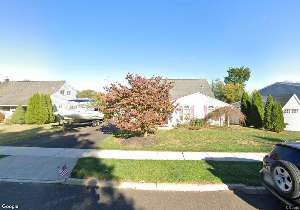
14 Downhill Rd Levittown, PA 19056
Estimated Value: $389,000 - $430,000
3
Beds
2
Baths
1,679
Sq Ft
$247/Sq Ft
Est. Value
About This Home
This home is located at 14 Downhill Rd, Levittown, PA 19056 and is currently estimated at $414,012, approximately $246 per square foot. 14 Downhill Rd is a home located in Bucks County with nearby schools including Albert Schweitzer Elementary School, Sandburg Middle School, and Neshaminy High School.
Ownership History
Date
Name
Owned For
Owner Type
Purchase Details
Closed on
Aug 3, 2009
Sold by
Warren David A and Warren Crystal I
Bought by
Strippoli David M
Current Estimated Value
Home Financials for this Owner
Home Financials are based on the most recent Mortgage that was taken out on this home.
Original Mortgage
$212,800
Outstanding Balance
$140,575
Interest Rate
5.47%
Mortgage Type
Purchase Money Mortgage
Estimated Equity
$273,437
Create a Home Valuation Report for This Property
The Home Valuation Report is an in-depth analysis detailing your home's value as well as a comparison with similar homes in the area
Purchase History
| Date | Buyer | Sale Price | Title Company |
|---|---|---|---|
| Strippoli David M | $266,000 | None Available |
Source: Public Records
Mortgage History
| Date | Status | Borrower | Loan Amount |
|---|---|---|---|
| Open | Strippoli David M | $212,800 |
Source: Public Records
Tax History
| Year | Tax Paid | Tax Assessment Tax Assessment Total Assessment is a certain percentage of the fair market value that is determined by local assessors to be the total taxable value of land and additions on the property. | Land | Improvement |
|---|---|---|---|---|
| 2025 | $4,835 | $22,210 | $4,680 | $17,530 |
| 2024 | $4,835 | $22,210 | $4,680 | $17,530 |
| 2023 | $4,758 | $22,210 | $4,680 | $17,530 |
| 2022 | $4,633 | $22,210 | $4,680 | $17,530 |
| 2021 | $4,633 | $22,210 | $4,680 | $17,530 |
| 2020 | $4,578 | $22,210 | $4,680 | $17,530 |
| 2019 | $4,476 | $22,210 | $4,680 | $17,530 |
| 2018 | $4,394 | $22,210 | $4,680 | $17,530 |
| 2017 | $4,281 | $22,210 | $4,680 | $17,530 |
| 2016 | $4,281 | $22,210 | $4,680 | $17,530 |
| 2015 | $4,471 | $22,210 | $4,680 | $17,530 |
| 2014 | $4,471 | $22,210 | $4,680 | $17,530 |
Source: Public Records
Map
Nearby Homes
- 232 Forsythia Dr S Unit S
- 70 Sandybrook Dr
- L:070 Trenton Rd
- 0 Fir Ave
- 711 Madison Ave
- 9 Harmony Rd
- 9 Honey Locust Rd
- 51 Hollybrooke Dr
- 28 Sycamore Rd
- 169 Forsythia Dr N
- 430 Parkview Ave
- 24 Rose Apple Rd
- 217 Apple St
- 1751 Bristol Oxford Valley Rd
- 6 Unity Turn
- 111 Dehaven Ave
- 56 W Lincoln Hwy
- 409 Fairview Ave
- 194 Cobalt Ridge Dr S Unit S
- 17 Tulip Tree Rd
- 10 Downhill Rd
- 18 Downhill Rd
- 44 Deep Dale Dr E
- 11 Downhill Rd
- 15 Downhill Rd
- 42 Deep Dale Dr E
- 48 Deep Dale Dr E
- 20 Downhill Rd
- 4 Downhill Rd
- 9 Downhill Rd
- 19 Downhill Rd
- 56 Deep Dale Dr E
- 40 Deep Dale Dr E
- 5 Downhill Rd
- 2 Downhill Rd
- 30 Downhill Rd
- 104 Deep Dale Dr E
- 100 Deep Dale Dr E
- 1 Downhill Rd
- 96 Deep Dale Dr E
Your Personal Tour Guide
Ask me questions while you tour the home.