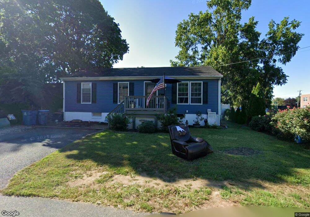
14 E Roney Ave North East, MD 21901
Estimated Value: $196,000 - $244,817
3
Beds
2
Baths
960
Sq Ft
$235/Sq Ft
Est. Value
About This Home
This home is located at 14 E Roney Ave, North East, MD 21901 and is currently estimated at $225,704, approximately $235 per square foot. 14 E Roney Ave is a home located in Cecil County with nearby schools including North East Elementary School, North East Middle School, and North East High School.
Ownership History
Date
Name
Owned For
Owner Type
Purchase Details
Closed on
Jul 25, 2011
Sold by
Springleaf Financial Services Inc
Bought by
Harris David N and Harris Aprile F
Current Estimated Value
Purchase Details
Closed on
Mar 15, 2011
Sold by
Mellon Georgenne L
Bought by
American General Financial Service
Purchase Details
Closed on
Feb 28, 2011
Sold by
Mellon Georgenne L
Bought by
American General Financial Service
Purchase Details
Closed on
Apr 15, 2004
Sold by
Granger Stephen E and Granger Diana K
Bought by
Mellon Georgenne L
Create a Home Valuation Report for This Property
The Home Valuation Report is an in-depth analysis detailing your home's value as well as a comparison with similar homes in the area
Home Values in the Area
Average Home Value in this Area
Purchase History
| Date | Buyer | Sale Price | Title Company |
|---|---|---|---|
| Harris David N | $107,101 | Sage Title Group Llc | |
| American General Financial Service | $172,817 | -- | |
| American General Financial Service | $172,817 | -- | |
| Mellon Georgenne L | $147,000 | -- |
Source: Public Records
Mortgage History
| Date | Status | Borrower | Loan Amount |
|---|---|---|---|
| Closed | Mellon Georgenne L | -- |
Source: Public Records
Tax History Compared to Growth
Tax History
| Year | Tax Paid | Tax Assessment Tax Assessment Total Assessment is a certain percentage of the fair market value that is determined by local assessors to be the total taxable value of land and additions on the property. | Land | Improvement |
|---|---|---|---|---|
| 2025 | $2,955 | $166,433 | $0 | $0 |
| 2024 | $2,776 | $155,867 | $0 | $0 |
| 2023 | $2,612 | $145,300 | $44,100 | $101,200 |
| 2022 | $2,578 | $143,467 | $0 | $0 |
| 2021 | $2,512 | $141,633 | $0 | $0 |
| 2020 | $2,450 | $139,800 | $44,100 | $95,700 |
| 2019 | $2,450 | $137,367 | $0 | $0 |
| 2018 | $2,404 | $134,933 | $0 | $0 |
| 2017 | $2,359 | $132,500 | $0 | $0 |
| 2016 | $2,165 | $130,000 | $0 | $0 |
| 2015 | $2,165 | $127,500 | $0 | $0 |
| 2014 | $2,789 | $125,000 | $0 | $0 |
Source: Public Records
Map
Nearby Homes
- 15 S Mauldin Ave
- 25 Beech St
- 105 W Walnut St
- parcel # 66 Rolling Mill Ln
- 6 Colonial Cir
- 122 NE Isle Dr
- 511 Deans Bank Rd
- 144 NE Isles Dr Unit 95A
- 14 Mallory Way Unit WYNDHAM
- 62 Rehill Ave
- 73 NE Isle Dr
- 37 NE Isle Dr
- 0 Pulaski Hwy
- 2515 Pulaski Hwy
- 101 Belvue Rd
- 0 Mallory Way Unit MDCC2003990
- 0 Mallory Way Unit MDCC169342
- 15 Yarmouth Ln
- 13 Forest Dr
- 61 Dune Dr
- 16 E Roney Ave
- 17 E Church St
- 15 E Church St
- 9 E Roney Ave
- 19 E Church St
- 11 E Roney Ave
- 11 E Church St
- 7 E Roney Ave
- 5 E Roney Ave
- 302 S Mauldin Ave
- 308 S Mauldin Ave
- 3 E Roney Ave
- 16 E Church St
- 14 E Church St
- 203 S Mauldin Ave
- 18 E Church St
- 12 E Church St
- 210 S Mauldin Ave
- 302 S Main St
- 308 S Main St