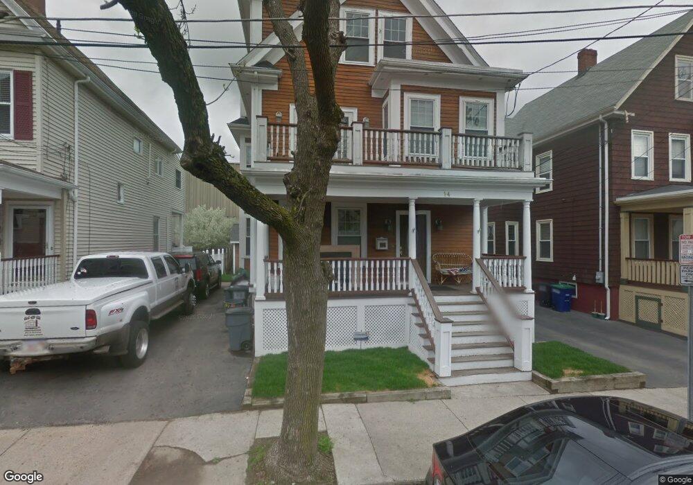
14 Grant St Somerville, MA 02145
Ten Hills NeighborhoodEstimated Value: $1,329,018 - $1,576,000
5
Beds
4
Baths
2,350
Sq Ft
$617/Sq Ft
Est. Value
About This Home
This home is located at 14 Grant St, Somerville, MA 02145 and is currently estimated at $1,450,255, approximately $617 per square foot. 14 Grant St is a home located in Middlesex County with nearby schools including Somerville High School, Prospect Hill Academy Upper Elementary Campus, and Bright Future Educare Center.
Ownership History
Date
Name
Owned For
Owner Type
Purchase Details
Closed on
Aug 28, 2025
Sold by
Reynoso Manuel
Bought by
14 Grant Street Rt and Reynoso
Current Estimated Value
Purchase Details
Closed on
Oct 30, 2020
Sold by
Dean Mary B
Bought by
Reynoso Manuel
Purchase Details
Closed on
Jan 5, 2005
Sold by
Dean Mary B
Bought by
Dean-Reynoso Mary B
Home Financials for this Owner
Home Financials are based on the most recent Mortgage that was taken out on this home.
Original Mortgage
$550,000
Interest Rate
5.75%
Mortgage Type
Purchase Money Mortgage
Purchase Details
Closed on
Aug 29, 1996
Sold by
Est Quatieri Ettore and Bortone Catherine
Bought by
Dean Mary B
Create a Home Valuation Report for This Property
The Home Valuation Report is an in-depth analysis detailing your home's value as well as a comparison with similar homes in the area
Home Values in the Area
Average Home Value in this Area
Purchase History
| Date | Buyer | Sale Price | Title Company |
|---|---|---|---|
| 14 Grant Street Rt | -- | -- | |
| 14 Grant Street Rt | -- | -- | |
| Reynoso Manuel | $803,000 | None Available | |
| Reynoso Manuel | $803,000 | None Available | |
| Dean-Reynoso Mary B | -- | -- | |
| Dean-Reynoso Mary B | -- | -- | |
| Dean-Reynoso Mary B | -- | -- | |
| Dean Mary B | $121,000 | -- | |
| Dean Mary B | $121,000 | -- |
Source: Public Records
Mortgage History
| Date | Status | Borrower | Loan Amount |
|---|---|---|---|
| Previous Owner | Dean-Reynoso Mary B | $550,000 |
Source: Public Records
Tax History Compared to Growth
Tax History
| Year | Tax Paid | Tax Assessment Tax Assessment Total Assessment is a certain percentage of the fair market value that is determined by local assessors to be the total taxable value of land and additions on the property. | Land | Improvement |
|---|---|---|---|---|
| 2025 | $13,945 | $1,278,200 | $309,800 | $968,400 |
| 2024 | $12,876 | $1,224,000 | $309,800 | $914,200 |
| 2023 | $11,801 | $1,141,300 | $309,800 | $831,500 |
| 2022 | $10,888 | $1,069,500 | $295,000 | $774,500 |
| 2021 | $10,014 | $982,700 | $268,000 | $714,700 |
| 2020 | $9,322 | $923,900 | $257,700 | $666,200 |
| 2019 | $9,378 | $871,600 | $216,800 | $654,800 |
| 2018 | $8,797 | $777,800 | $197,100 | $580,700 |
| 2017 | $8,115 | $695,400 | $186,000 | $509,400 |
| 2016 | $7,588 | $605,600 | $151,000 | $454,600 |
Source: Public Records
Map
Nearby Homes
- 13 Sargent Ave Unit 2
- 7 Jaques St
- 30A Summer
- 77 Wheatland St Unit 2
- 84 Grant St Unit 7
- 73 Bonair St
- 176-182 Broadway
- 59 Dartmouth St Unit A
- 94 Jaques St Unit B
- 11 Macarthur St Unit B
- 11 Macarthur St Unit A
- 115 Thurston St Unit I
- 115 Thurston St Unit B
- 19 Fenwick St Unit 4
- 29 Fenwick St
- 32 Radcliffe Rd
- 27 Gilman Terrace
- 71 Thurston St
- 7 Stickney Ave
- 41 Bailey Rd
- 10 Grant St
- 10 Grant St
- 10 Grant St Unit 1
- 10 Grant St Unit 2
- 16 Grant St
- 18 Grant St
- 18 Grant St Unit A
- 18 Grant St Unit B
- 10 Sewall St Unit 4
- 281 Broadway
- 281 Broadway Unit B
- 281 Broadway Unit 1
- 12 Sewall St
- 15A Grant St
- 9 Grant St
- 15 Grant St
- 17 Grant St
- 17 Grant St Unit 2
- 17 Grant St Unit 1
- 17-2 Grant St Unit 17