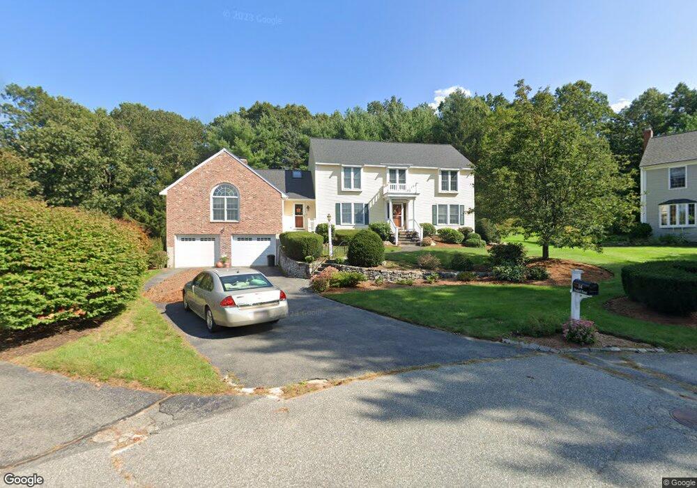
14 Haskell Rd Andover, MA 01810
Shawsheen Heights NeighborhoodEstimated Value: $1,330,000 - $1,834,000
4
Beds
3
Baths
3,366
Sq Ft
$451/Sq Ft
Est. Value
About This Home
This home is located at 14 Haskell Rd, Andover, MA 01810 and is currently estimated at $1,518,356, approximately $451 per square foot. 14 Haskell Rd is a home located in Essex County with nearby schools including West Elementary School, Andover West Middle School, and Andover High School.
Ownership History
Date
Name
Owned For
Owner Type
Purchase Details
Closed on
Aug 17, 2017
Sold by
Lamontagne Kenneth L and Lamontagne Donna K
Bought by
Lamontagne Ret and Lamontagne
Current Estimated Value
Purchase Details
Closed on
Oct 14, 1994
Sold by
Canavin Madonna K
Bought by
Lamontagne Kenneth L
Home Financials for this Owner
Home Financials are based on the most recent Mortgage that was taken out on this home.
Original Mortgage
$150,000
Interest Rate
8.43%
Mortgage Type
Purchase Money Mortgage
Create a Home Valuation Report for This Property
The Home Valuation Report is an in-depth analysis detailing your home's value as well as a comparison with similar homes in the area
Home Values in the Area
Average Home Value in this Area
Purchase History
| Date | Buyer | Sale Price | Title Company |
|---|---|---|---|
| Lamontagne Ret | -- | -- | |
| Lamontagne Ret | -- | -- | |
| Lamontagne Kenneth L | $436,250 | -- | |
| Lamontagne Kenneth L | $436,250 | -- |
Source: Public Records
Mortgage History
| Date | Status | Borrower | Loan Amount |
|---|---|---|---|
| Previous Owner | Lamontagne Kenneth L | $150,000 | |
| Previous Owner | Lamontagne Kenneth L | $139,000 | |
| Previous Owner | Lamontagne Kenneth L | $150,000 |
Source: Public Records
Tax History
| Year | Tax Paid | Tax Assessment Tax Assessment Total Assessment is a certain percentage of the fair market value that is determined by local assessors to be the total taxable value of land and additions on the property. | Land | Improvement |
|---|---|---|---|---|
| 2024 | $17,343 | $1,346,500 | $623,600 | $722,900 |
| 2023 | $16,234 | $1,188,400 | $533,000 | $655,400 |
| 2022 | $15,552 | $1,065,200 | $480,100 | $585,100 |
| 2021 | $14,931 | $976,500 | $436,600 | $539,900 |
| 2020 | $14,524 | $967,600 | $436,600 | $531,000 |
| 2019 | $14,200 | $929,900 | $406,900 | $523,000 |
| 2018 | $13,730 | $877,900 | $394,900 | $483,000 |
| 2017 | $13,188 | $868,800 | $387,200 | $481,600 |
| 2016 | $12,927 | $872,300 | $387,200 | $485,100 |
| 2015 | $12,669 | $846,300 | $387,200 | $459,100 |
Source: Public Records
Map
Nearby Homes
- 53 Martingale Ln
- 34 Martingale Ln Unit 34
- 40 Chandler Cir
- 3 Caileigh Ct
- 354 N Main St Unit 204
- 10 Dartmouth Rd
- 16 Balmoral St Unit 214
- 21 Clubview Dr Unit 21
- 25 Clubview Dr Unit 25
- 37 Crenshaw Ln Unit 37
- 70 Washington Park Dr Unit 6
- 31 Crenshaw Ln Unit 31
- 40C Washington Park Dr Unit 12
- 17 Carisbrooke St
- 42 York St
- 2 Powder Mill Square Unit 2B
- 11 Cuba St
- 1 Sweeney Ct
- 20 Robert Dr Unit 20
- 12 Robert Dr Unit 12
Your Personal Tour Guide
Ask me questions while you tour the home.