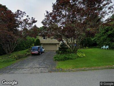
14 Hillside Ave Boylston, MA 01505
Estimated Value: $417,691 - $557,000
3
Beds
2
Baths
1,222
Sq Ft
$415/Sq Ft
Est. Value
About This Home
This home is located at 14 Hillside Ave, Boylston, MA 01505 and is currently estimated at $506,673, approximately $414 per square foot. 14 Hillside Ave is a home located in Worcester County with nearby schools including Tahanto Regional High School and Central New England Christian Academy.
Ownership History
Date
Name
Owned For
Owner Type
Purchase Details
Closed on
Nov 3, 2016
Sold by
Otoole Margaret
Bought by
Otoole Margaret and Fortuna Mark
Current Estimated Value
Purchase Details
Closed on
Sep 30, 2010
Sold by
Palmieri Stephen A and Palmieri Eleanor O
Bought by
Otoole Margaret
Home Financials for this Owner
Home Financials are based on the most recent Mortgage that was taken out on this home.
Original Mortgage
$224,000
Interest Rate
4.44%
Mortgage Type
Purchase Money Mortgage
Create a Home Valuation Report for This Property
The Home Valuation Report is an in-depth analysis detailing your home's value as well as a comparison with similar homes in the area
Home Values in the Area
Average Home Value in this Area
Purchase History
| Date | Buyer | Sale Price | Title Company |
|---|---|---|---|
| Otoole Margaret | -- | -- | |
| Otoole Margaret | $264,000 | -- |
Source: Public Records
Mortgage History
| Date | Status | Borrower | Loan Amount |
|---|---|---|---|
| Previous Owner | Otoole Margaret | $224,000 |
Source: Public Records
Tax History Compared to Growth
Tax History
| Year | Tax Paid | Tax Assessment Tax Assessment Total Assessment is a certain percentage of the fair market value that is determined by local assessors to be the total taxable value of land and additions on the property. | Land | Improvement |
|---|---|---|---|---|
| 2025 | $5,282 | $381,900 | $145,300 | $236,600 |
| 2024 | $5,128 | $371,300 | $145,300 | $226,000 |
| 2023 | $5,001 | $347,300 | $137,200 | $210,100 |
| 2022 | $4,427 | $279,500 | $137,200 | $142,300 |
| 2021 | $4,505 | $265,300 | $137,200 | $128,100 |
| 2020 | $3,859 | $233,300 | $109,300 | $124,000 |
| 2019 | $3,628 | $226,200 | $107,200 | $119,000 |
| 2018 | $3,692 | $220,700 | $107,200 | $113,500 |
| 2017 | $3,558 | $220,700 | $107,200 | $113,500 |
| 2016 | $3,544 | $216,500 | $101,800 | $114,700 |
| 2015 | $3,769 | $216,500 | $101,800 | $114,700 |
| 2014 | $3,487 | $200,500 | $91,100 | $109,400 |
Source: Public Records
Map
Nearby Homes
- 7 Birchwood Dr
- 18 Highland St
- 19 Stockton St
- 48 Poe Ave
- 130 Nicholas Ave
- 2 Brooke Rd
- 28 Sewall St
- 148 Angell Brook Dr Unit 148
- 2 Burkhardt Cir Unit 5
- 122 Angell Brook Dr Unit 122
- 33 Cobblestone Ln
- 13 Enaya Cir Unit 38
- 6 Candlewood Way
- 267 Gulf St
- 12 Fatima Ln
- 231 Gulf St
- 48 Hillside Village Dr
- 10 Matteo St
- 20 Brooklawn Pkwy
- 47 Garrison Ave
- 14 Hillside Ave
- 16 Hillside Ave
- 10 Hillside Ave
- 6 Birchwood Dr
- 4 Birchwood Dr
- 20 Hillside Ave
- 9 Hillside Ave
- 15 Hillside Ave
- 8 Birchwood Dr
- 7 Hillside Ave
- 7 Hillside Ave
- 19 Hillside Ave
- 10 Birchwood Dr
- 149 Main St
- 23 Hillside Ave
- 3 Hillside Ave
- 5 Birchwood Dr
- 3 Birchwood Dr
- 6 Cynthia Dr
- 27 Hillside Ave