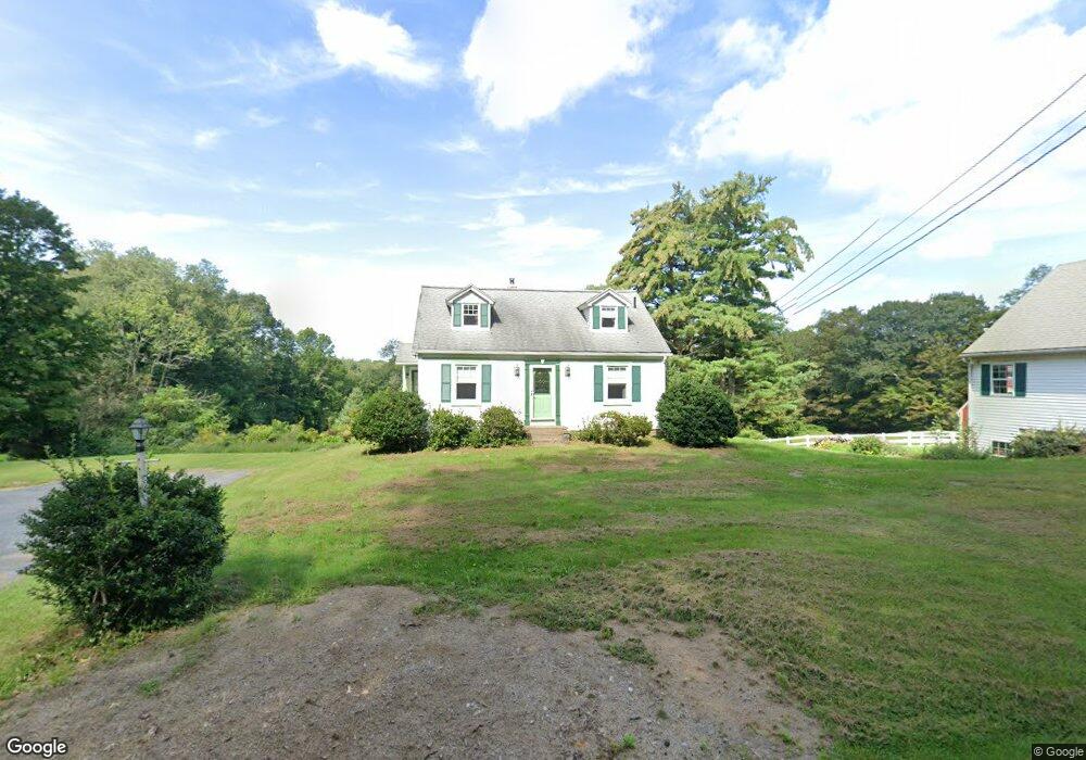
14 Howe Rd Spencer, MA 01562
Estimated Value: $400,000 - $484,000
2
Beds
1
Bath
1,699
Sq Ft
$261/Sq Ft
Est. Value
About This Home
This home is located at 14 Howe Rd, Spencer, MA 01562 and is currently estimated at $444,042, approximately $261 per square foot. 14 Howe Rd is a home with nearby schools including David Prouty High School.
Ownership History
Date
Name
Owned For
Owner Type
Purchase Details
Closed on
May 20, 2014
Sold by
Est Allan Judith E and Allan William H
Bought by
Aucoin Paul R
Current Estimated Value
Purchase Details
Closed on
Sep 1, 1982
Bought by
Aucoin Paul R
Create a Home Valuation Report for This Property
The Home Valuation Report is an in-depth analysis detailing your home's value as well as a comparison with similar homes in the area
Home Values in the Area
Average Home Value in this Area
Purchase History
| Date | Buyer | Sale Price | Title Company |
|---|---|---|---|
| Aucoin Paul R | -- | -- | |
| Aucoin Paul R | -- | -- |
Source: Public Records
Mortgage History
| Date | Status | Borrower | Loan Amount |
|---|---|---|---|
| Previous Owner | Aucoin Paul R | $170,000 | |
| Previous Owner | Aucoin Paul R | $25,000 |
Source: Public Records
Tax History
| Year | Tax Paid | Tax Assessment Tax Assessment Total Assessment is a certain percentage of the fair market value that is determined by local assessors to be the total taxable value of land and additions on the property. | Land | Improvement |
|---|---|---|---|---|
| 2025 | $44 | $373,500 | $118,300 | $255,200 |
| 2024 | $4,073 | $356,000 | $118,300 | $237,700 |
| 2023 | $3,946 | $327,200 | $118,300 | $208,900 |
| 2022 | $3,978 | $302,300 | $112,900 | $189,400 |
| 2021 | $3,920 | $279,200 | $112,900 | $166,300 |
| 2020 | $3,709 | $262,700 | $112,900 | $149,800 |
| 2019 | $3,512 | $253,400 | $108,100 | $145,300 |
| 2018 | $3,296 | $245,600 | $115,300 | $130,300 |
| 2017 | $2,646 | $189,275 | $66,475 | $122,800 |
| 2016 | $2,586 | $180,975 | $66,475 | $114,500 |
| 2015 | $2,572 | $188,175 | $71,875 | $116,300 |
| 2014 | $2,475 | $188,175 | $71,875 | $116,300 |
Source: Public Records
Map
Nearby Homes
Your Personal Tour Guide
Ask me questions while you tour the home.