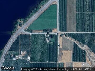
14 Howes Landing Rd Orondo, WA 98843
Estimated Value: $508,000 - $651,000
3
Beds
1
Bath
1,960
Sq Ft
$288/Sq Ft
Est. Value
About This Home
This home is located at 14 Howes Landing Rd, Orondo, WA 98843 and is currently estimated at $564,359, approximately $287 per square foot. 14 Howes Landing Rd is a home located in Douglas County with nearby schools including Orondo Elementary/Middle School.
Ownership History
Date
Name
Owned For
Owner Type
Purchase Details
Closed on
Feb 23, 2007
Sold by
Phillips Jodi L and Phillips Richard W
Bought by
Mccall Julie A and Mccall Patrick N
Current Estimated Value
Home Financials for this Owner
Home Financials are based on the most recent Mortgage that was taken out on this home.
Original Mortgage
$198,000
Outstanding Balance
$132,882
Interest Rate
7.87%
Mortgage Type
Adjustable Rate Mortgage/ARM
Estimated Equity
$442,020
Purchase Details
Closed on
Oct 28, 2005
Sold by
Mccall Patrick N and Mccall Julianne A
Bought by
Phillips Jodi L and Phillips Richard W
Home Financials for this Owner
Home Financials are based on the most recent Mortgage that was taken out on this home.
Original Mortgage
$150,000
Interest Rate
7.95%
Mortgage Type
Adjustable Rate Mortgage/ARM
Create a Home Valuation Report for This Property
The Home Valuation Report is an in-depth analysis detailing your home's value as well as a comparison with similar homes in the area
Home Values in the Area
Average Home Value in this Area
Purchase History
| Date | Buyer | Sale Price | Title Company |
|---|---|---|---|
| Mccall Julie A | $210,000 | None Available | |
| Phillips Jodi L | $150,000 | First American Title Ins Co |
Source: Public Records
Mortgage History
| Date | Status | Borrower | Loan Amount |
|---|---|---|---|
| Open | Zuniga Antonio N | $35,000 | |
| Closed | Zuniga Antonio N | $35,000 | |
| Open | Mccall Julie A | $198,000 | |
| Previous Owner | Mccall Patrick N | $48,500 | |
| Previous Owner | Phillips Jodi L | $150,000 |
Source: Public Records
Tax History Compared to Growth
Tax History
| Year | Tax Paid | Tax Assessment Tax Assessment Total Assessment is a certain percentage of the fair market value that is determined by local assessors to be the total taxable value of land and additions on the property. | Land | Improvement |
|---|---|---|---|---|
| 2025 | $3,017 | $471,100 | $192,700 | $278,400 |
| 2024 | $3,017 | $441,800 | $180,900 | $260,900 |
| 2023 | $3,218 | $423,200 | $180,900 | $242,300 |
| 2022 | $3,276 | $379,400 | $171,700 | $207,700 |
| 2021 | $3,222 | $299,900 | $92,200 | $207,700 |
| 2020 | $2,936 | $381,000 | $176,400 | $204,600 |
| 2018 | $2,707 | $264,700 | $92,200 | $172,500 |
| 2017 | $2,228 | $264,700 | $92,200 | $172,500 |
| 2016 | $2,244 | $218,300 | $92,200 | $126,100 |
| 2015 | $2,361 | $218,100 | $92,200 | $125,900 |
| 2014 | -- | $248,300 | $127,200 | $121,100 |
| 2013 | -- | $245,100 | $127,200 | $117,900 |
Source: Public Records
Map
Nearby Homes
- 0 Fisher Ln
- 0 Entiat River Rd Unit NWM2340501
- 2391 Albin Dr
- 13397 State Rd
- 13555 Hillcrest Dr
- 24 Mile Entiat River Rd
- 1017 Crest Loop
- 1010 Crest Loop
- 9988 Saska Way
- 9955 Griffith Place
- 14780 State Highway 97a
- 14944 Golden Delicious St
- 15330 Lakeview St
- 25 Corral Ln
- 98 Tyee View Loop Rd
- 66 Coyote Ln
- 0 Deer Creek Dr Unit NWM2294724
- 3 Tyee View Loop
- 827 Desert Canyon Blvd
- 933 Desert Canyon Blvd
- 14 Howes Landing Rd
- 43 Fisher Ln
- 39 Fisher Ln
- 21600 State Highway 97
- 0 XX Fisher Ln
- 18 Howes Landing Rd
- 20 Howes Landing Rd
- 45 Fisher Ln
- 30 Griggs Ln
- 50 Griggs Ln
- 15 Goldy Ln
- 8 Davis Ln
- 21516 State Highway 97
- 21508 State Highway 97
- 10589 Us 97a
- 2526 Entiat Way
- 2530 Entiat Way
- 0 Entiat River Rd Unit 1303513
- 0 Entiat River Rd Unit 1303511
- 0 Entiat River Rd Unit 1296498
