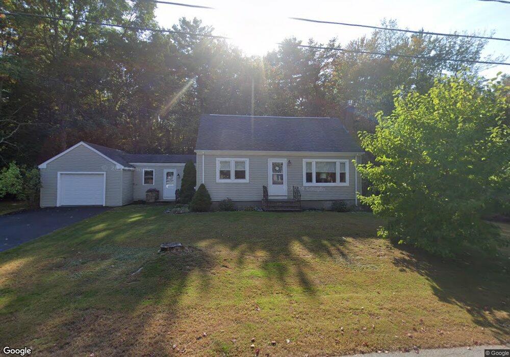
14 Karole Ln Cumberland Center, ME 04021
Estimated Value: $560,826 - $643,000
3
Beds
2
Baths
1,248
Sq Ft
$487/Sq Ft
Est. Value
About This Home
This home is located at 14 Karole Ln, Cumberland Center, ME 04021 and is currently estimated at $607,957, approximately $487 per square foot. 14 Karole Ln is a home located in Cumberland County with nearby schools including Mabel I. Wilson School, Greely Middle School 4-5, and Greely Middle School.
Ownership History
Date
Name
Owned For
Owner Type
Purchase Details
Closed on
Sep 25, 2020
Sold by
Higgins Lorrie R
Bought by
Higgins Lorrie R and Higgins Ashlee L
Current Estimated Value
Home Financials for this Owner
Home Financials are based on the most recent Mortgage that was taken out on this home.
Original Mortgage
$153,000
Outstanding Balance
$135,159
Interest Rate
2.9%
Mortgage Type
New Conventional
Estimated Equity
$472,798
Create a Home Valuation Report for This Property
The Home Valuation Report is an in-depth analysis detailing your home's value as well as a comparison with similar homes in the area
Home Values in the Area
Average Home Value in this Area
Purchase History
| Date | Buyer | Sale Price | Title Company |
|---|---|---|---|
| Higgins Lorrie R | -- | None Available | |
| Higgins Lorrie R | -- | None Available |
Source: Public Records
Mortgage History
| Date | Status | Borrower | Loan Amount |
|---|---|---|---|
| Open | Higgins Lorrie R | $153,000 | |
| Closed | Higgins Lorrie R | $153,000 |
Source: Public Records
Tax History Compared to Growth
Tax History
| Year | Tax Paid | Tax Assessment Tax Assessment Total Assessment is a certain percentage of the fair market value that is determined by local assessors to be the total taxable value of land and additions on the property. | Land | Improvement |
|---|---|---|---|---|
| 2025 | $5,885 | $233,700 | $112,000 | $121,700 |
| 2024 | $5,434 | $233,700 | $112,000 | $121,700 |
| 2023 | $5,176 | $233,700 | $112,000 | $121,700 |
| 2022 | $4,954 | $233,700 | $112,000 | $121,700 |
| 2021 | $4,803 | $233,700 | $112,000 | $121,700 |
| 2020 | $4,756 | $233,700 | $112,000 | $121,700 |
| 2019 | $4,639 | $233,700 | $112,000 | $121,700 |
| 2018 | $4,440 | $225,400 | $112,000 | $113,400 |
| 2017 | $4,238 | $225,400 | $112,000 | $113,400 |
| 2016 | $4,114 | $225,400 | $112,000 | $113,400 |
| 2015 | $4,080 | $225,400 | $112,000 | $113,400 |
| 2014 | $3,922 | $225,400 | $112,000 | $113,400 |
| 2013 | $3,832 | $225,400 | $112,000 | $113,400 |
Source: Public Records
Map
Nearby Homes
- 294 Greely Rd
- 445 Greely Extension Rd
- 9 Black Oak Dr
- 7 Parsonage Rd Unit 4
- 193 Main St
- 31 Stony Brook Ln
- 8 Summer Way
- 160 Memorial Hwy
- 133 Longwoods Rd
- 39 Harris Rd
- 9 Newell Rd
- 90 Harris Lot 1 Rd
- Lot 8 Coastal Pines
- 11 Coastal Pines Lot 5
- Lot #4 Secretariat Dr
- Lot #3 Secretariat Dr
- 27 Carriage Hill
- 0 Thomes Way
- 53 Ridgewood Ln
- 90 W Main St