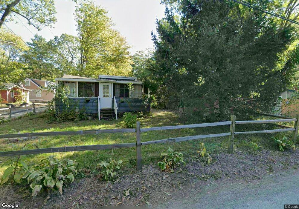
14 Kinnear Ave Lancaster, MA 01523
Estimated Value: $316,000 - $507,000
2
Beds
1
Bath
888
Sq Ft
$461/Sq Ft
Est. Value
About This Home
This home is located at 14 Kinnear Ave, Lancaster, MA 01523 and is currently estimated at $409,699, approximately $461 per square foot. 14 Kinnear Ave is a home located in Worcester County with nearby schools including Mary Rowlandson Elementary School, Luther Burbank Middle School, and Nashoba Regional High School.
Ownership History
Date
Name
Owned For
Owner Type
Purchase Details
Closed on
Nov 7, 2016
Sold by
Lancelotta Michael B
Bought by
Lancelotta Michael B and Lancelotta Laura
Current Estimated Value
Purchase Details
Closed on
Sep 18, 2006
Sold by
Handrahan Janice L
Bought by
Lancelotta Michael B
Home Financials for this Owner
Home Financials are based on the most recent Mortgage that was taken out on this home.
Original Mortgage
$138,320
Interest Rate
6.71%
Mortgage Type
Purchase Money Mortgage
Create a Home Valuation Report for This Property
The Home Valuation Report is an in-depth analysis detailing your home's value as well as a comparison with similar homes in the area
Home Values in the Area
Average Home Value in this Area
Purchase History
| Date | Buyer | Sale Price | Title Company |
|---|---|---|---|
| Lancelotta Michael B | -- | -- | |
| Lancelotta Michael B | $172,900 | -- |
Source: Public Records
Mortgage History
| Date | Status | Borrower | Loan Amount |
|---|---|---|---|
| Previous Owner | Lancelotta Michael B | $138,320 |
Source: Public Records
Tax History Compared to Growth
Tax History
| Year | Tax Paid | Tax Assessment Tax Assessment Total Assessment is a certain percentage of the fair market value that is determined by local assessors to be the total taxable value of land and additions on the property. | Land | Improvement |
|---|---|---|---|---|
| 2025 | $5,575 | $345,000 | $89,000 | $256,000 |
| 2024 | $5,641 | $323,100 | $82,800 | $240,300 |
| 2023 | $5,181 | $301,400 | $75,300 | $226,100 |
| 2022 | $4,874 | $250,600 | $78,500 | $172,100 |
| 2021 | $4,751 | $237,800 | $78,500 | $159,300 |
| 2020 | $4,724 | $238,000 | $74,700 | $163,300 |
| 2019 | $4,276 | $216,500 | $74,700 | $141,800 |
| 2018 | $3,858 | $193,100 | $74,700 | $118,400 |
| 2016 | $3,507 | $179,400 | $74,000 | $105,400 |
Source: Public Records
Map
Nearby Homes
- 7 Lawson Ave
- 95 Old Union Turnpike
- 1497 Lunenburg Rd
- 35 Mcgovern Blvd
- 0 Windsor Rd
- 2038-1 Laurel Hill Ln
- 2038 Laurel Hill Ln Unit LOT 18
- 303 Ponakin Rd
- 2237 Main St
- 27 Lancaster Rd
- 50 Sky Ln
- 3 Mill St
- 25 Front St
- 30 Ayer Rd
- 40 Ayer Rd
- 851 Lancaster St
- 213 Bayberry Hill Ln
- 64 Sycamore Dr
- 36 Sunrise Ave
- 3 Ambrose Way Unit 3
- 31 Spec Pond Ave
- 85 Spec Pond Ave
- 11 Kinnear Ave
- 43 Fuller Ave
- 15 Kinnear Ave
- 43 Spec Pond Ave
- 28 Kinnear Ave
- 28 Kinnear Ave Unit 1
- 20 Vincent Ave
- 13 Spec Pond Ave
- 35 Kinnear Ave
- 26 Vincent Ave
- 24 Fuller Ave
- 24 Fuller Ave Unit 1
- 35 Fuller Ave
- 28 Fuller Ave
- 59 Beach Ave
- 5 Vincent Ave
- 69 Beach Ave
- 11 Vincent Ave