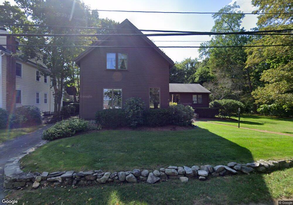
14 Leach Ln Natick, MA 01760
Estimated Value: $932,892 - $1,116,000
4
Beds
3
Baths
1,997
Sq Ft
$517/Sq Ft
Est. Value
About This Home
This home is located at 14 Leach Ln, Natick, MA 01760 and is currently estimated at $1,031,473, approximately $516 per square foot. 14 Leach Ln is a home located in Middlesex County with nearby schools including Natick High School, Memorial Elementary School, and J F Kennedy Middle School.
Ownership History
Date
Name
Owned For
Owner Type
Purchase Details
Closed on
Jan 2, 2022
Sold by
Egan Robert H and Egan Kathleen M
Bought by
Egan Robert H
Current Estimated Value
Purchase Details
Closed on
May 19, 1988
Sold by
Egan Robert H
Bought by
Egan Kathleen M
Create a Home Valuation Report for This Property
The Home Valuation Report is an in-depth analysis detailing your home's value as well as a comparison with similar homes in the area
Home Values in the Area
Average Home Value in this Area
Purchase History
| Date | Buyer | Sale Price | Title Company |
|---|---|---|---|
| Egan Robert H | -- | None Available | |
| Egan Robert H | -- | None Available | |
| Egan Kathleen M | $1,000 | -- |
Source: Public Records
Mortgage History
| Date | Status | Borrower | Loan Amount |
|---|---|---|---|
| Previous Owner | Egan Kathleen M | $25,000 |
Source: Public Records
Tax History Compared to Growth
Tax History
| Year | Tax Paid | Tax Assessment Tax Assessment Total Assessment is a certain percentage of the fair market value that is determined by local assessors to be the total taxable value of land and additions on the property. | Land | Improvement |
|---|---|---|---|---|
| 2025 | $8,993 | $751,900 | $475,800 | $276,100 |
| 2024 | $8,659 | $706,300 | $449,400 | $256,900 |
| 2023 | $8,347 | $660,400 | $420,600 | $239,800 |
| 2022 | $8,016 | $600,900 | $381,700 | $219,200 |
| 2021 | $5,424 | $565,000 | $360,800 | $204,200 |
| 2020 | $7,476 | $549,300 | $345,100 | $204,200 |
| 2019 | $6,982 | $549,300 | $345,100 | $204,200 |
| 2018 | $4,988 | $538,100 | $329,500 | $208,600 |
| 2017 | $6,811 | $504,900 | $300,300 | $204,600 |
| 2016 | $6,725 | $495,600 | $292,700 | $202,900 |
| 2015 | $6,617 | $478,800 | $292,700 | $186,100 |
Source: Public Records
Map
Nearby Homes