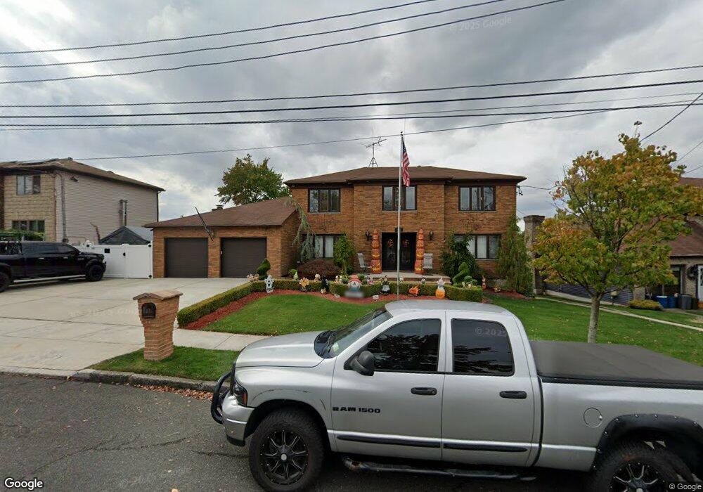
14 Lenevar Ave Staten Island, NY 10309
Woodrow NeighborhoodEstimated Value: $1,077,000 - $1,562,000
4
Beds
4
Baths
3,200
Sq Ft
$404/Sq Ft
Est. Value
About This Home
This home is located at 14 Lenevar Ave, Staten Island, NY 10309 and is currently estimated at $1,293,635, approximately $404 per square foot. 14 Lenevar Ave is a home located in Richmond County with nearby schools including P.S. 56 - The Louis Desario School, Is 34 Tottenville, and Tottenville High School.
Ownership History
Date
Name
Owned For
Owner Type
Purchase Details
Closed on
Dec 4, 2003
Sold by
Ciaravino Angelo and Ciaravino Evelyn
Bought by
Lipstein Shawn and Lipstein Amanda
Current Estimated Value
Home Financials for this Owner
Home Financials are based on the most recent Mortgage that was taken out on this home.
Original Mortgage
$600,000
Interest Rate
5.71%
Mortgage Type
Purchase Money Mortgage
Purchase Details
Closed on
Mar 27, 2000
Sold by
Ciaravino Angelo and Ciaravino Evelyn
Bought by
Angelo Ciaravino Revocable Living Trust and Evelyn Ciaravino Revocable Living Trust
Create a Home Valuation Report for This Property
The Home Valuation Report is an in-depth analysis detailing your home's value as well as a comparison with similar homes in the area
Home Values in the Area
Average Home Value in this Area
Purchase History
| Date | Buyer | Sale Price | Title Company |
|---|---|---|---|
| Lipstein Shawn | $755,000 | First American Title | |
| Angelo Ciaravino Revocable Living Trust | -- | -- |
Source: Public Records
Mortgage History
| Date | Status | Borrower | Loan Amount |
|---|---|---|---|
| Previous Owner | Lipstein Shawn | $600,000 |
Source: Public Records
Tax History Compared to Growth
Tax History
| Year | Tax Paid | Tax Assessment Tax Assessment Total Assessment is a certain percentage of the fair market value that is determined by local assessors to be the total taxable value of land and additions on the property. | Land | Improvement |
|---|---|---|---|---|
| 2025 | $12,831 | $64,920 | $20,326 | $44,594 |
| 2024 | $12,843 | $68,640 | $18,889 | $49,751 |
| 2023 | $12,224 | $61,590 | $16,765 | $44,825 |
| 2022 | $11,312 | $70,680 | $19,860 | $50,820 |
| 2021 | $11,349 | $62,820 | $19,860 | $42,960 |
| 2020 | $11,424 | $61,800 | $19,860 | $41,940 |
| 2019 | $11,088 | $63,780 | $19,860 | $43,920 |
| 2018 | $10,165 | $51,325 | $18,587 | $32,738 |
| 2017 | $9,571 | $48,420 | $19,860 | $28,560 |
| 2016 | $8,914 | $46,140 | $19,860 | $26,280 |
| 2015 | $8,504 | $47,460 | $16,560 | $30,900 |
| 2014 | $8,504 | $45,900 | $16,560 | $29,340 |
Source: Public Records
Map
Nearby Homes
- 45 Lenevar Ave
- 265 Ramapo Ave
- 108 Wieland Ave
- 0 Woodrow Rd
- 106 Wieland Ave
- 104 Wieland Ave
- 963 Sinclair Ave
- 973 Sheldon Ave
- 22 El Camino Loop
- 41 Brookside Loop
- 28 Brookside Loop
- 192 Mason Blvd
- 867 Sinclair Ave
- 880 Sinclair Ave
- 1024 Rensselaer Ave
- 980 Rensselaer Ave
- 91 Bombay St
- 728 Maguire Ave
- 87 Bombay St
- 1015 Rathbun Ave
- 24 Lenevar Ave
- 6 Lenevar Ave
- 61 Elks Place
- 32 Lenevar Ave
- 71 Elks Place
- 51 Elks Place
- 1336 Woodrow Rd
- 81 Elks Place
- 21 Lenevar Ave
- 41 Helios Place
- 1326 Woodrow Rd
- 176 Wieland Ave
- 180 Wieland Ave
- 58 Elks Place
- 40 Latham Place
- 172 Wieland Ave
- 68 Elks Place
- 184 Wieland Ave
- 141 Wieland Ave
- 152 Wieland Ave