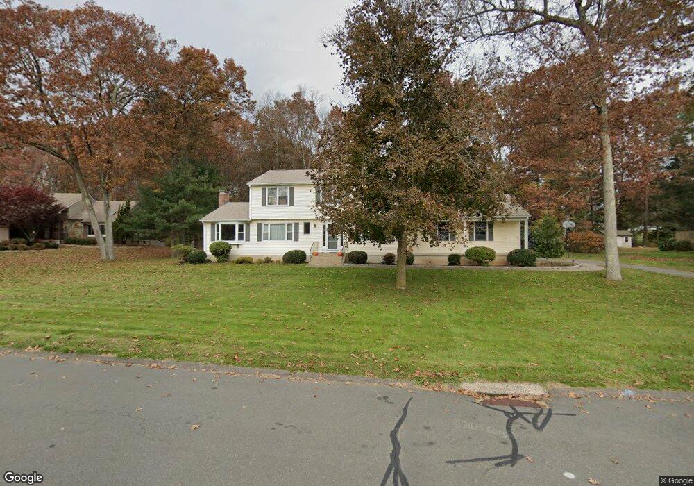
14 Majus Cir Ellington, CT 06029
Estimated Value: $586,000 - $754,000
4
Beds
3
Baths
2,529
Sq Ft
$257/Sq Ft
Est. Value
About This Home
This home is located at 14 Majus Cir, Ellington, CT 06029 and is currently estimated at $649,893, approximately $256 per square foot. 14 Majus Cir is a home located in Tolland County with nearby schools including Ellington High School.
Ownership History
Date
Name
Owned For
Owner Type
Purchase Details
Closed on
Sep 27, 2021
Sold by
Samson Peter F and Samson Joanne L
Bought by
Tierney Thomas J and Tierney Jana K
Current Estimated Value
Home Financials for this Owner
Home Financials are based on the most recent Mortgage that was taken out on this home.
Original Mortgage
$436,000
Outstanding Balance
$397,591
Interest Rate
2.8%
Mortgage Type
Purchase Money Mortgage
Estimated Equity
$252,302
Purchase Details
Closed on
Feb 26, 1992
Sold by
Franzen William and Franzen Robin
Bought by
Thompson Peter and Thompson Deborah
Purchase Details
Closed on
Feb 16, 1988
Sold by
Westwood Park Inc
Bought by
Franzen William
Create a Home Valuation Report for This Property
The Home Valuation Report is an in-depth analysis detailing your home's value as well as a comparison with similar homes in the area
Home Values in the Area
Average Home Value in this Area
Purchase History
| Date | Buyer | Sale Price | Title Company |
|---|---|---|---|
| Tierney Thomas J | $545,000 | None Available | |
| Thompson Peter | $200,000 | -- | |
| Franzen William | $232,649 | -- |
Source: Public Records
Mortgage History
| Date | Status | Borrower | Loan Amount |
|---|---|---|---|
| Open | Tierney Thomas J | $436,000 | |
| Previous Owner | Franzen William | $128,000 | |
| Previous Owner | Franzen William | $38,000 | |
| Previous Owner | Franzen William | $115,000 | |
| Previous Owner | Franzen William | $130,500 |
Source: Public Records
Tax History
| Year | Tax Paid | Tax Assessment Tax Assessment Total Assessment is a certain percentage of the fair market value that is determined by local assessors to be the total taxable value of land and additions on the property. | Land | Improvement |
|---|---|---|---|---|
| 2025 | $8,526 | $229,810 | $58,560 | $171,250 |
| 2024 | $8,273 | $229,810 | $58,560 | $171,250 |
| 2023 | $7,882 | $229,810 | $58,560 | $171,250 |
| 2022 | $7,469 | $229,810 | $58,560 | $171,250 |
| 2021 | $7,262 | $229,810 | $58,560 | $171,250 |
| 2020 | $7,214 | $221,280 | $59,050 | $162,230 |
| 2019 | $7,214 | $221,280 | $59,050 | $162,230 |
| 2016 | $6,749 | $221,280 | $59,050 | $162,230 |
| 2015 | $6,858 | $224,850 | $59,050 | $165,800 |
| 2014 | $6,453 | $224,850 | $59,050 | $165,800 |
Source: Public Records
Map
Nearby Homes
- 59 Wapping Wood Rd
- 194 Lisa Dr
- 57 Hayes Ave
- 35 Vincent Cir
- 14 Pinney St Unit 46
- 3 Brookmeadow Ln
- 12 Shady Brook Ln
- 37 Vista View Ln Unit 37
- 95 Meadowview Ln
- 85 Old Town Rd Unit 57
- 11 Settlers Way
- 610 Niederwerfer Rd
- 3 Standish Rd
- 11 Mara Trail
- 343 Merline Rd
- 36 Ellridge Place
- 73 Wilson Ln Unit 1
- 28 Tracy Dr
- 15 Terrace Dr
- 27 Grand Blvd
- 15 Majus Cir
- 20 Majus Cir
- 6 Majus Cir
- 10 Grant Rd
- 25 Majus Cir
- 9 Majus Cir
- 8 Grant Rd
- 3 Majus Cir
- 5 Woodmar Cir
- 19 Majus Cir
- 3 Barbaras Way
- 6 Grant Rd
- 21 Grant Rd
- 2 Barbaras Way
- 205 Natsisky Farm Rd
- 217 Natsisky Farm Rd
- 201 Natsisky Farm Rd
- 54 Wapping Wood Rd
- 223 Natsisky Farm Rd
- 191 Natsisky Farm Rd
Your Personal Tour Guide
Ask me questions while you tour the home.