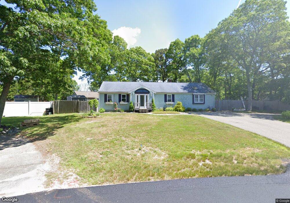
14 Matchewuttah Rd Mashpee, MA 02649
Estimated Value: $547,544 - $637,000
3
Beds
2
Baths
1,414
Sq Ft
$419/Sq Ft
Est. Value
About This Home
This home is located at 14 Matchewuttah Rd, Mashpee, MA 02649 and is currently estimated at $593,136, approximately $419 per square foot. 14 Matchewuttah Rd is a home located in Barnstable County with nearby schools including Kenneth C. Coombs School, Quashnet School, and Mashpee Middle School.
Ownership History
Date
Name
Owned For
Owner Type
Purchase Details
Closed on
Nov 2, 2018
Sold by
Laporta Leonarda M
Bought by
Leonarda M Laporta Ret
Current Estimated Value
Purchase Details
Closed on
Jul 1, 2013
Sold by
Laporta Graziella
Bought by
Laporta Leonarde
Purchase Details
Closed on
Feb 27, 2012
Sold by
Probert Richard T and Probert Graziella
Bought by
Probert Graziella
Create a Home Valuation Report for This Property
The Home Valuation Report is an in-depth analysis detailing your home's value as well as a comparison with similar homes in the area
Purchase History
| Date | Buyer | Sale Price | Title Company |
|---|---|---|---|
| Leonarda M Laporta Ret | -- | -- | |
| Laporta Leonarde | -- | -- | |
| Probert Graziella | -- | -- |
Source: Public Records
Tax History
| Year | Tax Paid | Tax Assessment Tax Assessment Total Assessment is a certain percentage of the fair market value that is determined by local assessors to be the total taxable value of land and additions on the property. | Land | Improvement |
|---|---|---|---|---|
| 2025 | $3,283 | $495,900 | $185,600 | $310,300 |
| 2024 | $3,012 | $468,400 | $168,700 | $299,700 |
| 2023 | $2,828 | $403,400 | $160,700 | $242,700 |
| 2022 | $2,688 | $329,000 | $130,600 | $198,400 |
| 2021 | $5,406 | $283,400 | $117,700 | $165,700 |
| 2020 | $5,622 | $272,800 | $113,200 | $159,600 |
| 2019 | $4,899 | $261,200 | $113,200 | $148,000 |
| 2018 | $2,172 | $243,500 | $113,200 | $130,300 |
| 2017 | $2,113 | $229,900 | $113,200 | $116,700 |
| 2016 | $2,049 | $221,700 | $113,200 | $108,500 |
| 2015 | $1,979 | $217,200 | $113,200 | $104,000 |
| 2014 | $2,013 | $214,400 | $111,800 | $102,600 |
Source: Public Records
Map
Nearby Homes
- 300 Falmouth Rd Unit 6B
- 300 Falmouth Rd Unit 6B
- 300 Falmouth Rd Unit 16A
- 300 Falmouth Rd Unit 20C
- 300 Falmouth Rd Unit 21E
- 300 Falmouth Rd Unit 16A
- 70 Quinaquisset Ave
- 10 Butler Ln
- 195 Falmouth Rd Unit 12E
- 195 Falmouth Rd Unit 9F
- 195 Falmouth Rd Unit 9F
- 195 Falmouth Rd
- 195 Falmouth Rd Unit 9D
- 145 Quinaquisset Ave
- 6 Willow Cir
- 11 Webquish Ln
- 26 Rainbow Ln
- 11 Watson Dr
- 34 Rainbow Ln
- 94 Lowell Rd
- 19 Papnomett Rd
- 10 Matchewuttah Rd
- 397 Ashers Path E
- 39 Papnomet Rd
- 24 Papnomett Rd
- 31 Papnomett Rd
- 391 Ashers Path E
- 30 Papnomett Rd
- 403 Asher's Path E Unit EAST
- 403 Ashers Path E
- 16 Papnomett Rd
- 4 Matchewuttah Rd
- 305 Falmouth Rd
- 2 High Sachem Rd
- 14 High Sachem Rd
- 311 Falmouth Rd
- 36 Papnomett Rd
- 409 Ashers Path E
- 299 Falmouth Rd
- 10 Papnomett Rd
Your Personal Tour Guide
Ask me questions while you tour the home.