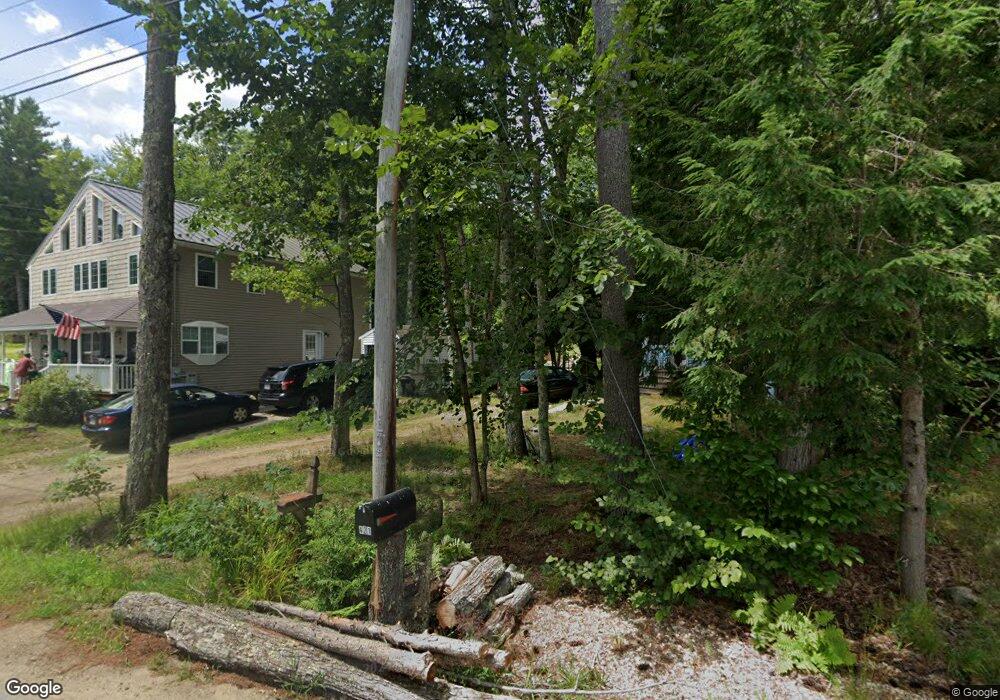
14 Mclarren Dr Northwood, NH 03261
Estimated Value: $406,000 - $495,470
1
Bed
1
Bath
1,400
Sq Ft
$332/Sq Ft
Est. Value
About This Home
This home is located at 14 Mclarren Dr, Northwood, NH 03261 and is currently estimated at $464,618, approximately $331 per square foot. 14 Mclarren Dr is a home located in Rockingham County with nearby schools including Northwood Elementary School and Coe-Brown Northwood Academy.
Ownership History
Date
Name
Owned For
Owner Type
Purchase Details
Closed on
Feb 1, 2012
Sold by
Houline Mark A and Houline Susan E
Bought by
Brown Cheyenne C and Brown Darryl N
Current Estimated Value
Purchase Details
Closed on
Aug 3, 2001
Sold by
Marston Philip D
Bought by
Houlne Mark A and Houlne Susan E
Home Financials for this Owner
Home Financials are based on the most recent Mortgage that was taken out on this home.
Original Mortgage
$144,200
Interest Rate
7.14%
Create a Home Valuation Report for This Property
The Home Valuation Report is an in-depth analysis detailing your home's value as well as a comparison with similar homes in the area
Home Values in the Area
Average Home Value in this Area
Purchase History
| Date | Buyer | Sale Price | Title Company |
|---|---|---|---|
| Brown Cheyenne C | $125,000 | -- | |
| Brown Cheyenne C | $125,000 | -- | |
| Houlne Mark A | $115,000 | -- | |
| Houlne Mark A | $115,000 | -- |
Source: Public Records
Mortgage History
| Date | Status | Borrower | Loan Amount |
|---|---|---|---|
| Previous Owner | Houlne Mark A | $29,000 | |
| Previous Owner | Houlne Mark A | $144,200 | |
| Closed | Houlne Mark A | $0 |
Source: Public Records
Tax History Compared to Growth
Tax History
| Year | Tax Paid | Tax Assessment Tax Assessment Total Assessment is a certain percentage of the fair market value that is determined by local assessors to be the total taxable value of land and additions on the property. | Land | Improvement |
|---|---|---|---|---|
| 2024 | $5,440 | $349,400 | $171,000 | $178,400 |
| 2023 | $4,822 | $349,400 | $171,000 | $178,400 |
| 2022 | $4,395 | $349,400 | $171,000 | $178,400 |
| 2021 | $3,906 | $252,500 | $116,300 | $136,200 |
| 2020 | $4,487 | $252,500 | $116,300 | $136,200 |
| 2019 | $3,964 | $176,000 | $69,600 | $106,400 |
| 2018 | $4,520 | $176,000 | $69,600 | $106,400 |
| 2016 | $4,247 | $177,100 | $69,600 | $107,500 |
| 2015 | $4,424 | $177,100 | $69,600 | $107,500 |
| 2014 | $4,496 | $188,100 | $97,600 | $90,500 |
| 2012 | $4,373 | $188,500 | $97,600 | $90,900 |
Source: Public Records
Map
Nearby Homes
- 133 & 137 Browns Pasture Rd
- 207 Long Pond Rd
- Map 219 Lot 6-8 Ridge Rd
- 8 Bow Lake Rd
- 0 1st New Hampshire Turnpike Unit 5026030
- 0 1st New Hampshire Turnpike Unit 5013320
- 150A 1st New Hampshire Turnpike
- 129 Water St
- 51 Kelsey Mill Rd
- 64 Kelsey Mill Rd
- 6 Pine St
- Map 102 Lot 9 Kramas Ln
- 17 Brook Circle Rd
- 11 Drake Hill Rd
- 152 Olde Canterbury Rd
- 21 Quimby Dr
- 20 Quimby Dr
- 10 Sunset Dr
- 49 Tasker Shore Dr
- 16 Deer Run Ln
- 5 Mclarren Dr
- 21 Mclarren Dr
- 403 Bow Lake Rd
- 421 Bow Lake Rd
- 419 Bow Lake Rd
- 415 Bow Lake Rd
- 427 Bow Lake Rd
- 411 Bow Lake Rd
- 12 Mclarren Dr
- 422 Bow Lake Rd
- 22 Mclarren Dr
- 407 Bow Lake Rd
- 426 Bow Lake Rd
- 429 Bow Lake Rd
- 412 Bow Lake Rd
- 430 Bow Lake Rd
- 433 Bow Lake Rd
- 3 Henson Ln
- 406 Bow Lake Rd
- 399 Bow Lake Rd